Estimated Value: $236,000 - $270,075
2
Beds
1
Bath
1,016
Sq Ft
$253/Sq Ft
Est. Value
About This Home
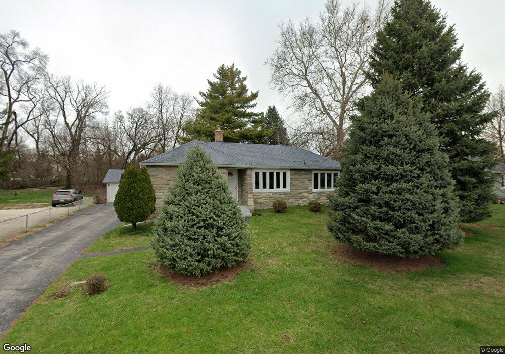
This home is located at 4702 W 128th Place, Alsip, IL 60803 and is currently estimated at $257,269, approximately $253 per square foot. 4702 W 128th Place is a home located in Cook County with nearby schools including Nathan Hale Primary School, Nathan Hale Intermediate School, and Nathan Hale Middle School.
Ownership History
Date
Name
Owned For
Owner Type
Purchase Details
Closed on
Oct 5, 2020
Sold by
Wozniak Angela W and Granoski John
Bought by
Wozniak Angela W and Granoski John
Current Estimated Value
Purchase Details
Closed on
May 7, 1997
Sold by
Nelson Nancy A
Bought by
Wozniak Angela W
Home Financials for this Owner
Home Financials are based on the most recent Mortgage that was taken out on this home.
Original Mortgage
$113,000
Outstanding Balance
$13,343
Interest Rate
8.05%
Estimated Equity
$243,926
Create a Home Valuation Report for This Property
The Home Valuation Report is an in-depth analysis detailing your home's value as well as a comparison with similar homes in the area
Home Values in the Area
Average Home Value in this Area
Purchase History
| Date | Buyer | Sale Price | Title Company |
|---|---|---|---|
| Wozniak Angela W | -- | Attorney | |
| Wozniak Angela W | $119,000 | -- |
Source: Public Records
Mortgage History
| Date | Status | Borrower | Loan Amount |
|---|---|---|---|
| Open | Wozniak Angela W | $113,000 |
Source: Public Records
Tax History
| Year | Tax Paid | Tax Assessment Tax Assessment Total Assessment is a certain percentage of the fair market value that is determined by local assessors to be the total taxable value of land and additions on the property. | Land | Improvement |
|---|---|---|---|---|
| 2025 | $7,195 | $22,718 | $7,999 | $14,719 |
| 2024 | $7,195 | $22,718 | $7,999 | $14,719 |
| 2023 | $4,546 | $24,000 | $9,281 | $14,719 |
| 2022 | $4,546 | $14,553 | $8,016 | $6,537 |
| 2021 | $4,369 | $14,552 | $8,015 | $6,537 |
| 2020 | $4,378 | $14,552 | $8,015 | $6,537 |
| 2019 | $4,084 | $13,229 | $7,171 | $6,058 |
| 2018 | $3,930 | $13,229 | $7,171 | $6,058 |
| 2017 | $4,031 | $13,229 | $7,171 | $6,058 |
| 2016 | $3,562 | $11,051 | $5,906 | $5,145 |
| 2015 | $3,441 | $11,051 | $5,906 | $5,145 |
| 2014 | $3,363 | $11,051 | $5,906 | $5,145 |
| 2013 | $3,615 | $12,581 | $5,906 | $6,675 |
Source: Public Records
Map
Nearby Homes
- 12769 S Loveland St
- 4654 W 131st St Unit 1S
- 12818 S Blossom Dr
- 12741 S La Crosse Ave Unit 2B
- 12738 S Kenneth Ave Unit E
- 4406 W 127th Place
- 4343 W Emerald Way St
- 4326 W Emerald Way St
- 4940 Circle Ct Unit 604
- 5024 Circle Ct Unit 1010
- 12919 E Playfield Dr
- 13300 W Circle Drive Pkwy Unit G222
- 12409 S 44th Ct
- 4501 W 123rd Place
- 4955 134th Place Unit 3B
- 4955 134th Place Unit 2D
- 13540 Lawler Ave Unit 76
- 4735 W 122nd St
- 4211 135th St
- 4818 W 122nd St Unit 3W
- 4646 W 128th Place
- 4708 W 128th Place
- 4714 W 128th Place
- 4638 W 128th Place
- 4709 W 128th Place
- 4703 W 128th Place
- 4715 W 128th Place
- 4645 W 128th Place
- 4720 W 128th Place
- 4720 W 128th Place
- 4620 W 128th Place
- 4721 W 128th Place
- 4637 W 128th Place
- 4657 W 128th St
- 13033 S Spencer Ct
- 4633 W 128th Place
- 4633 W 128th Place
- 4727 W 128th Place
- 13034 S Mcdaniels Ct Unit 1
- 13037 S Spencer Ct Unit 1