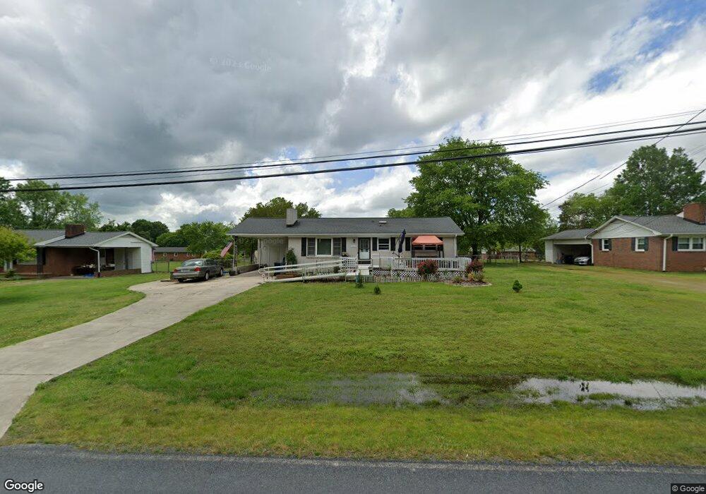
4703 Huff Rd High Point, NC 27263
Estimated Value: $179,000 - $197,097
Studio
2
Baths
1,107
Sq Ft
$168/Sq Ft
Est. Value
About This Home
This home is located at 4703 Huff Rd, High Point, NC 27263 and is currently estimated at $185,524, approximately $167 per square foot. 4703 Huff Rd is a home located in Randolph County with nearby schools including Trindale Elementary School, Wheatmore Middle School, and Trinity High School.
Ownership History
Date
Name
Owned For
Owner Type
Purchase Details
Closed on
Nov 25, 2025
Sold by
Bland Homer J and Bland Fresca K
Bought by
Garner Eric Lee and Lyon-Garner Nikkita
Current Estimated Value
Home Financials for this Owner
Home Financials are based on the most recent Mortgage that was taken out on this home.
Original Mortgage
$176,129
Outstanding Balance
$175,630
Interest Rate
6.3%
Mortgage Type
FHA
Estimated Equity
$9,894
Purchase Details
Closed on
Feb 6, 2024
Sold by
Bland Homer J and Bland Fresca K
Bought by
Bland Homer J and Bland Fresca K
Purchase Details
Closed on
Jul 21, 2021
Sold by
Bland Homer J and Bland Fresca K
Bought by
Bland Homer J and Bland Fresca K
Purchase Details
Closed on
Sep 4, 2020
Sold by
Bland Homer J and Bland Bethany A
Bought by
Bland Homer J and Bland Nathan Scott
Purchase Details
Closed on
Aug 1, 2000
Bought by
Bland, Homer J Iii Bland, Bethany A
Create a Home Valuation Report for This Property
The Home Valuation Report is an in-depth analysis detailing your home's value as well as a comparison with similar homes in the area
Home Values in the Area
Average Home Value in this Area
Purchase History
| Date | Buyer | Sale Price | Title Company |
|---|---|---|---|
| Garner Eric Lee | $180,000 | None Listed On Document | |
| Bland Homer J | -- | None Listed On Document | |
| Bland Homer J | -- | Chicago Title | |
| Bland Homer J | -- | None Available | |
| Bland, Homer J Iii Bland, Bethany A | $83,000 | -- |
Source: Public Records
Mortgage History
| Date | Status | Borrower | Loan Amount |
|---|---|---|---|
| Open | Garner Eric Lee | $176,129 | |
| Closed | Garner Eric Lee | $15,000 |
Source: Public Records
Tax History
| Year | Tax Paid | Tax Assessment Tax Assessment Total Assessment is a certain percentage of the fair market value that is determined by local assessors to be the total taxable value of land and additions on the property. | Land | Improvement |
|---|---|---|---|---|
| 2025 | $1,146 | $156,240 | $57,660 | $98,580 |
| 2024 | $1,130 | $156,240 | $57,660 | $98,580 |
| 2023 | $1,130 | $156,240 | $57,660 | $98,580 |
| 2022 | $815 | $92,630 | $24,600 | $68,030 |
| 2021 | $815 | $92,630 | $24,600 | $68,030 |
| 2020 | $814 | $92,630 | $24,600 | $68,030 |
| 2019 | $814 | $92,630 | $24,600 | $68,030 |
| 2018 | $748 | $82,970 | $17,710 | $65,260 |
| 2016 | $729 | $82,966 | $17,710 | $65,256 |
| 2015 | $731 | $82,966 | $17,710 | $65,256 |
| 2014 | $731 | $82,966 | $17,710 | $65,256 |
Source: Public Records
Map
Nearby Homes
- 113 Oak Way
- 4375 Huff Rd
- 105 Oak Ridge Dr
- 107 Autumn Hill Ct
- 0 Waterbury Dr
- 1202 Dogwood Ln
- 101 Brightleaf Ct
- 108 Sprucewood Ct
- 0 Sprucewood Ct
- 147 Dove Meadows Dr
- 510 Aldridge Rd
- 424 Aldridge Rd
- 4020 Knollwood Dr
- 0-C Us Highway 311
- 309 Alison Ln
- 219 Tarheel Dr
- 118 Rand Blvd
- 6071 Weant Rd
- 0-A Us Highway 311
- 115 Lindsay Dr
- 4699 Huff Rd
- 4713 Huff Rd
- 6496 Allendale Dr
- 4689 Huff Rd
- 4702 Huff Rd
- 6508 Allendale Dr
- 4725 Huff Rd
- 6711 Weant Rd
- 6482 Allendale Dr
- 6520 Allendale Dr
- 4679 Huff Rd
- 6695 Weant Rd
- 6534 Allendale Dr
- 6478 Allendale Dr
- 6793 Weant Rd
- 6497 Allendale Dr
- 4659 Huff Rd
- 6501 Allendale Dr
- 6465 Allendale Dr
- 6538 Allendale Dr
Your Personal Tour Guide
Ask me questions while you tour the home.