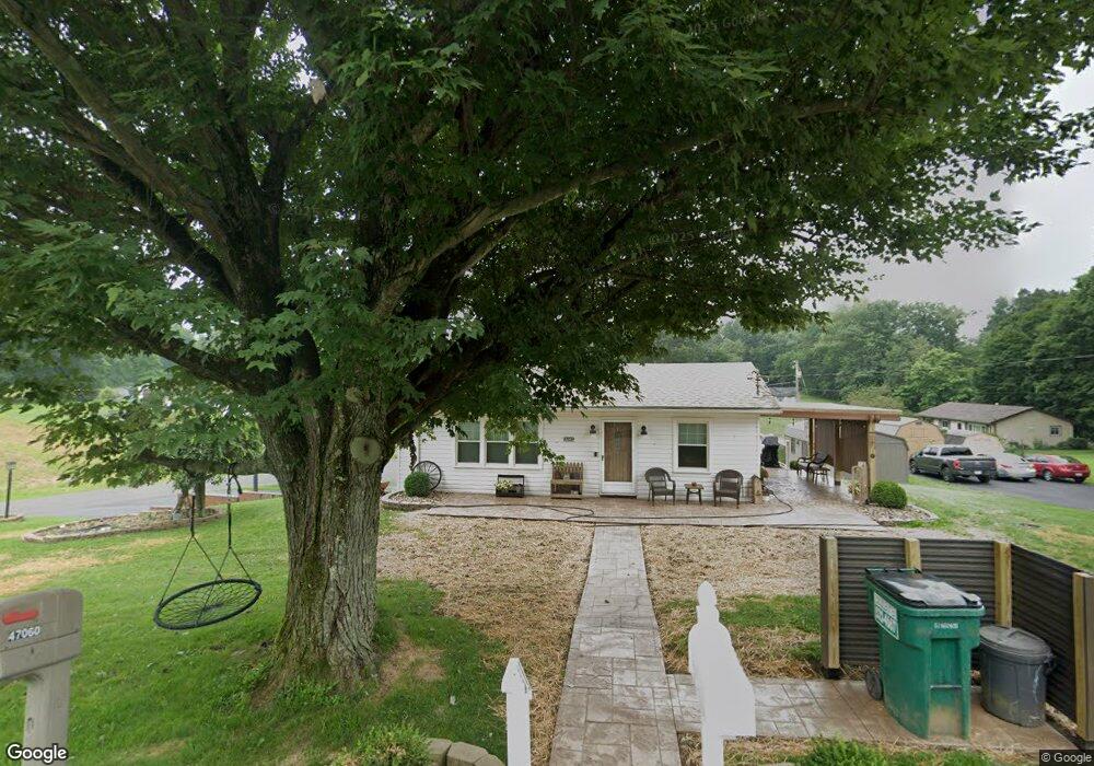
47039 McDonald St East Liverpool, OH 43920
Estimated Value: $114,000 - $194,000
3
Beds
1
Bath
1,220
Sq Ft
$123/Sq Ft
Est. Value
About This Home
This home is located at 47039 McDonald St, East Liverpool, OH 43920 and is currently estimated at $150,575, approximately $123 per square foot. 47039 McDonald St is a home with nearby schools including Westgate Middle School, LaCroft Elementary School, and East Liverpool High School.
Ownership History
Date
Name
Owned For
Owner Type
Purchase Details
Closed on
Aug 8, 1996
Sold by
Kenneth E Delposon
Bought by
Mcdaniel Kevin C and Mcdaniel Cheryl L
Current Estimated Value
Home Financials for this Owner
Home Financials are based on the most recent Mortgage that was taken out on this home.
Original Mortgage
$56,800
Outstanding Balance
$3,873
Interest Rate
6.63%
Mortgage Type
New Conventional
Estimated Equity
$146,702
Purchase Details
Closed on
Feb 11, 1991
Sold by
Mcdaniel Kevin C and Mcdaniel Or
Bought by
Delposen Kenneth E and Delposen Or T
Create a Home Valuation Report for This Property
The Home Valuation Report is an in-depth analysis detailing your home's value as well as a comparison with similar homes in the area
Home Values in the Area
Average Home Value in this Area
Purchase History
| Date | Buyer | Sale Price | Title Company |
|---|---|---|---|
| Mcdaniel Kevin C | $71,000 | -- | |
| Delposen Kenneth E | $33,800 | -- |
Source: Public Records
Mortgage History
| Date | Status | Borrower | Loan Amount |
|---|---|---|---|
| Open | Mcdaniel Kevin C | $56,800 |
Source: Public Records
Tax History Compared to Growth
Tax History
| Year | Tax Paid | Tax Assessment Tax Assessment Total Assessment is a certain percentage of the fair market value that is determined by local assessors to be the total taxable value of land and additions on the property. | Land | Improvement |
|---|---|---|---|---|
| 2024 | $1,344 | $36,090 | $3,570 | $32,520 |
| 2023 | $1,345 | $36,090 | $3,570 | $32,520 |
| 2022 | $1,346 | $36,090 | $3,570 | $32,520 |
| 2021 | $1,223 | $30,170 | $3,150 | $27,020 |
| 2020 | $1,167 | $28,770 | $3,150 | $25,620 |
| 2019 | $1,167 | $28,770 | $3,150 | $25,620 |
| 2018 | $1,096 | $25,240 | $2,770 | $22,470 |
| 2017 | $1,078 | $25,240 | $2,770 | $22,470 |
| 2016 | $1,076 | $27,970 | $3,890 | $24,080 |
| 2015 | $1,207 | $27,970 | $3,890 | $24,080 |
| 2014 | $1,209 | $28,390 | $3,890 | $24,500 |
Source: Public Records
Map
Nearby Homes
- 46835 Mary St
- 15782 Vale St
- 16467 Staunton Ave
- 16104 State Route 267
- 0 Rodaman
- 16573 Annesley Rd
- 15904 E Liverpool Rd
- 46150 Y and O Rd
- 45804 Yeager Dr
- 46690 Winston Dr
- 16007 Simmons St
- 15054 Strader Rd
- 1952 Dunn Rd
- 2492 Irish Ridge Rd
- 17140 Cannons Mill Rd
- 602 9th Ave
- 967 7th Ave
- 48511 Calcutta-Smith Ferry Rd
- 2476 Lisbon St
- 14540 Birch Rd
- 47017 McDonald St
- 16032 Laurie Rd
- 47003 McDonald St
- 16058 Laurie Rd
- 16045 Laurie Rd
- 47083 McDonald St
- 46900 McDonald St
- 47068 McDonald St
- 47036 McDonald St
- 46887 McDonald St
- 16084 Laurie Rd
- 16071 Laurie Rd
- 47092 McDonald St
- 47092 McDonald St
- 47101 McDonald St
- 46861 McDonald St
- 16038 Martha St
- 46852 McDonald St
- 16095 Laurie Rd
- 16095 Laurie Rd