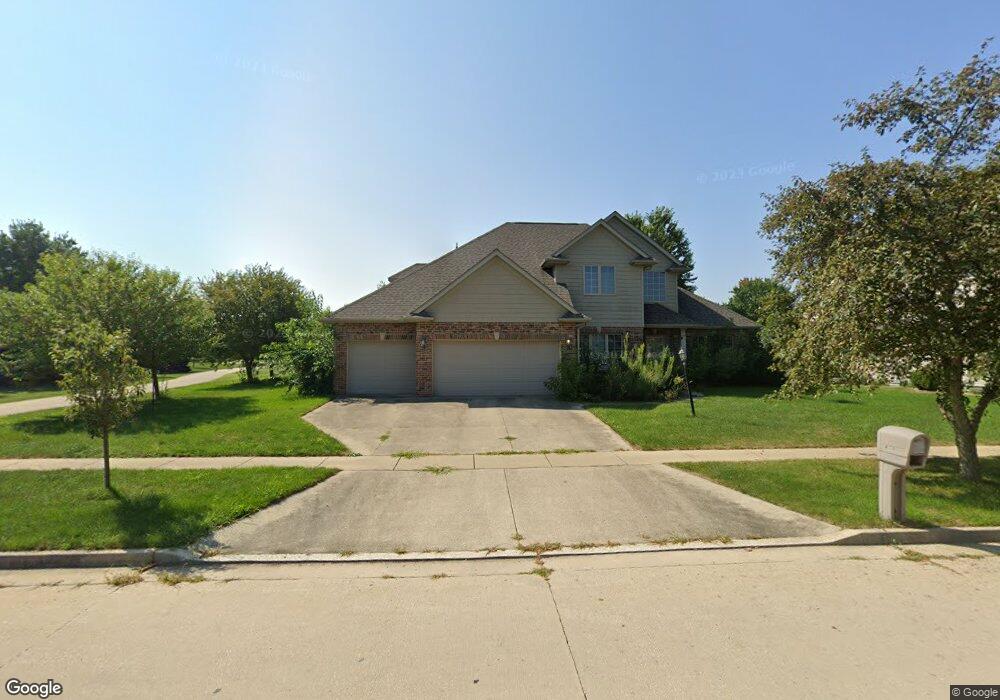
4705 Stonebridge Dr Champaign, IL 61822
Estimated Value: $444,556 - $522,000
4
Beds
4
Baths
--
Sq Ft
13,504
Sq Ft
About This Home
This home is located at 4705 Stonebridge Dr, Champaign, IL 61822 and is currently estimated at $488,889. 4705 Stonebridge Dr is a home located in Champaign County with nearby schools including Centennial High School, Countryside School, and Swann Special Care Center-Elem/Secondary School.
Ownership History
Date
Name
Owned For
Owner Type
Purchase Details
Closed on
Mar 1, 2010
Sold by
Lee Hanjie and Yao Chunlan
Bought by
Ye Xinhuai and Lu Yanrong
Current Estimated Value
Home Financials for this Owner
Home Financials are based on the most recent Mortgage that was taken out on this home.
Original Mortgage
$256,000
Outstanding Balance
$158,939
Interest Rate
3.75%
Mortgage Type
New Conventional
Estimated Equity
$329,950
Purchase Details
Closed on
Aug 28, 2003
Sold by
Stewart Rick
Bought by
Lee Hanjie and Yao Chunlan
Home Financials for this Owner
Home Financials are based on the most recent Mortgage that was taken out on this home.
Original Mortgage
$261,600
Interest Rate
5.69%
Mortgage Type
Balloon
Purchase Details
Closed on
Apr 7, 2003
Sold by
Ironwood West Llc
Bought by
Stewart Rick
Create a Home Valuation Report for This Property
The Home Valuation Report is an in-depth analysis detailing your home's value as well as a comparison with similar homes in the area
Purchase History
| Date | Buyer | Sale Price | Title Company |
|---|---|---|---|
| Ye Xinhuai | $320,000 | None Available | |
| Lee Hanjie | $330,500 | -- | |
| Stewart Rick | $55,000 | -- |
Source: Public Records
Mortgage History
| Date | Status | Borrower | Loan Amount |
|---|---|---|---|
| Open | Ye Xinhuai | $256,000 | |
| Previous Owner | Lee Hanjie | $261,600 |
Source: Public Records
Tax History
| Year | Tax Paid | Tax Assessment Tax Assessment Total Assessment is a certain percentage of the fair market value that is determined by local assessors to be the total taxable value of land and additions on the property. | Land | Improvement |
|---|---|---|---|---|
| 2024 | $11,154 | $132,390 | $25,040 | $107,350 |
| 2023 | $11,154 | $122,240 | $23,120 | $99,120 |
| 2022 | $10,073 | $114,030 | $21,570 | $92,460 |
| 2021 | $9,833 | $112,020 | $21,190 | $90,830 |
| 2020 | $9,741 | $110,910 | $20,980 | $89,930 |
| 2019 | $9,450 | $109,060 | $20,630 | $88,430 |
| 2018 | $9,434 | $109,060 | $20,630 | $88,430 |
| 2017 | $9,445 | $109,060 | $20,630 | $88,430 |
| 2016 | $8,550 | $107,790 | $20,630 | $87,160 |
| 2015 | $8,652 | $107,790 | $20,630 | $87,160 |
| 2014 | $8,266 | $102,760 | $20,630 | $82,130 |
| 2013 | $8,193 | $102,760 | $20,630 | $82,130 |
Source: Public Records
Map
Nearby Homes
- 2109 Emerald Dr
- 2317 Joseph St
- 5005 Stonebridge Dr
- 2107 Max Run Dr
- 4511 Copper Ridge Rd
- 4309 Stonebridge Ct
- 4406 Crossgate Dr
- 5008 Emmas Way
- 4809 W Windsor Rd Unit B07
- 4809 W Windsor Rd Unit B06
- 4809 W Windsor Rd Unit B15
- 4809 W Windsor Rd Unit C23
- 4809 W Windsor Rd Unit D05
- 4809 W Windsor Rd Unit C12
- 4809 W Windsor Rd Unit B24
- 4809 W Windsor Rd Unit A15
- 4809 W Windsor Rd Unit F28
- 4809 W Windsor Rd Unit C02
- 4700 Chestnut Grove Dr
- 1621 English Oak Dr
- 4707 Stonebridge Dr
- 2114 Emerald Dr
- 4706 Watermark Dr
- 2201 Strand Dr
- 4708 Watermark Dr
- 4709 Stonebridge Dr
- 2115 Strand Dr
- 2203 Strand Dr
- 2112 Emerald Dr
- 4710 Watermark Dr
- 2113 Emerald Dr
- 4711 Stonebridge Dr
- 2113 Strand Dr
- 2110 Emerald Dr
- 2111 Emerald Dr
- 4707 Watermark Dr
- 2111 Strand Dr
- 4709 Watermark Dr
- 4703 Watermark Dr
- 4713 Stonebridge Dr
Your Personal Tour Guide
Ask me questions while you tour the home.