Estimated Value: $291,000 - $322,000
4
Beds
2
Baths
2,121
Sq Ft
$146/Sq Ft
Est. Value
About This Home
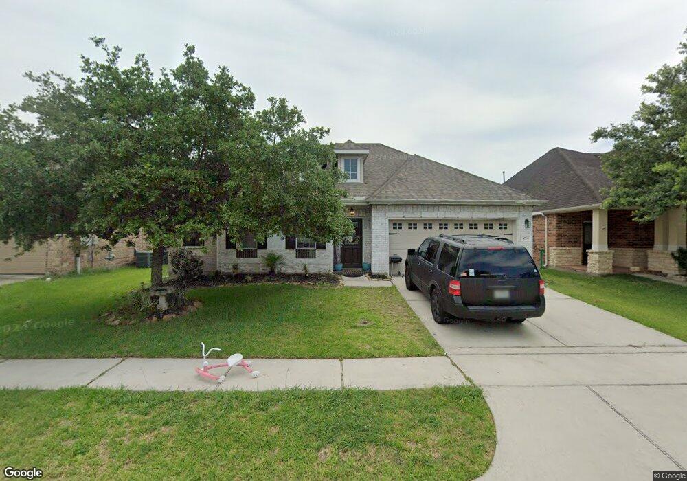
This home is located at 4706 Lake Rim Dr, Alvin, TX 77511 and is currently estimated at $308,630, approximately $145 per square foot. 4706 Lake Rim Dr is a home located in Brazoria County with nearby schools including Mark Twain Elementary School, G.W. Harby Junior High School, and Alvin High School.
Ownership History
Date
Name
Owned For
Owner Type
Purchase Details
Closed on
Sep 20, 2010
Sold by
K Hovnanian Of Houston Ii Llc
Bought by
Korenek William S and Korenek Tiana L
Current Estimated Value
Home Financials for this Owner
Home Financials are based on the most recent Mortgage that was taken out on this home.
Original Mortgage
$163,744
Outstanding Balance
$113,785
Interest Rate
5.5%
Mortgage Type
FHA
Estimated Equity
$194,845
Create a Home Valuation Report for This Property
The Home Valuation Report is an in-depth analysis detailing your home's value as well as a comparison with similar homes in the area
Home Values in the Area
Average Home Value in this Area
Purchase History
| Date | Buyer | Sale Price | Title Company |
|---|---|---|---|
| Korenek William S | -- | Alamo Title Company |
Source: Public Records
Mortgage History
| Date | Status | Borrower | Loan Amount |
|---|---|---|---|
| Open | Korenek William S | $163,744 |
Source: Public Records
Tax History Compared to Growth
Tax History
| Year | Tax Paid | Tax Assessment Tax Assessment Total Assessment is a certain percentage of the fair market value that is determined by local assessors to be the total taxable value of land and additions on the property. | Land | Improvement |
|---|---|---|---|---|
| 2025 | $8,214 | $314,870 | $61,230 | $253,640 |
| 2023 | $8,214 | $296,317 | $61,230 | $263,280 |
| 2022 | $9,248 | $269,379 | $35,360 | $238,410 |
| 2021 | $8,784 | $244,890 | $35,360 | $209,530 |
| 2020 | $8,578 | $236,510 | $35,360 | $201,150 |
| 2019 | $8,580 | $231,790 | $24,290 | $207,500 |
| 2018 | $7,812 | $210,610 | $24,290 | $186,320 |
| 2017 | $7,724 | $206,130 | $24,290 | $181,840 |
| 2016 | $7,307 | $195,000 | $24,290 | $170,710 |
| 2015 | $6,317 | $182,070 | $24,290 | $157,780 |
| 2014 | $6,317 | $185,020 | $25,300 | $159,720 |
Source: Public Records
Map
Nearby Homes
- 349 Lake Line Dr
- 4706 Alluvial Cir
- 4724 Alluvial Cir
- 4738 Alluvial Cir
- 726 Rim Water Dr
- 334 Kendall Crest Dr
- 340 Kendall Crest Dr
- 310 Kendall Crest Dr
- 5307 Camerford Ct
- 350 Selah Ct
- 356 Selah Ct
- 5307 Cascade Ct
- 380 Kendall Crest Dr
- 368 Selah Ct
- 5318 Latigo Ct
- Madison Plan at Kendall Lakes
- Avery Plan at Kendall Lakes
- Elias Plan at Skyview
- Christina Plan at Kendall Lakes
- Rev Plan at Skyview
- 4704 Lake Rim Dr
- 4708 Lake Rim Dr
- 4702 Lake Rim Dr
- 4710 Lake Rim Dr
- 4707 High Creek Ct
- 4705 High Creek Ct
- 4709 High Creek Ct
- 4707 Lake Rim Dr
- 4703 High Creek Ct
- 4711 High Creek Ct
- 4712 Lake Rim Dr
- 4709 Lake Rim Dr
- 4705 Lake Rim Dr
- 4700 Lake Rim Dr
- 4703 Lake Rim Dr
- 4711 Lake Rim Dr
- 4713 High Creek Ct
- 4701 High Creek Ct
- 4714 Lake Rim Dr
- 4713 Lake Rim Dr