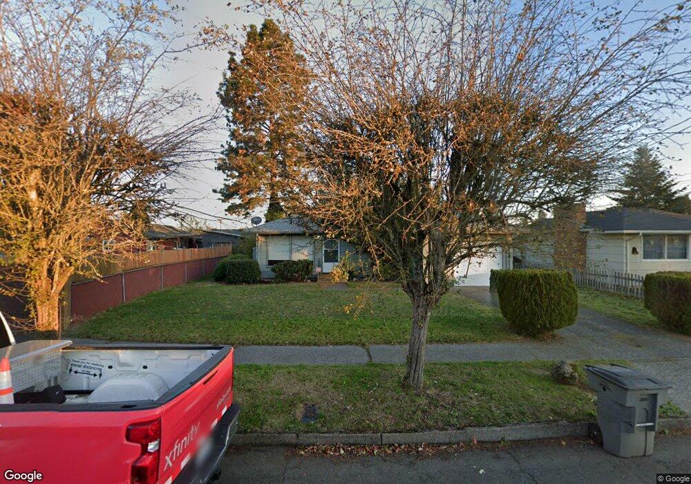
4706 Sheridan Dr Vancouver, WA 98661
Meadow Homes NeighborhoodEstimated Value: $368,000 - $389,546
3
Beds
1
Bath
999
Sq Ft
$383/Sq Ft
Est. Value
About This Home
This home is located at 4706 Sheridan Dr, Vancouver, WA 98661 and is currently estimated at $382,387, approximately $382 per square foot. 4706 Sheridan Dr is a home located in Clark County with nearby schools including Martin Luther King Elementary School, McLoughlin Middle School, and Fort Vancouver High School.
Ownership History
Date
Name
Owned For
Owner Type
Purchase Details
Closed on
Dec 30, 2024
Sold by
Eastman Gary and Eastman Tamara
Bought by
Eastman Trust and Eastman
Current Estimated Value
Purchase Details
Closed on
Oct 26, 2016
Sold by
Shaffer Jeanne and Gagnier Rachel
Bought by
Eastman Gary and Eastman Tamara
Purchase Details
Closed on
May 18, 2004
Sold by
English Cathy
Bought by
Rivoli Dorothy
Purchase Details
Closed on
Sep 2, 1997
Sold by
Rivoli Dorothy
Bought by
English Cathy and Rivoli Dorothy
Create a Home Valuation Report for This Property
The Home Valuation Report is an in-depth analysis detailing your home's value as well as a comparison with similar homes in the area
Home Values in the Area
Average Home Value in this Area
Purchase History
| Date | Buyer | Sale Price | Title Company |
|---|---|---|---|
| Eastman Trust | $313 | None Listed On Document | |
| Eastman Trust | $313 | None Listed On Document | |
| Eastman Gary | $165,000 | Chicago Title Fl Vancouver | |
| Rivoli Dorothy | -- | -- | |
| English Cathy | -- | -- |
Source: Public Records
Tax History Compared to Growth
Tax History
| Year | Tax Paid | Tax Assessment Tax Assessment Total Assessment is a certain percentage of the fair market value that is determined by local assessors to be the total taxable value of land and additions on the property. | Land | Improvement |
|---|---|---|---|---|
| 2025 | $3,437 | $362,711 | $182,400 | $180,311 |
| 2024 | $3,216 | $351,668 | $182,400 | $169,268 |
| 2023 | $3,167 | $343,469 | $179,200 | $164,269 |
| 2022 | $3,015 | $339,680 | $179,200 | $160,480 |
| 2021 | $2,721 | $301,281 | $160,000 | $141,281 |
| 2020 | $2,462 | $256,251 | $116,594 | $139,657 |
| 2019 | $2,321 | $240,278 | $102,480 | $137,798 |
| 2018 | $2,300 | $234,620 | $0 | $0 |
| 2017 | $2,087 | $193,017 | $0 | $0 |
| 2016 | $116 | $16,900 | $0 | $0 |
| 2015 | $123 | $16,900 | $0 | $0 |
| 2014 | -- | $16,900 | $0 | $0 |
| 2013 | -- | $16,900 | $0 | $0 |
Source: Public Records
Map
Nearby Homes
- 3921 E Fourth Plain Blvd
- 3921 E Fourth Plain Blvd Unit 53
- 3921 E 4th Plain Blvd Unit 54
- 3909 E Fourth Plain Blvd Unit 11
- 3909 E Fourth Plain Blvd Unit 4
- 3909 E Fourth Plain Blvd Unit 61
- 3909 E Fourth Plain Blvd
- 3909 E 4th Plain Blvd Unit 47
- 4613 E 18th St Unit 28
- 4001 E 18th St
- 4311 Plomondon St
- 3903 E 18th St Unit 22
- 3903 E 18th St
- 5301 Plomondon St Unit F24
- 4305 E 15th St
- 13 Algona Dr
- 0 Falk Rd
- 1620 Brandt Rd
- 1307 Ogden Ave
- 1618 Brandt Rd
- 4710 Sheridan Dr
- 2203 Sheridan Dr
- 2205 Sheridan Dr
- 2200 General Anderson Rd
- 2210 General Anderson Rd
- 2210 General Anderson Ave
- 2301 Sheridan Dr
- 2300 General Anderson Rd
- 4709 Sheridan Dr
- 4705 Sheridan Dr
- 2200 Sheridan Dr
- 2300 General Anderson Ave
- 4713 Sheridan Dr
- 2300 Sheridan Dr
- 2204 Sheridan Dr
- 2305 Sheridan Dr
- 2304 General Anderson Rd
- 2205 General Anderson Rd
- 2106 General Anderson Rd
- 2117 General Anderson Rd