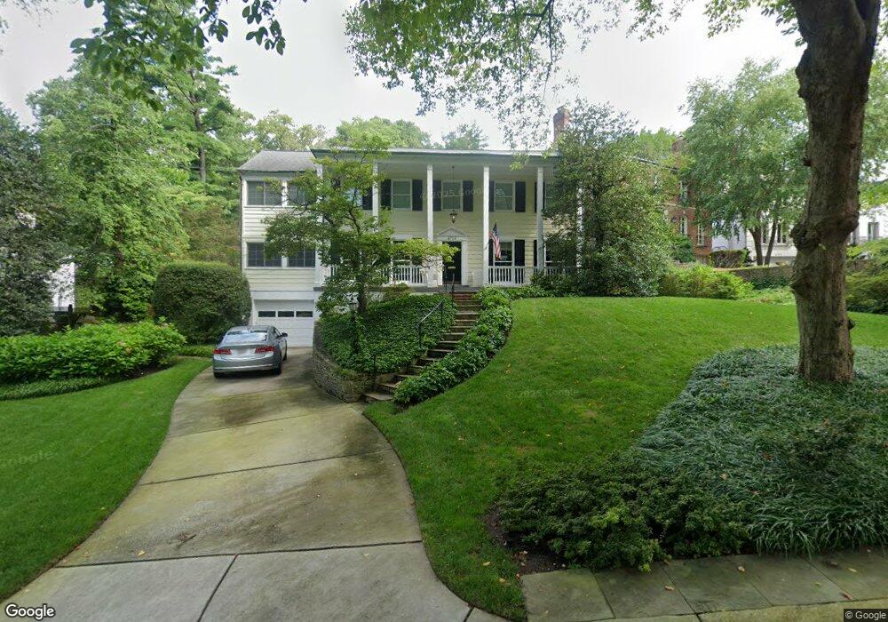
4708 Jamestown Rd Bethesda, MD 20816
Westmoreland NeighborhoodEstimated Value: $2,176,000 - $2,924,000
--
Bed
5
Baths
3,644
Sq Ft
$680/Sq Ft
Est. Value
About This Home
This home is located at 4708 Jamestown Rd, Bethesda, MD 20816 and is currently estimated at $2,478,872, approximately $680 per square foot. 4708 Jamestown Rd is a home located in Montgomery County with nearby schools including Westbrook Elementary School, Westland Middle School, and Bethesda-Chevy Chase High School.
Ownership History
Date
Name
Owned For
Owner Type
Purchase Details
Closed on
Jul 5, 2007
Sold by
Gale Roger W
Bought by
Garin Geoffrey Douglas
Current Estimated Value
Home Financials for this Owner
Home Financials are based on the most recent Mortgage that was taken out on this home.
Original Mortgage
$650,000
Outstanding Balance
$405,847
Interest Rate
6.48%
Mortgage Type
Purchase Money Mortgage
Estimated Equity
$2,073,025
Purchase Details
Closed on
Jul 2, 2007
Sold by
Gale Roger W
Bought by
Garin Geoffrey Douglas
Home Financials for this Owner
Home Financials are based on the most recent Mortgage that was taken out on this home.
Original Mortgage
$650,000
Outstanding Balance
$405,847
Interest Rate
6.48%
Mortgage Type
Purchase Money Mortgage
Estimated Equity
$2,073,025
Create a Home Valuation Report for This Property
The Home Valuation Report is an in-depth analysis detailing your home's value as well as a comparison with similar homes in the area
Home Values in the Area
Average Home Value in this Area
Purchase History
| Date | Buyer | Sale Price | Title Company |
|---|---|---|---|
| Garin Geoffrey Douglas | $1,995,000 | -- | |
| Garin Geoffrey Douglas | $1,995,000 | -- |
Source: Public Records
Mortgage History
| Date | Status | Borrower | Loan Amount |
|---|---|---|---|
| Open | Garin Geoffrey Douglas | $650,000 | |
| Closed | Garin Geoffrey Douglas | $650,000 |
Source: Public Records
Tax History Compared to Growth
Tax History
| Year | Tax Paid | Tax Assessment Tax Assessment Total Assessment is a certain percentage of the fair market value that is determined by local assessors to be the total taxable value of land and additions on the property. | Land | Improvement |
|---|---|---|---|---|
| 2025 | $21,858 | $1,879,600 | $989,400 | $890,200 |
| 2024 | $21,858 | $1,835,200 | $0 | $0 |
| 2023 | $20,645 | $1,790,800 | $0 | $0 |
| 2022 | $19,233 | $1,746,400 | $899,300 | $847,100 |
| 2021 | $17,795 | $1,685,967 | $0 | $0 |
| 2020 | $17,795 | $1,625,533 | $0 | $0 |
| 2019 | $17,087 | $1,565,100 | $817,600 | $747,500 |
| 2018 | $17,087 | $1,565,100 | $817,600 | $747,500 |
| 2017 | $17,391 | $1,565,100 | $0 | $0 |
| 2016 | $14,478 | $1,579,900 | $0 | $0 |
| 2015 | $14,478 | $1,511,633 | $0 | $0 |
| 2014 | $14,478 | $1,443,367 | $0 | $0 |
Source: Public Records
Map
Nearby Homes
- 5110 Duvall Dr
- 5204 Portsmouth Rd
- 5203 Portsmouth Rd
- 4509 Wetherill Rd
- 4937 Brandywine St NW
- 4931 Butterworth Place NW
- 5011 Baltimore Ave
- 5011 Newport Ave
- 4911 Bayard Blvd
- 4840-4842 Western Ave
- 4720 Ellicott St NW
- 5303 Wakefield Rd
- 5105 Westbard Ave
- 5226 Baltimore Ave
- 4200 49th St NW
- 5605 Wood Way
- 4257 Fordham Rd NW
- 4960 Sentinel Dr
- 4974 Sentinel Dr
- 5311 Allandale Rd
- 4710 Jamestown Rd
- 4712 Jamestown Rd
- 4714 Jamestown Rd
- 4704 Jamestown Rd
- 4715 Jamestown Rd
- 4711 Jamestown Rd
- 5104 Cape Cod Ct
- 5106 Cape Cod Ct
- 5221 Farrington Rd
- 5223 Farrington Rd
- 4717 Jamestown Rd
- 5219 Farrington Rd
- 5200 Massachusetts Ave
- 4702 Jamestown Rd
- 5202 Massachusetts Ave
- 5225 Farrington Rd
- 5102 Cape Cod Ct
- 5204 Massachusetts Ave
- 5217 Farrington Rd
- 5108 Cape Cod Ct