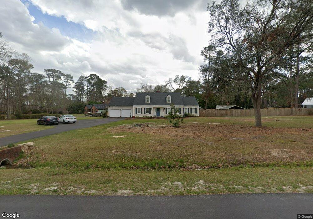
4709 Summerfield Dr Hahira, GA 31632
Estimated Value: $279,011 - $341,000
3
Beds
2
Baths
2,213
Sq Ft
$141/Sq Ft
Est. Value
About This Home
This home is located at 4709 Summerfield Dr, Hahira, GA 31632 and is currently estimated at $311,253, approximately $140 per square foot. 4709 Summerfield Dr is a home located in Lowndes County with nearby schools including Westside Elementary School, Hahira Middle School, and Lowndes High School.
Ownership History
Date
Name
Owned For
Owner Type
Purchase Details
Closed on
May 20, 2005
Sold by
Turner Scott B
Bought by
Cooper Stephen F
Current Estimated Value
Home Financials for this Owner
Home Financials are based on the most recent Mortgage that was taken out on this home.
Original Mortgage
$40,000
Outstanding Balance
$12,325
Interest Rate
5.74%
Mortgage Type
New Conventional
Estimated Equity
$298,928
Purchase Details
Closed on
Jan 21, 1994
Bought by
Turner Scott B
Create a Home Valuation Report for This Property
The Home Valuation Report is an in-depth analysis detailing your home's value as well as a comparison with similar homes in the area
Home Values in the Area
Average Home Value in this Area
Purchase History
| Date | Buyer | Sale Price | Title Company |
|---|---|---|---|
| Cooper Stephen F | $200,000 | -- | |
| Turner Scott B | $96,500 | -- |
Source: Public Records
Mortgage History
| Date | Status | Borrower | Loan Amount |
|---|---|---|---|
| Open | Cooper Stephen F | $40,000 | |
| Open | Cooper Stephen F | $160,000 |
Source: Public Records
Tax History Compared to Growth
Tax History
| Year | Tax Paid | Tax Assessment Tax Assessment Total Assessment is a certain percentage of the fair market value that is determined by local assessors to be the total taxable value of land and additions on the property. | Land | Improvement |
|---|---|---|---|---|
| 2024 | $2,489 | $108,773 | $18,000 | $90,773 |
| 2023 | $2,489 | $108,773 | $18,000 | $90,773 |
| 2022 | $1,870 | $71,742 | $18,000 | $53,742 |
| 2021 | $1,952 | $71,742 | $18,000 | $53,742 |
| 2020 | $1,815 | $71,742 | $18,000 | $53,742 |
| 2019 | $1,834 | $71,742 | $18,000 | $53,742 |
| 2018 | $1,852 | $71,742 | $18,000 | $53,742 |
| 2017 | $1,875 | $71,742 | $18,000 | $53,742 |
| 2016 | $1,880 | $71,742 | $18,000 | $53,742 |
| 2015 | -- | $71,742 | $18,000 | $53,742 |
| 2014 | $1,839 | $71,742 | $18,000 | $53,742 |
Source: Public Records
Map
Nearby Homes
- 4801 Springbrook Dr
- 1000 Ballantyne Ln
- The Ryleigh Plan at Ballantyne
- The Embry Plan at Ballantyne
- The Carol Plan at Ballantyne
- The Belfort Plan at Ballantyne
- 4501 Wellington Woods Dr
- 2048 Tottenham Dr
- 4504 Wellington Woods Dr
- 4040 Ashbourne Dr
- 4227 Tillman Bluff Rd
- 4005 Ashbourne Dr
- 5211 Abbott Cir
- 4029 Ashbourne Dr
- 5460 Union Rd
- 4900 Tillman Crossing
- 5084 Village Way
- 4267 Whisperwood Cir
- 5172 Carlton Ridge Cir
- 5041 Carlton Ridge Cir
- 4713 Summerfield Dr
- 4603 Laurelwood S
- 4607 Laurelwood S
- 4710 Summerfield Dr
- 4708 Summerfield Dr
- 4712 Summerfield Dr
- 4611 Laurelwood S
- 4706 Summerfield Dr
- 4714 Summerfield Dr
- 4803 Springbrook Dr
- 4703 Summerfield Dr
- 4615 Laurelwood S
- 4809 Springbrook Dr
- 4706 Laurelwood N
- 4604 Laurelwood S
- 4702 Summerfield Dr
- 4811 Springbrook Dr
- 4800 Springbrook Dr
- 4804 Springbrook Dr
- 4619 Laurelwood S