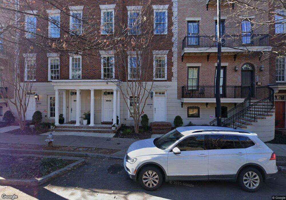
471 Bartram St SE Unit 20A Atlanta, GA 30316
Ormewood Park NeighborhoodEstimated Value: $473,305 - $508,000
3
Beds
4
Baths
1,000
Sq Ft
$484/Sq Ft
Est. Value
About This Home
This home is located at 471 Bartram St SE Unit 20A, Atlanta, GA 30316 and is currently estimated at $483,826, approximately $483 per square foot. 471 Bartram St SE Unit 20A is a home located in Fulton County with nearby schools including Parkside Elementary School, King Middle School, and Maynard Holbrook Jackson High School.
Ownership History
Date
Name
Owned For
Owner Type
Purchase Details
Closed on
Feb 28, 2022
Sold by
Whitling Rhesha A
Bought by
Faduski Charles
Current Estimated Value
Purchase Details
Closed on
May 22, 2015
Sold by
Fabina Christopher A
Bought by
Whitling Rhesha A and Whitling Nicholas A
Home Financials for this Owner
Home Financials are based on the most recent Mortgage that was taken out on this home.
Original Mortgage
$223,200
Interest Rate
3.77%
Mortgage Type
New Conventional
Purchase Details
Closed on
Feb 5, 2013
Sold by
Fabina Christopher A
Bought by
Fabina Christopher A and Fabina Laurie E
Home Financials for this Owner
Home Financials are based on the most recent Mortgage that was taken out on this home.
Original Mortgage
$169,400
Interest Rate
3.43%
Mortgage Type
New Conventional
Create a Home Valuation Report for This Property
The Home Valuation Report is an in-depth analysis detailing your home's value as well as a comparison with similar homes in the area
Home Values in the Area
Average Home Value in this Area
Purchase History
| Date | Buyer | Sale Price | Title Company |
|---|---|---|---|
| Faduski Charles | $460,000 | -- | |
| Whitling Rhesha A | $248,000 | -- | |
| Fabina Christopher A | -- | -- |
Source: Public Records
Mortgage History
| Date | Status | Borrower | Loan Amount |
|---|---|---|---|
| Previous Owner | Whitling Rhesha A | $223,200 | |
| Previous Owner | Fabina Christopher A | $169,400 |
Source: Public Records
Tax History Compared to Growth
Tax History
| Year | Tax Paid | Tax Assessment Tax Assessment Total Assessment is a certain percentage of the fair market value that is determined by local assessors to be the total taxable value of land and additions on the property. | Land | Improvement |
|---|---|---|---|---|
| 2025 | $34 | $184,000 | $38,680 | $145,320 |
| 2023 | $7,618 | $184,000 | $38,680 | $145,320 |
| 2022 | $3,532 | $170,720 | $35,400 | $135,320 |
| 2021 | $3,139 | $155,520 | $51,440 | $104,080 |
| 2020 | $2,856 | $144,000 | $36,600 | $107,400 |
| 2019 | $118 | $135,440 | $24,920 | $110,520 |
| 2018 | $2,893 | $121,600 | $20,760 | $100,840 |
| 2017 | $2,298 | $99,200 | $32,120 | $67,080 |
| 2016 | $2,301 | $99,200 | $32,120 | $67,080 |
| 2015 | $1,795 | $69,280 | $22,440 | $46,840 |
| 2014 | -- | $69,280 | $22,440 | $46,840 |
Source: Public Records
Map
Nearby Homes
- 438 Bill Kennedy Way SE
- 418 Bill Kennedy Way SE
- 925 Garrett St SE Unit 215
- 495 Hamilton St SE
- 953 Faith Ave SE
- 916 Ives Ln SE
- 956 Glenwood Park Dr SE
- 474 Glenwood Place SE
- 943 N Ormewood Park Dr SE Unit 202
- 965 N Ormewood Park Dr SE
- 951 Glenwood Ave SE Unit 1708
- 951 Glenwood Ave SE Unit 1004
- 951 Glenwood Ave SE Unit 1404
- 951 Glenwood Ave SE Unit 103
- 951 Glenwood Ave SE Unit 1706
- 1058 Sanders Ave SE
- 1064 Glenwood Ave SE
- 444 Lytle Ave SE
- 477 Bartram St SE Unit A
- 471 Bartram St SE Unit A
- 467 Bartram St SE Unit 467A
- 477 Bartram St SE Unit Na
- 477 Bartram St SE Unit 477A
- 481 Bartram St SE Unit A
- 461 Bartram St SE Unit 25A
- 469 Bartram St SE Unit 21A
- 461 Bartram St SE Unit 25
- 467 Bartram St SE Unit B
- 467 Bartram St SE Unit A
- 469 Bartram St SE Unit B
- 471 Bartram St SE Unit 20
- 477 Bartram St SE Unit 17B
- 477 Bartram St SE Unit 17A
- 481 Bartram St SE Unit B
- 481 Bartram St SE Unit 15A
- 483 Bartram St SE Unit 14B
- 483 Bartram St SE Unit A
- 483 Bartram St SE