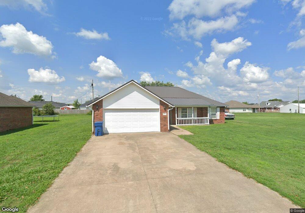
471 Bloomfield St Gentry, AR 72734
Estimated Value: $229,000 - $252,000
Studio
2
Baths
1,269
Sq Ft
$188/Sq Ft
Est. Value
About This Home
This home is located at 471 Bloomfield St, Gentry, AR 72734 and is currently estimated at $238,975, approximately $188 per square foot. 471 Bloomfield St is a home located in Benton County with nearby schools including Gentry Primary School, Gentry Intermediate School, and Gentry Middle School.
Ownership History
Date
Name
Owned For
Owner Type
Purchase Details
Closed on
Jul 14, 2017
Sold by
Beeler Leslee D and Hundley Leslee D
Bought by
Beeler Roy and Beeler Leslee
Current Estimated Value
Home Financials for this Owner
Home Financials are based on the most recent Mortgage that was taken out on this home.
Original Mortgage
$80,000
Outstanding Balance
$54,663
Interest Rate
3.94%
Estimated Equity
$184,312
Purchase Details
Closed on
Jul 5, 2001
Bought by
Hundley
Purchase Details
Closed on
Sep 6, 1994
Bought by
Wil-Bee 41Lts
Create a Home Valuation Report for This Property
The Home Valuation Report is an in-depth analysis detailing your home's value as well as a comparison with similar homes in the area
Home Values in the Area
Average Home Value in this Area
Purchase History
| Date | Buyer | Sale Price | Title Company |
|---|---|---|---|
| Beeler Roy | -- | None Available | |
| Hundley | $76,000 | -- | |
| Wil-Bee 41Lts | $130,000 | -- |
Source: Public Records
Mortgage History
| Date | Status | Borrower | Loan Amount |
|---|---|---|---|
| Open | Beeler Roy | $80,000 |
Source: Public Records
Tax History
| Year | Tax Paid | Tax Assessment Tax Assessment Total Assessment is a certain percentage of the fair market value that is determined by local assessors to be the total taxable value of land and additions on the property. | Land | Improvement |
|---|---|---|---|---|
| 2025 | $1,476 | $45,849 | $7,000 | $38,849 |
| 2024 | $1,394 | $45,849 | $7,000 | $38,849 |
| 2023 | $1,327 | $29,210 | $5,000 | $24,210 |
| 2022 | $964 | $29,210 | $5,000 | $24,210 |
| 2021 | $900 | $29,210 | $5,000 | $24,210 |
| 2020 | $844 | $20,880 | $1,800 | $19,080 |
| 2019 | $844 | $20,880 | $1,800 | $19,080 |
| 2018 | $869 | $20,880 | $1,800 | $19,080 |
| 2017 | $1,194 | $20,880 | $1,800 | $19,080 |
| 2016 | $1,194 | $20,880 | $1,800 | $19,080 |
| 2015 | $1,027 | $18,580 | $1,800 | $16,780 |
| 2014 | $677 | $18,580 | $1,800 | $16,780 |
Source: Public Records
Map
Nearby Homes
- 545 Red Oak St
- 526 White Oak St
- 308 White Oak St
- 304 White Oak St
- 399 Pioneer Ln
- 305 Pin Oak St
- 300 Post Oak Ave
- 200 Post Oak Ave
- 1704 Gerald Shay Rd
- 200 Whitten Ave
- 208 Whitten Ave
- 904 W Main St
- 204 Whitten Ave
- 1705 Pittman St
- 900 Churchill Ct
- 1713 Pittman St
- 1704 Pittman St
- 1708 Pittman St
- 1716 Pittman St
- 1709 Pittman St
- 491 Bloomfield St
- 466 Red Oak St
- 484 Red Oak St
- 208 Bloomfield Str St
- 26 Bloomfield Str St
- 12 Bloomfield Str St
- 470 Bloomfield St
- 531 Bloomfield St
- 448 Red Oak St
- 500 Red Oak St
- 1240 Crafton Place
- 492 Bloomfield St
- 484 Red Oak
- 430 Red Oak St
- 0 White Oak Red Oak & Live Oak St Unit 666186
- 0 Bloomfield St
- 518 Red Oak St
- 551 Bloomfield St
- 0 Crafton Place Unit 577445
- 0 Crafton Place Unit 577446
Your Personal Tour Guide
Ask me questions while you tour the home.