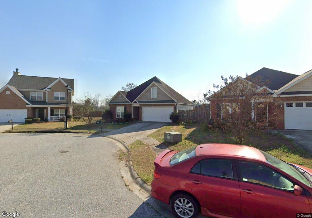
471 Bob White Rd Macon, GA 31216
Estimated Value: $192,186 - $225,000
3
Beds
2
Baths
1,265
Sq Ft
$167/Sq Ft
Est. Value
About This Home
This home is located at 471 Bob White Rd, Macon, GA 31216 and is currently estimated at $211,797, approximately $167 per square foot. 471 Bob White Rd is a home located in Bibb County with nearby schools including Heard Elementary School, Rutland Middle School, and Rutland High School.
Ownership History
Date
Name
Owned For
Owner Type
Purchase Details
Closed on
Apr 19, 2013
Sold by
Paul Franklin A and Kennedy Nelda
Bought by
Jenkins Christopher L
Current Estimated Value
Home Financials for this Owner
Home Financials are based on the most recent Mortgage that was taken out on this home.
Original Mortgage
$86,406
Outstanding Balance
$60,167
Interest Rate
3.25%
Mortgage Type
FHA
Estimated Equity
$151,630
Purchase Details
Closed on
Aug 19, 2011
Sold by
Project Development & Management Llc
Bought by
Kennedy Nelda
Purchase Details
Closed on
May 10, 2007
Bought by
Project Dvlpmt & Mgmt Llc
Create a Home Valuation Report for This Property
The Home Valuation Report is an in-depth analysis detailing your home's value as well as a comparison with similar homes in the area
Home Values in the Area
Average Home Value in this Area
Purchase History
| Date | Buyer | Sale Price | Title Company |
|---|---|---|---|
| Jenkins Christopher L | $88,000 | None Available | |
| Jenkins Christopher L | $88,000 | None Available | |
| Kennedy Nelda | $102,000 | None Available | |
| Kennedy Nelda | $102,000 | None Available | |
| Project Dvlpmt & Mgmt Llc | $175,000 | -- | |
| Project Dvlpmt & Mgmt Llc | $175,000 | -- |
Source: Public Records
Mortgage History
| Date | Status | Borrower | Loan Amount |
|---|---|---|---|
| Open | Jenkins Christopher L | $86,406 |
Source: Public Records
Tax History Compared to Growth
Tax History
| Year | Tax Paid | Tax Assessment Tax Assessment Total Assessment is a certain percentage of the fair market value that is determined by local assessors to be the total taxable value of land and additions on the property. | Land | Improvement |
|---|---|---|---|---|
| 2025 | $1,584 | $64,452 | $10,000 | $54,452 |
| 2024 | $1,637 | $64,452 | $10,000 | $54,452 |
| 2023 | $1,589 | $62,582 | $10,000 | $52,582 |
| 2022 | $1,892 | $54,662 | $8,000 | $46,662 |
| 2021 | $1,978 | $52,040 | $7,600 | $44,440 |
| 2020 | $1,731 | $44,574 | $6,800 | $37,774 |
| 2019 | $1,745 | $44,574 | $6,800 | $37,774 |
| 2018 | $2,666 | $41,464 | $6,800 | $34,664 |
| 2017 | $1,504 | $40,130 | $6,800 | $33,330 |
| 2016 | $1,251 | $36,170 | $5,950 | $30,220 |
| 2015 | $1,771 | $36,170 | $5,950 | $30,220 |
| 2014 | $1,726 | $35,591 | $5,950 | $29,641 |
Source: Public Records
Map
Nearby Homes
- 465 Bob White Rd
- 428 Bob White Rd
- 411 Bob White Rd
- 408 Resting Fawn Place
- 436 Joseph Chandler Dr
- DUPONT Plan at Quail Ridge
- GARDNER Plan at Quail Ridge
- KINGSTON Plan at Quail Ridge
- ESSEX Plan at Quail Ridge
- 708 Coopers Lnd
- 3160 Walden Rd
- 116 Wynens Way
- 102 Haylie Ct
- 104 Alayna Ct
- 813 Ocala National Trail
- 330 Cody Dr
- 328 Cody Dr
- 405 Stonecrest Ct
- 471 Bob White Rd Unit 32
- 469 Bob White Rd
- 473 Bob White Rd
- 467 Bob White Rd
- 475 Bob White Rd
- 477 Bob White Rd
- 463 Bob White Rd
- 479 Bob White Rd Unit 36
- 479 Bob White Rd
- 480 Bob White Rd
- 114 Sweetgum Way
- 461 Bob White Rd
- 481 Bob White Rd
- 110 Sweetgum Way Unit 1/79
- 110 Sweetgum Way
- 110 Sweetgum Way Unit 136/4
- 482 Bob White Rd
- 483 Bob White Rd
- 459 Bob White Rd
- 108 Sweetgum Way