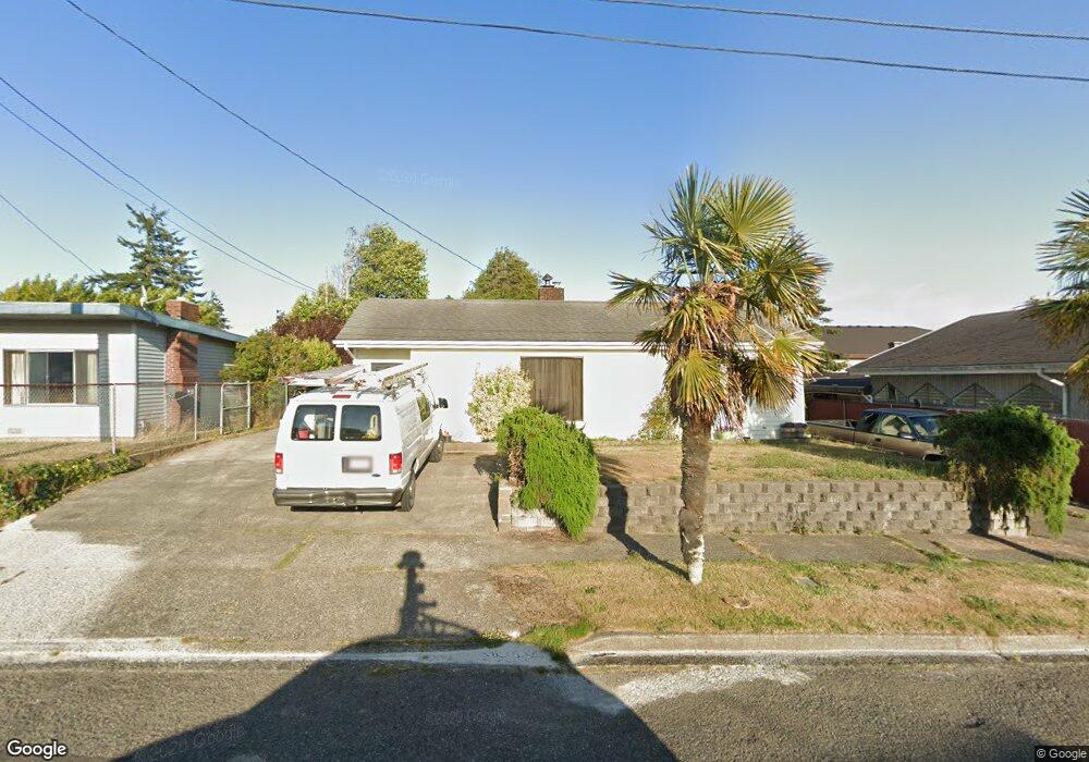
471 Brule St Coos Bay, OR 97420
Estimated Value: $344,000 - $395,872
4
Beds
3
Baths
1,694
Sq Ft
$218/Sq Ft
Est. Value
About This Home
This home is located at 471 Brule St, Coos Bay, OR 97420 and is currently estimated at $369,936, approximately $218 per square foot. 471 Brule St is a home located in Coos County with nearby schools including Sunset School, Madison Elementary School, and Marshfield Senior High School.
Ownership History
Date
Name
Owned For
Owner Type
Purchase Details
Closed on
Jul 27, 2005
Sold by
Austin Phillip D
Bought by
Bushmaker Scott
Current Estimated Value
Home Financials for this Owner
Home Financials are based on the most recent Mortgage that was taken out on this home.
Original Mortgage
$25,875
Interest Rate
5.16%
Mortgage Type
Stand Alone Second
Create a Home Valuation Report for This Property
The Home Valuation Report is an in-depth analysis detailing your home's value as well as a comparison with similar homes in the area
Home Values in the Area
Average Home Value in this Area
Purchase History
| Date | Buyer | Sale Price | Title Company |
|---|---|---|---|
| Bushmaker Scott | $172,500 | Ticor Title Insurance |
Source: Public Records
Mortgage History
| Date | Status | Borrower | Loan Amount |
|---|---|---|---|
| Closed | Bushmaker Scott | $25,875 | |
| Open | Bushmaker Scott | $138,000 |
Source: Public Records
Tax History Compared to Growth
Tax History
| Year | Tax Paid | Tax Assessment Tax Assessment Total Assessment is a certain percentage of the fair market value that is determined by local assessors to be the total taxable value of land and additions on the property. | Land | Improvement |
|---|---|---|---|---|
| 2024 | $3,722 | $214,140 | -- | -- |
| 2023 | $3,610 | $207,910 | $0 | $0 |
| 2022 | $3,550 | $201,860 | $0 | $0 |
| 2021 | $3,459 | $195,990 | $0 | $0 |
| 2020 | $3,361 | $195,990 | $0 | $0 |
| 2019 | $3,227 | $184,750 | $0 | $0 |
| 2018 | $3,116 | $179,370 | $0 | $0 |
| 2017 | $2,761 | $174,150 | $0 | $0 |
| 2016 | $2,636 | $169,080 | $0 | $0 |
| 2015 | $2,456 | $164,160 | $0 | $0 |
| 2014 | $2,456 | $159,380 | $0 | $0 |
Source: Public Records
Map
Nearby Homes
- 1770 Shorepines Dr
- 1848 Thomas Ave
- 2780 34th St
- 3380 Walnut Ave
- 580 Shorepines Place
- 2730 33rd St
- 1445 Village Pines Ave
- 630 Shorepines Heights
- 1465 Village Pines Ct
- 3300 Pacific Loop
- 3290 Pacific Loop
- 640 Village Pines Dr
- 340 Radar Rd
- 3483 Fir St
- 0 Newmark Ave Unit 24289444
- 0 0 Fir
- 507 Puerto Vista Dr
- 3677 Pine St
- 2310 Driftwood Ln
- 543 Puerto Vista Dr