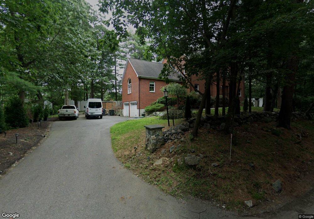
471 Commonwealth Rd Wayland, MA 01778
Estimated Value: $1,331,000 - $1,500,000
4
Beds
4
Baths
4,900
Sq Ft
$288/Sq Ft
Est. Value
About This Home
This home is located at 471 Commonwealth Rd, Wayland, MA 01778 and is currently estimated at $1,409,683, approximately $287 per square foot. 471 Commonwealth Rd is a home located in Middlesex County with nearby schools including Natick High School, Bennett-Hemenway (Ben-Hem) Elementary School, and Wilson Middle School.
Ownership History
Date
Name
Owned For
Owner Type
Purchase Details
Closed on
Nov 14, 2014
Sold by
Fortune Gardens T
Bought by
Hoang Tao V and Hoang Thang V
Current Estimated Value
Home Financials for this Owner
Home Financials are based on the most recent Mortgage that was taken out on this home.
Original Mortgage
$470,000
Outstanding Balance
$362,280
Interest Rate
4.17%
Mortgage Type
New Conventional
Estimated Equity
$1,047,403
Purchase Details
Closed on
Nov 24, 2006
Sold by
Mah Betty S and Mah Fay S G
Bought by
Fortune Gardens T
Create a Home Valuation Report for This Property
The Home Valuation Report is an in-depth analysis detailing your home's value as well as a comparison with similar homes in the area
Home Values in the Area
Average Home Value in this Area
Purchase History
| Date | Buyer | Sale Price | Title Company |
|---|---|---|---|
| Hoang Tao V | $755,000 | -- | |
| Fortune Gardens T | $720,000 | -- |
Source: Public Records
Mortgage History
| Date | Status | Borrower | Loan Amount |
|---|---|---|---|
| Open | Hoang Tao V | $470,000 |
Source: Public Records
Tax History
| Year | Tax Paid | Tax Assessment Tax Assessment Total Assessment is a certain percentage of the fair market value that is determined by local assessors to be the total taxable value of land and additions on the property. | Land | Improvement |
|---|---|---|---|---|
| 2025 | $13,871 | $1,159,800 | $350,300 | $809,500 |
| 2024 | $13,385 | $1,091,800 | $329,600 | $762,200 |
| 2023 | $12,919 | $1,022,100 | $326,700 | $695,400 |
| 2022 | $12,494 | $936,600 | $295,400 | $641,200 |
| 2021 | $11,928 | $876,400 | $279,200 | $597,200 |
| 2020 | $11,762 | $864,200 | $267,000 | $597,200 |
| 2019 | $10,984 | $864,200 | $267,000 | $597,200 |
| 2018 | $10,414 | $798,000 | $254,900 | $543,100 |
| 2017 | $9,980 | $739,800 | $159,500 | $580,300 |
| 2016 | $9,937 | $732,300 | $157,400 | $574,900 |
| 2015 | $10,046 | $726,900 | $188,800 | $538,100 |
Source: Public Records
Map
Nearby Homes
- 5 Pickwick Way
- 6 Briar Ln
- 12 Cutting Cross Way
- 6 Steepletree Ln
- 16 Coltsway Unit 16CW
- 79 Walnut Rd
- 63 Sylvan Ln
- 4 Essex
- 620 South Ave
- 286 Country Dr
- 3 Sunnyside Ave
- 16 Sunnyside Ave
- 83 Brown St
- 8 Oakdale Ave
- 15 Rockport Rd
- 19 Northgate Rd
- 568 Wellesley St
- 169 Hickory Rd
- 1605 Wisteria Way
- 6 Meadowbrook Rd
- 471 Commonwealth Rd
- 471 Commonwealth Rd Unit 1
- 475 Commonwealth Rd
- 479 Commonwealth Rd
- 474 Commonwealth Rd
- 0 Indian Rock Rd
- Lot 4 10 Indian Rock Rd
- 15 Saddlebrook Rd
- 481 Commonwealth Rd
- 472 Commonwealth Rd
- 10 Indian Rock Rd
- 10 Indian Rock Rd
- 470 Commonwealth Rd
- 20 Indian Rock Rd
- 470 Commonwealth Rd(off Of)
- 20 Saddlebrook Rd
- 37 Clubhouse Ln
- 22 Indian Rock Rd
- 22 Indian Rock Rd
- 24 Indian Rock Rd
Your Personal Tour Guide
Ask me questions while you tour the home.