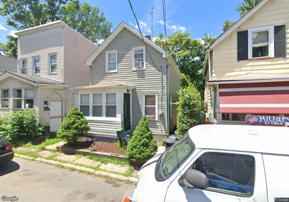
471 Flagg St Orange, NJ 07050
Estimated Value: $280,000 - $403,000
Studio
--
Bath
993
Sq Ft
$335/Sq Ft
Est. Value
About This Home
This home is located at 471 Flagg St, Orange, NJ 07050 and is currently estimated at $332,381, approximately $334 per square foot. 471 Flagg St is a home located in Essex County.
Ownership History
Date
Name
Owned For
Owner Type
Purchase Details
Closed on
Aug 17, 2011
Sold by
Secretary Of Housing & Urban Development
Bought by
Wiggins Renee
Current Estimated Value
Home Financials for this Owner
Home Financials are based on the most recent Mortgage that was taken out on this home.
Original Mortgage
$38,986
Outstanding Balance
$27,368
Interest Rate
4.87%
Mortgage Type
FHA
Estimated Equity
$305,013
Purchase Details
Closed on
Mar 1, 2011
Sold by
Wells Fargo Bank N A
Bought by
The Secretary Of Housing & Urban Develop
Purchase Details
Closed on
Dec 30, 2010
Sold by
Marion Jeanette L
Bought by
Wells Fargo Bank N A
Purchase Details
Closed on
Jun 12, 2006
Sold by
Crowley Arleen
Bought by
Marion Jeanette
Home Financials for this Owner
Home Financials are based on the most recent Mortgage that was taken out on this home.
Original Mortgage
$172,296
Interest Rate
6.62%
Mortgage Type
FHA
Create a Home Valuation Report for This Property
The Home Valuation Report is an in-depth analysis detailing your home's value as well as a comparison with similar homes in the area
Home Values in the Area
Average Home Value in this Area
Purchase History
| Date | Buyer | Sale Price | Title Company |
|---|---|---|---|
| Wiggins Renee | $40,300 | Collegiate Title Corp | |
| The Secretary Of Housing & Urban Develop | -- | None Available | |
| Wells Fargo Bank N A | -- | None Available | |
| Marion Jeanette | $175,000 | -- |
Source: Public Records
Mortgage History
| Date | Status | Borrower | Loan Amount |
|---|---|---|---|
| Open | Wiggins Renee | $38,986 | |
| Previous Owner | Marion Jeanette | $172,296 |
Source: Public Records
Tax History
| Year | Tax Paid | Tax Assessment Tax Assessment Total Assessment is a certain percentage of the fair market value that is determined by local assessors to be the total taxable value of land and additions on the property. | Land | Improvement |
|---|---|---|---|---|
| 2025 | $6,999 | $187,800 | $67,500 | $120,300 |
| 2024 | $6,999 | $187,800 | $67,500 | $120,300 |
| 2022 | $6,509 | $187,800 | $67,500 | $120,300 |
| 2021 | $5,809 | $100,500 | $43,900 | $56,600 |
| 2020 | $5,635 | $100,500 | $43,900 | $56,600 |
| 2019 | $5,342 | $100,500 | $43,900 | $56,600 |
| 2018 | $5,256 | $100,500 | $43,900 | $56,600 |
| 2017 | $4,894 | $100,500 | $43,900 | $56,600 |
| 2016 | $4,802 | $100,500 | $43,900 | $56,600 |
| 2015 | $4,676 | $100,500 | $43,900 | $56,600 |
| 2014 | $4,471 | $100,500 | $43,900 | $56,600 |
Source: Public Records
Map
Nearby Homes
- 639 Nassau St Unit 8
- 585 Mcchesney St
- 527 Valley St
- 567 Mcchesney St
- 540 Liberty St
- 9 S Valley Rd
- 45 Freeman St
- 53 Forest Hill Rd
- 346 S Jefferson St
- 467 Fairview Ave
- 350 Scotland Rd Unit 304
- 350 Scotland Rd
- 548 Tremont Ave
- 622 Tremont Ave
- 76 Mitchell St
- 433 Lincoln Ave Unit B8
- 433 Lincoln Ave Unit C002G
- 433 Lincoln Ave
- 631 Valley St
- 530 Lincoln Ave
Your Personal Tour Guide
Ask me questions while you tour the home.