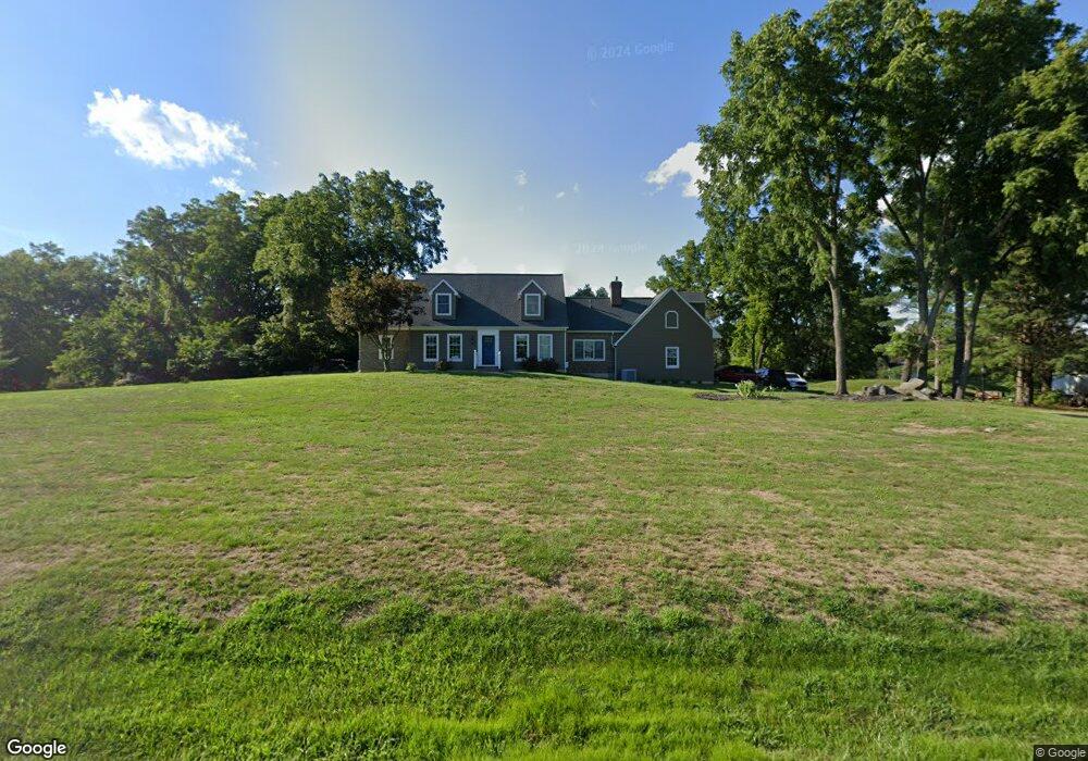
471 Knight Rd Unit 19 Gettysburg, PA 17325
Estimated Value: $524,000 - $678,000
4
Beds
3
Baths
2,734
Sq Ft
$223/Sq Ft
Est. Value
About This Home
This home is located at 471 Knight Rd Unit 19, Gettysburg, PA 17325 and is currently estimated at $610,440, approximately $223 per square foot. 471 Knight Rd Unit 19 is a home located in Adams County with nearby schools including Gettysburg Area High School.
Ownership History
Date
Name
Owned For
Owner Type
Purchase Details
Closed on
Aug 15, 2005
Sold by
Keen Ernest J and Keen John Ernest
Bought by
Amott Teresa L
Current Estimated Value
Home Financials for this Owner
Home Financials are based on the most recent Mortgage that was taken out on this home.
Original Mortgage
$153,000
Interest Rate
5.81%
Mortgage Type
Purchase Money Mortgage
Create a Home Valuation Report for This Property
The Home Valuation Report is an in-depth analysis detailing your home's value as well as a comparison with similar homes in the area
Home Values in the Area
Average Home Value in this Area
Purchase History
| Date | Buyer | Sale Price | Title Company |
|---|---|---|---|
| Amott Teresa L | $345,000 | -- |
Source: Public Records
Mortgage History
| Date | Status | Borrower | Loan Amount |
|---|---|---|---|
| Closed | Amott Teresa L | $153,000 |
Source: Public Records
Tax History Compared to Growth
Tax History
| Year | Tax Paid | Tax Assessment Tax Assessment Total Assessment is a certain percentage of the fair market value that is determined by local assessors to be the total taxable value of land and additions on the property. | Land | Improvement |
|---|---|---|---|---|
| 2025 | $7,869 | $421,700 | $121,500 | $300,200 |
| 2024 | $7,089 | $397,200 | $121,500 | $275,700 |
| 2023 | $6,990 | $397,200 | $121,500 | $275,700 |
| 2022 | $6,929 | $397,200 | $121,500 | $275,700 |
| 2021 | $6,795 | $397,200 | $121,500 | $275,700 |
| 2020 | $6,795 | $397,200 | $121,500 | $275,700 |
| 2019 | $6,752 | $397,200 | $121,500 | $275,700 |
| 2018 | $6,715 | $397,200 | $121,500 | $275,700 |
| 2017 | $6,344 | $397,200 | $121,500 | $275,700 |
| 2016 | -- | $397,200 | $121,500 | $275,700 |
| 2015 | -- | $397,200 | $121,500 | $275,700 |
| 2014 | -- | $397,200 | $121,500 | $275,700 |
Source: Public Records
Map
Nearby Homes
- 105 Round Top Ln Unit 8
- 437 Ridge Rd
- 90 Knight Rd Unit 55
- 949 Ridge Rd
- 2465 Emmitsburg Rd
- 2691 Emmitsburg Rd
- 175 Chapel Road Extension
- 374 Cunningham Rd
- 804 Highland Ave
- 1685 LOT #3 Baltimore Pike
- 31 Ivy Ln Unit 2C
- 64 Cooper Ln
- 45 Plank Rd Unit 1
- 151 Clapsaddle Rd
- 0 Fairfield and Iron Springs Rd Unit PAAD2014760
- 34 Redding Ln
- 504 Baltimore St
- 460 Baltimore St
- 0 Unit PAAD2015388
- 1 Crosby Ct
- 501 Knight Rd Unit 17
- 90 Round Top Ln Unit 20
- 30 Round Top Ln Unit 21
- 114 Round Top Ln Unit 18
- 460 Knight Rd Unit 4
- 39 Round Top Ln Unit 3
- 520 Knight Rd
- 81 Round Top Ln Unit 6
- 198 Round Top Ln Unit 15
- 160 Round Top Ln Unit 16
- 67 Round Top Ln Unit 5
- 95 Round Top Ln Unit 7
- 125 Round Top Ln Unit 9
- 11 Round Top Ln Unit 2
- 57 Round Top Ln Unit 4
- 550 Knight Rd Unit 2
- 195 Round Top Ln Unit 14
- 145 Round Top Ln Unit 10
- 440 Knight Rd
- 175 Round Top Ln Unit 12