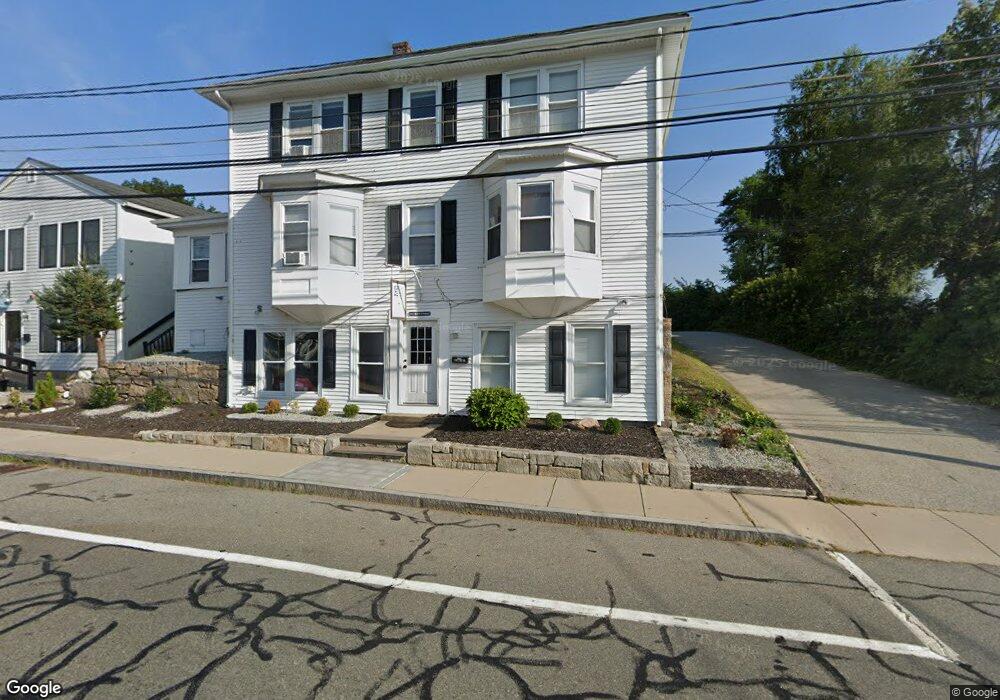
471 Main St Wakefield, RI 02879
Estimated Value: $949,301
--
Bed
--
Bath
790
Sq Ft
$1,202/Sq Ft
Est. Value
About This Home
This home is located at 471 Main St, Wakefield, RI 02879 and is currently estimated at $949,301, approximately $1,201 per square foot. 471 Main St is a home located in Washington County with nearby schools including South Kingstown High School, Monsignor Matthew Clarke Catholic Regional School, and Bradley School-South.
Ownership History
Date
Name
Owned For
Owner Type
Purchase Details
Closed on
Oct 26, 2015
Sold by
Hallberg Scot V
Bought by
471 Main Llc
Current Estimated Value
Purchase Details
Closed on
Nov 25, 2002
Sold by
Hallberg Howard V
Bought by
Hallberg Scot V
Home Financials for this Owner
Home Financials are based on the most recent Mortgage that was taken out on this home.
Original Mortgage
$300,000
Interest Rate
6.07%
Create a Home Valuation Report for This Property
The Home Valuation Report is an in-depth analysis detailing your home's value as well as a comparison with similar homes in the area
Home Values in the Area
Average Home Value in this Area
Purchase History
| Date | Buyer | Sale Price | Title Company |
|---|---|---|---|
| 471 Main Llc | -- | -- | |
| 471 Main Llc | -- | -- | |
| Hallberg Scot V | $325,000 | -- | |
| Hallberg Scot V | $325,000 | -- |
Source: Public Records
Mortgage History
| Date | Status | Borrower | Loan Amount |
|---|---|---|---|
| Closed | Hallberg Scot V | $0 | |
| Previous Owner | Hallberg Scot V | $300,000 |
Source: Public Records
Tax History Compared to Growth
Tax History
| Year | Tax Paid | Tax Assessment Tax Assessment Total Assessment is a certain percentage of the fair market value that is determined by local assessors to be the total taxable value of land and additions on the property. | Land | Improvement |
|---|---|---|---|---|
| 2025 | $6,389 | $714,700 | $317,400 | $397,300 |
| 2024 | $7,154 | $647,400 | $264,300 | $383,100 |
| 2023 | $7,126 | $644,900 | $264,300 | $380,600 |
| 2022 | $7,062 | $644,900 | $264,300 | $380,600 |
| 2021 | $8,475 | $586,500 | $230,200 | $356,300 |
| 2020 | $8,475 | $586,500 | $230,200 | $356,300 |
| 2019 | $8,475 | $586,500 | $230,200 | $356,300 |
| 2018 | $7,962 | $507,800 | $191,900 | $315,900 |
| 2017 | $7,774 | $507,800 | $191,900 | $315,900 |
| 2016 | $7,663 | $507,800 | $191,900 | $315,900 |
| 2015 | $7,509 | $483,800 | $191,900 | $291,900 |
| 2014 | -- | $483,800 | $191,900 | $291,900 |
Source: Public Records
Map
Nearby Homes
- 98 Meadow Ave
- 35 Whittier Dr
- 37 Whittier Dr
- 23 Rockland Dr
- 37 Columbia St
- 10 Hendricks St
- 39 Hazard Ave
- 156 River St Unit B
- 45 Cherry Ln Unit C
- 48 Stone Bridge Dr
- 47 Tuckertown Rd
- 128 Rodman St
- 333 South Rd
- 5 Secluded Dr
- 40 Amos St
- 38 Eisenhower Place
- 228 Rodman St
- 3 Larkin St
- 30 Sweet Meadows Ct Unit 26
- 70 Broad Rock Rd
- 473 Main St Unit 473 Main
- 103 Birdie Ct Unit 103
- 101 Birdie Ct Unit 101
- 100 Birdie Ct Unit 100
- 102 Birdie Ct Unit 102
- 476 Main St
- 457 Main St
- 466 Main St
- 491 Main St
- 484 Main St
- 19 Wright Ave
- 19 Wright Ave Unit 2
- 445 Main St
- 25 Wright Ave
- 12 High St
- 22 Johnson Place
- 500 Main St
- 446 Main St
- 433 Main St
- 33 Wright Ave