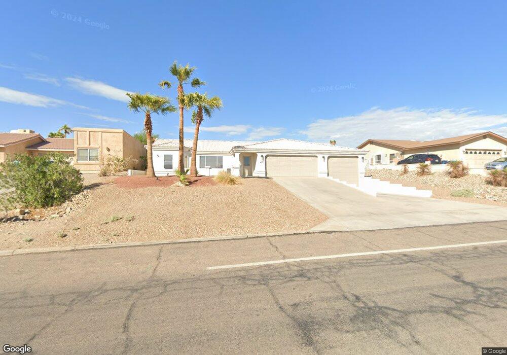
471 Mulberry Ave Lake Havasu City, AZ 86403
Estimated Value: $538,768 - $707,000
--
Bed
1
Bath
1,459
Sq Ft
$411/Sq Ft
Est. Value
About This Home
This home is located at 471 Mulberry Ave, Lake Havasu City, AZ 86403 and is currently estimated at $599,192, approximately $410 per square foot. 471 Mulberry Ave is a home located in Mohave County with nearby schools including Starline Elementary School, Thunderbolt Middle School, and Lake Havasu High School.
Ownership History
Date
Name
Owned For
Owner Type
Purchase Details
Closed on
Mar 15, 2021
Sold by
Rodgers Peter Mogan and Rodgers Traci Lynn
Bought by
Rodgers Peter Mogan and Rodgers Traci Lynn
Current Estimated Value
Purchase Details
Closed on
Aug 23, 2000
Sold by
Muscavitz Thelma P
Bought by
Rodgers Peter Mogan and Rodgers Traci Lynn
Home Financials for this Owner
Home Financials are based on the most recent Mortgage that was taken out on this home.
Original Mortgage
$116,000
Outstanding Balance
$45,102
Interest Rate
9.25%
Mortgage Type
New Conventional
Estimated Equity
$554,090
Create a Home Valuation Report for This Property
The Home Valuation Report is an in-depth analysis detailing your home's value as well as a comparison with similar homes in the area
Home Values in the Area
Average Home Value in this Area
Purchase History
| Date | Buyer | Sale Price | Title Company |
|---|---|---|---|
| Rodgers Peter Mogan | -- | Amrock Inc | |
| Rodgers Peter Mogan | $145,000 | Capital Title Agency Inc |
Source: Public Records
Mortgage History
| Date | Status | Borrower | Loan Amount |
|---|---|---|---|
| Open | Rodgers Peter Mogan | $116,000 |
Source: Public Records
Tax History Compared to Growth
Tax History
| Year | Tax Paid | Tax Assessment Tax Assessment Total Assessment is a certain percentage of the fair market value that is determined by local assessors to be the total taxable value of land and additions on the property. | Land | Improvement |
|---|---|---|---|---|
| 2026 | $920 | -- | -- | -- |
| 2025 | $1,865 | $48,477 | $0 | $0 |
| 2024 | $1,865 | $49,346 | $0 | $0 |
| 2023 | $1,865 | $36,678 | $0 | $0 |
| 2022 | $1,785 | $31,234 | $0 | $0 |
| 2021 | $1,960 | $27,563 | $0 | $0 |
| 2019 | $1,862 | $24,394 | $0 | $0 |
| 2018 | $1,798 | $23,727 | $0 | $0 |
| 2017 | $1,781 | $21,380 | $0 | $0 |
| 2016 | $1,612 | $19,383 | $0 | $0 |
| 2015 | $1,544 | $17,738 | $0 | $0 |
Source: Public Records
Map
Nearby Homes
- 1711 Combat Dr Unit 12
- 500 Lake Havasu Ave S Unit A12
- 1827 Combat Dr
- 1838 Montana Vista Unit C
- 1840 Montana Vista Unit D
- 1852 Montana Vista Unit B
- 1824 Montana Vista Unit D
- 1881 Pinion Tree Dr
- 1884 Montana Vista Unit 63B
- 1723 Montana Vista Unit D
- 371 Cottonwood Dr
- 1958 Montana Vista Unit D
- 1793 Montana Vista Unit C
- 1786 Los Lagos Dr Unit A
- 220 White Oak Dr
- 1771 Los Lagos Dr Unit D
- 1775 Los Lagos Dr Unit B
- 539 Burkemo Ln Unit A1
- 190 Aspen Dr
- 565 Jones Dr Unit 3b
- 481 Mulberry Ave
- 461 Mulberry Ave
- 1806 Combat Dr
- 491 Mulberry Ave
- 1804 Combat Dr
- 1808 Combat Dr
- 480 Mulberry Ave
- 470 Mulberry Ave
- 1802 Combat Dr
- 1810 Combat Dr
- 441 Mulberry Ave
- 450 Mulberry Ave
- 1800 Combat Dr
- 1812 Combat Dr
- 440 Mulberry Ave
- 490 Lake Havasu Ave S Unit 102
- 490 Lake Havasu Ave S Unit 104
- 490 Lake Havasu Ave S
- 431 Mulberry Ave
- 1805 Combat Dr