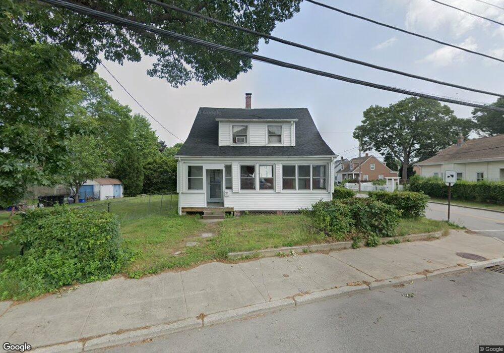
471 Power Rd Pawtucket, RI 02860
Fairlawn NeighborhoodEstimated Value: $339,000 - $488,000
2
Beds
2
Baths
1,166
Sq Ft
$342/Sq Ft
Est. Value
About This Home
This home is located at 471 Power Rd, Pawtucket, RI 02860 and is currently estimated at $398,787, approximately $342 per square foot. 471 Power Rd is a home located in Providence County with nearby schools including Blackstone Valley Prep Upper Elementary School, Blackstone Valley Prep Junior High School, and The San Miguel School.
Create a Home Valuation Report for This Property
The Home Valuation Report is an in-depth analysis detailing your home's value as well as a comparison with similar homes in the area
Home Values in the Area
Average Home Value in this Area
Tax History
| Year | Tax Paid | Tax Assessment Tax Assessment Total Assessment is a certain percentage of the fair market value that is determined by local assessors to be the total taxable value of land and additions on the property. | Land | Improvement |
|---|---|---|---|---|
| 2025 | $4,024 | $306,000 | $125,100 | $180,900 |
| 2024 | $3,776 | $306,000 | $125,100 | $180,900 |
| 2023 | $3,466 | $204,600 | $75,500 | $129,100 |
| 2022 | $3,392 | $204,600 | $75,500 | $129,100 |
| 2021 | $3,392 | $204,600 | $75,500 | $129,100 |
| 2020 | $2,914 | $139,500 | $53,000 | $86,500 |
| 2019 | $2,914 | $139,500 | $53,000 | $86,500 |
| 2018 | $2,808 | $139,500 | $53,000 | $86,500 |
| 2017 | $2,826 | $124,400 | $56,700 | $67,700 |
| 2016 | $2,723 | $124,400 | $56,700 | $67,700 |
| 2015 | $2,723 | $124,400 | $56,700 | $67,700 |
| 2014 | $2,737 | $118,700 | $56,700 | $62,000 |
Source: Public Records
Map
Nearby Homes
- 102 Francis Ave
- 220 Francis Ave
- 53 Oriole Ave
- 2 Ward Ave
- 60 Dorman Ave
- 458 Smithfield Ave
- 63 Chandler Ave
- 60 Stedman Ave
- 2 Cobble Hill Rd
- 53 Francis Ave
- 121 Samuel Ave
- 957 Mineral Spring Ave
- 18 Almy St
- 16 Rufus St
- 11 Franklin St
- 53 Samuel Ave
- 8 Arnold Ave
- 1190 Charles St Unit 20
- 1190 Charles St Unit 14
- 584 Weeden St
Your Personal Tour Guide
Ask me questions while you tour the home.