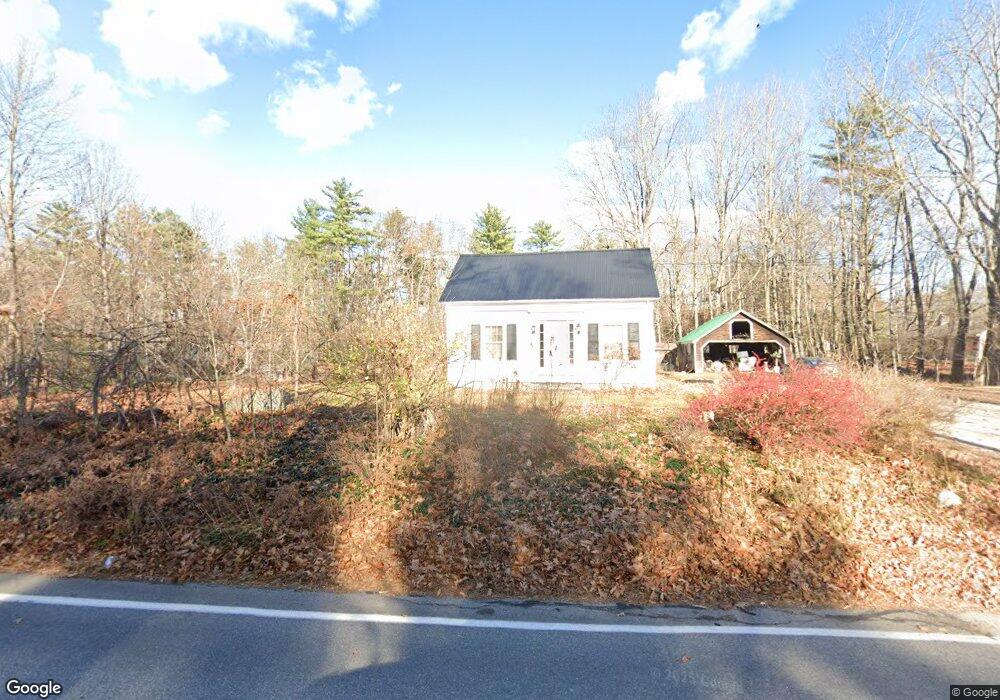
471 Whites Bridge Rd Standish, ME 04084
North Gorham NeighborhoodEstimated Value: $452,824 - $906,000
4
Beds
2
Baths
2,052
Sq Ft
$316/Sq Ft
Est. Value
About This Home
This home is located at 471 Whites Bridge Rd, Standish, ME 04084 and is currently estimated at $648,956, approximately $316 per square foot. 471 Whites Bridge Rd is a home located in Cumberland County with nearby schools including Bonny Eagle High School and Windham Christian Academy.
Ownership History
Date
Name
Owned For
Owner Type
Purchase Details
Closed on
Nov 3, 2017
Sold by
Richardson Ralph L
Bought by
Jr Partnership Llc
Current Estimated Value
Home Financials for this Owner
Home Financials are based on the most recent Mortgage that was taken out on this home.
Original Mortgage
$64,000
Interest Rate
3.83%
Mortgage Type
Purchase Money Mortgage
Purchase Details
Closed on
Dec 3, 2015
Sold by
Richardson Ralph L and Richardson Norma E
Bought by
Richardson R James
Create a Home Valuation Report for This Property
The Home Valuation Report is an in-depth analysis detailing your home's value as well as a comparison with similar homes in the area
Home Values in the Area
Average Home Value in this Area
Purchase History
| Date | Buyer | Sale Price | Title Company |
|---|---|---|---|
| Jr Partnership Llc | -- | -- | |
| Richardson R James | -- | -- |
Source: Public Records
Mortgage History
| Date | Status | Borrower | Loan Amount |
|---|---|---|---|
| Closed | Jr Partnership Llc | $64,000 |
Source: Public Records
Tax History Compared to Growth
Tax History
| Year | Tax Paid | Tax Assessment Tax Assessment Total Assessment is a certain percentage of the fair market value that is determined by local assessors to be the total taxable value of land and additions on the property. | Land | Improvement |
|---|---|---|---|---|
| 2024 | $3,305 | $262,300 | $74,900 | $187,400 |
| 2023 | $3,065 | $221,300 | $64,400 | $156,900 |
| 2022 | $2,682 | $185,600 | $58,300 | $127,300 |
| 2021 | $2,166 | $175,400 | $54,000 | $121,400 |
| 2019 | $4,546 | $173,200 | $51,800 | $121,400 |
| 2018 | $2,650 | $168,900 | $47,500 | $121,400 |
| 2017 | $2,238 | $168,900 | $47,500 | $121,400 |
| 2016 | $2,165 | $168,900 | $47,500 | $121,400 |
| 2015 | $2,160 | $168,900 | $47,500 | $121,400 |
| 2014 | $1,858 | $168,900 | $47,500 | $121,400 |
| 2013 | -- | $168,900 | $47,500 | $121,400 |
Source: Public Records
Map
Nearby Homes
- 41 Shaw Acres Rd
- 72 Sand Beach Rd
- 194 Hearthside Rd
- 79 Whites Point Rd
- 103 Basin Rd
- 34 Stoneridge Dr
- Lot #1 Chamberlain Dr
- 34 Trails End Rd
- 36 Whites Bridge Rd Unit 8
- 59 Wild Acres Rd
- 7 Papoose Island Rd
- 10 Arlene Ln
- 34 Robin Ln
- 7 Wild Acres Rd
- 1042 Roosevelt Trail
- 1 Matinicus Way
- 55 Page Rd
- 0 Turning Leaf Dr Unit 1640377
- 6 Gilman Rd
- 99 Enterprise Dr
- 480 Whites Bridge Rd
- 0 Shaw Acres Rd
- 4 Basin Harbor Dr
- 474 Whites Bridge Rd
- 470 Whites Bridge Rd
- 3 Basin Harbor Dr
- 8 Shaw Acres Rd
- 500 Whites Bridge Rd
- 28 Basin Harbor Dr
- 464 Whites Bridge Rd
- 443 Whites Bridge Rd
- 11 Shaw Acres Rd
- 25 Basin Harbor Dr
- 510 Whites Bridge Rd
- 40 Basin Harbor Dr
- 450 Whites Bridge Rd
- 21 Sand Beach Rd
- 39 Basin Harbor Dr
- 19 Leisure Point Rd
- 430 Whites Bridge Rd