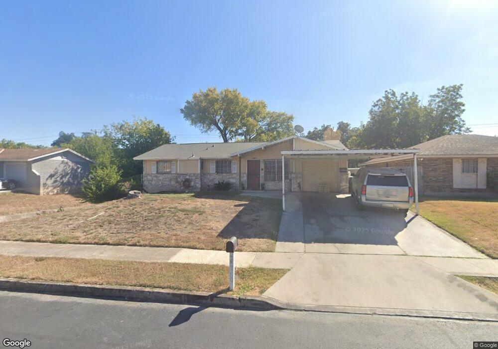
4710 Kay Ann Dr San Antonio, TX 78220
Southeast Side NeighborhoodEstimated Value: $173,258 - $199,000
4
Beds
2
Baths
1,162
Sq Ft
$164/Sq Ft
Est. Value
About This Home
This home is located at 4710 Kay Ann Dr, San Antonio, TX 78220 and is currently estimated at $190,065, approximately $163 per square foot. 4710 Kay Ann Dr is a home located in Bexar County with nearby schools including Hirsch Elementary School, Sam Houston High School, and Southwest Preparatory School.
Ownership History
Date
Name
Owned For
Owner Type
Purchase Details
Closed on
Dec 29, 2006
Sold by
A Place To Call Home Ltd
Bought by
Jacobo Enrique
Current Estimated Value
Home Financials for this Owner
Home Financials are based on the most recent Mortgage that was taken out on this home.
Original Mortgage
$73,150
Outstanding Balance
$55,106
Interest Rate
11.6%
Mortgage Type
Purchase Money Mortgage
Estimated Equity
$134,959
Purchase Details
Closed on
May 27, 2006
Sold by
Hardin Virgil E
Bought by
A Place To Call Home Ltd
Purchase Details
Closed on
Jan 27, 1999
Sold by
Powerhouse Church Of God In Christ
Bought by
Hardin Virgil Edgar and Hardin Dorothy Marie
Create a Home Valuation Report for This Property
The Home Valuation Report is an in-depth analysis detailing your home's value as well as a comparison with similar homes in the area
Home Values in the Area
Average Home Value in this Area
Purchase History
| Date | Buyer | Sale Price | Title Company |
|---|---|---|---|
| Jacobo Enrique | -- | Fidelity National Title | |
| A Place To Call Home Ltd | -- | Fidelity National Title | |
| Hardin Virgil Edgar | -- | -- |
Source: Public Records
Mortgage History
| Date | Status | Borrower | Loan Amount |
|---|---|---|---|
| Open | Jacobo Enrique | $73,150 |
Source: Public Records
Tax History Compared to Growth
Tax History
| Year | Tax Paid | Tax Assessment Tax Assessment Total Assessment is a certain percentage of the fair market value that is determined by local assessors to be the total taxable value of land and additions on the property. | Land | Improvement |
|---|---|---|---|---|
| 2025 | $1,671 | $146,751 | $42,620 | $112,720 |
| 2024 | $1,671 | $133,410 | $42,620 | $119,300 |
| 2023 | $1,671 | $121,282 | $42,620 | $125,860 |
| 2022 | $2,987 | $110,256 | $33,880 | $111,860 |
| 2021 | $2,800 | $100,233 | $20,260 | $107,670 |
| 2020 | $2,583 | $91,121 | $14,760 | $99,130 |
| 2019 | $2,374 | $82,837 | $13,710 | $85,920 |
| 2018 | $2,137 | $75,306 | $13,210 | $70,500 |
| 2017 | $1,932 | $68,460 | $12,070 | $56,390 |
| 2016 | $1,786 | $63,272 | $12,070 | $55,930 |
| 2015 | $1,629 | $57,520 | $12,070 | $45,450 |
| 2014 | $1,629 | $60,190 | $0 | $0 |
Source: Public Records
Map
Nearby Homes
- 4631 Kay Ann Dr
- 4614 Belinda Lee St
- 510 Carol Crest St
- 4610 Belinda Lee St
- 4603 Lavender Ln
- 4607 Belinda Lee St
- 4534 Kay Ann Dr
- 4851 Alfred Dr
- 4810 John Victor Dr
- 4823 John Victor Dr
- 203 Lynhaven Dr
- 4906 Frostwood Dr
- 302 Glenbrook
- 4842 Lord Rd
- 257 Glenoak Dr
- 8532 Frostwood Dr
- 4442 Lord Rd
- 4419 N Hein Rd
- 318 Charcliff Dr
- 111 Zerrcliff Ln
- 4706 Kay Ann Dr
- 4714 Kay Ann Dr
- 4718 Kay Ann Dr
- 4707 Kay Ann Dr
- 4711 Kay Ann Dr
- 4707 Lock Lomond Ln
- 4711 Lock Lomond Ln
- 4634 Kay Ann Dr
- 4703 Lock Lomond Ln
- 4703 Kay Ann Dr
- 4715 Kay Ann Dr
- 4722 Kay Ann Dr
- 4715 Lock Lomond Ln
- 4635 Kay Ann Dr
- 4719 Kay Ann Dr
- 4630 Kay Ann Dr
- 4619 Lock Lomond Ln
- 4719 Lock Lomond Ln
- 4726 Kay Ann Dr
- 4723 Kay Ann Dr