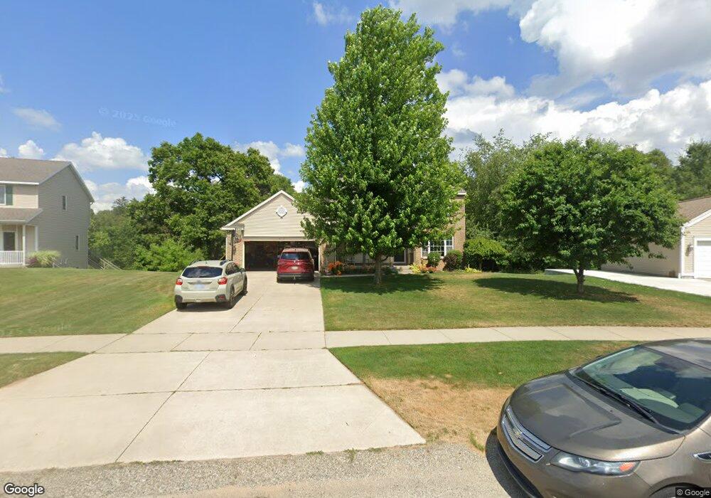
4710 Roaming Dr NE Grand Rapids, MI 49525
Northview NeighborhoodEstimated Value: $413,220 - $540,000
4
Beds
3
Baths
1,830
Sq Ft
$261/Sq Ft
Est. Value
About This Home
This home is located at 4710 Roaming Dr NE, Grand Rapids, MI 49525 and is currently estimated at $476,805, approximately $260 per square foot. 4710 Roaming Dr NE is a home located in Kent County with nearby schools including West Oakview Elementary School, North Oakview Elementary School, and East Oakview Elementary School.
Ownership History
Date
Name
Owned For
Owner Type
Purchase Details
Closed on
May 20, 2004
Sold by
Romersma & Wurn Builders
Bought by
Heldt Timothy A and Heldt Jacqueline R
Current Estimated Value
Home Financials for this Owner
Home Financials are based on the most recent Mortgage that was taken out on this home.
Original Mortgage
$145,000
Outstanding Balance
$70,319
Interest Rate
5.99%
Mortgage Type
Unknown
Estimated Equity
$406,486
Purchase Details
Closed on
Dec 18, 2003
Sold by
Coit Avenue Gravel Co Inc
Bought by
Roersma & Wurn Builders Inc
Create a Home Valuation Report for This Property
The Home Valuation Report is an in-depth analysis detailing your home's value as well as a comparison with similar homes in the area
Home Values in the Area
Average Home Value in this Area
Purchase History
| Date | Buyer | Sale Price | Title Company |
|---|---|---|---|
| Heldt Timothy A | $231,995 | Fatic | |
| Roersma & Wurn Builders Inc | $42,000 | Fatic |
Source: Public Records
Mortgage History
| Date | Status | Borrower | Loan Amount |
|---|---|---|---|
| Open | Heldt Timothy A | $145,000 |
Source: Public Records
Tax History Compared to Growth
Tax History
| Year | Tax Paid | Tax Assessment Tax Assessment Total Assessment is a certain percentage of the fair market value that is determined by local assessors to be the total taxable value of land and additions on the property. | Land | Improvement |
|---|---|---|---|---|
| 2025 | $2,659 | $196,300 | $0 | $0 |
| 2024 | $2,659 | $189,700 | $0 | $0 |
| 2023 | $2,544 | $182,500 | $0 | $0 |
| 2022 | $3,768 | $169,000 | $0 | $0 |
| 2021 | $3,670 | $157,800 | $0 | $0 |
| 2020 | $2,343 | $143,500 | $0 | $0 |
| 2019 | $3,587 | $142,100 | $0 | $0 |
| 2018 | $3,512 | $133,200 | $0 | $0 |
| 2017 | $3,421 | $121,400 | $0 | $0 |
| 2016 | $3,306 | $106,500 | $0 | $0 |
| 2015 | $3,269 | $106,500 | $0 | $0 |
| 2013 | -- | $97,300 | $0 | $0 |
Source: Public Records
Map
Nearby Homes
- 4750 Hunsberger Ave NE
- 5073 Coit Ave NE
- 5011 Coit Ave NE
- 4372 Hunsberger Ave NE
- 2233 Airway St NE
- 1940 Eldon St NE
- 4148 Chadwick Ave NE
- 2285-2289 Airway St NE
- 2289 Airway St NE
- 2285 Airway St NE
- 4611 Plainfield Ave NE
- 4847 Ridgeline Dr NE
- 3886 Vineyard Ave NE
- 5605 Coit Ave NE
- 4683 Rockvalley Dr NE Unit 2
- 3750 Benjamin Ave NE
- 5788 W River Dr NE
- 5741 Coit Ave NE
- 980 River Rock Dr NE
- 4785 Rockvalley Dr NE
- 4718 Roaming Dr NE
- 4692 Roaming Dr NE
- 4676 Roaming Dr NE
- 4732 Roaming Dr NE
- 4695 Roaming Dr NE
- 4748 Roaming Dr NE
- 4662 Roaming Dr NE
- 1680 Roaming Ct NE
- 4791 Rahn Ct NE
- 4775 Rahn Ct NE
- 4671 Roaming Dr NE
- 1770 Bluehill Dr NE
- 1799 Rahn Dr NE
- 4795 Rahn Ct NE
- 4764 Roaming Dr NE
- 4646 Roaming Dr NE
- 4733 Roaming Dr NE
- 1668 Roaming Ct NE
- 4655 Roaming Dr NE
- 1784 Bluehill Dr NE