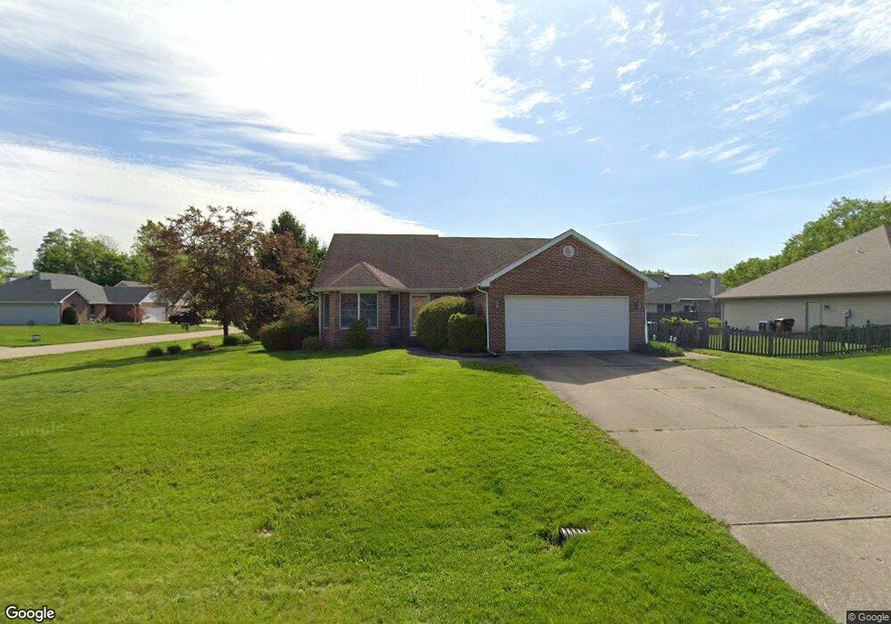
4710 S Path St Terre Haute, IN 47802
Estimated Value: $241,598 - $250,000
3
Beds
2
Baths
1,495
Sq Ft
$165/Sq Ft
Est. Value
About This Home
This home is located at 4710 S Path St, Terre Haute, IN 47802 and is currently estimated at $246,900, approximately $165 per square foot. 4710 S Path St is a home located in Vigo County with nearby schools including Blanche E. Fuqua Elementary School, Honey Creek Middle School, and Terre Haute South Vigo High School.
Ownership History
Date
Name
Owned For
Owner Type
Purchase Details
Closed on
Feb 8, 2016
Sold by
Smith William Todd and Smith Lisa C
Bought by
Hopp Brian Andrew
Current Estimated Value
Home Financials for this Owner
Home Financials are based on the most recent Mortgage that was taken out on this home.
Original Mortgage
$145,563
Outstanding Balance
$62,830
Interest Rate
4%
Mortgage Type
VA
Estimated Equity
$184,070
Create a Home Valuation Report for This Property
The Home Valuation Report is an in-depth analysis detailing your home's value as well as a comparison with similar homes in the area
Home Values in the Area
Average Home Value in this Area
Purchase History
| Date | Buyer | Sale Price | Title Company |
|---|---|---|---|
| Hopp Brian Andrew | -- | Honey Creek Vigo Title Svcs |
Source: Public Records
Mortgage History
| Date | Status | Borrower | Loan Amount |
|---|---|---|---|
| Open | Hopp Brian Andrew | $145,563 |
Source: Public Records
Tax History Compared to Growth
Tax History
| Year | Tax Paid | Tax Assessment Tax Assessment Total Assessment is a certain percentage of the fair market value that is determined by local assessors to be the total taxable value of land and additions on the property. | Land | Improvement |
|---|---|---|---|---|
| 2024 | $1,994 | $177,100 | $35,900 | $141,200 |
| 2023 | $1,906 | $169,300 | $35,900 | $133,400 |
| 2022 | $1,627 | $152,400 | $35,900 | $116,500 |
| 2021 | $1,515 | $142,200 | $35,200 | $107,000 |
| 2020 | $1,509 | $143,700 | $34,900 | $108,800 |
| 2019 | $1,478 | $141,000 | $34,200 | $106,800 |
| 2018 | $2,157 | $137,100 | $33,200 | $103,900 |
| 2017 | $1,735 | $140,800 | $39,000 | $101,800 |
| 2016 | $1,698 | $138,300 | $38,300 | $100,000 |
| 2014 | $1,346 | $134,000 | $36,700 | $97,300 |
| 2013 | $1,346 | $133,900 | $36,400 | $97,500 |
Source: Public Records
Map
Nearby Homes
- 4741 S 19th 1 2 St
- 4855 S Lost St
- 4412 S 12th St
- 4315 S 12th St
- 1012 Windsor Rd
- 3330 Albany Rd
- 44 Allendale
- 901 E Talisman Dr
- 61 S Jeane St
- 852 E Talisman Dr
- 809 E Azalia Dr
- 5000 Block S Us Hwy 41
- 4715 S 7th St
- 3325 Rabbit Run Ct
- 3270 Rabbit Run Ct
- 5609 Bison Ln
- 5614 Bison Ln
- 3879 Golf Bag Ln Unit Lot 7 Ph I
- 3123 S 21st St
- 1159 S Ravine St
- 4732 S Path St
- 4731 S Path St
- 2116 Lori Ct
- 4715 S Lock St
- 4707 S Path St
- 4755 S Path St
- 4737 S Lock St
- 2145 Springwood Ct
- 2200 Lori Ct
- 4759 S Lock St
- 2173 Springwood Ct
- 4776 S Path St
- 2117 Springwood Ct
- 4781 S Lock St Unit LT30
- 2201 Springwood Ct
- 4779 S Path St
- 4750 S Lock St
- 4752 S Lock St
- 4820 S Path St
- 2160 Springwood Ct