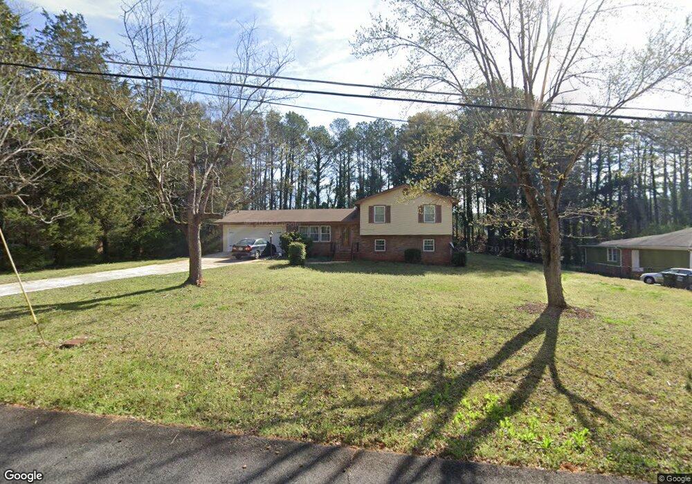
4711 Hemlock Dr Unit 8 Austell, GA 30106
Estimated Value: $262,632 - $316,000
3
Beds
2
Baths
1,223
Sq Ft
$236/Sq Ft
Est. Value
About This Home
This home is located at 4711 Hemlock Dr Unit 8, Austell, GA 30106 and is currently estimated at $288,658, approximately $236 per square foot. 4711 Hemlock Dr Unit 8 is a home located in Cobb County with nearby schools including Clarkdale Elementary School, Garrett Middle School, and South Cobb High School.
Ownership History
Date
Name
Owned For
Owner Type
Purchase Details
Closed on
Jun 25, 2004
Sold by
Sawyer Edward N and Sawyer Sarah A
Bought by
Thompson Gilbert
Current Estimated Value
Home Financials for this Owner
Home Financials are based on the most recent Mortgage that was taken out on this home.
Original Mortgage
$119,200
Outstanding Balance
$60,213
Interest Rate
6.5%
Mortgage Type
New Conventional
Estimated Equity
$228,445
Create a Home Valuation Report for This Property
The Home Valuation Report is an in-depth analysis detailing your home's value as well as a comparison with similar homes in the area
Home Values in the Area
Average Home Value in this Area
Purchase History
| Date | Buyer | Sale Price | Title Company |
|---|---|---|---|
| Thompson Gilbert | $149,000 | -- |
Source: Public Records
Mortgage History
| Date | Status | Borrower | Loan Amount |
|---|---|---|---|
| Open | Thompson Gilbert | $119,200 |
Source: Public Records
Tax History
| Year | Tax Paid | Tax Assessment Tax Assessment Total Assessment is a certain percentage of the fair market value that is determined by local assessors to be the total taxable value of land and additions on the property. | Land | Improvement |
|---|---|---|---|---|
| 2025 | $601 | $97,740 | $24,000 | $73,740 |
| 2024 | $2,243 | $97,740 | $24,000 | $73,740 |
| 2023 | $1,856 | $104,916 | $14,000 | $90,916 |
| 2022 | $2,159 | $93,064 | $14,000 | $79,064 |
| 2021 | $1,379 | $57,440 | $11,200 | $46,240 |
| 2020 | $1,379 | $57,440 | $11,200 | $46,240 |
| 2019 | $1,379 | $57,440 | $11,200 | $46,240 |
| 2018 | $950 | $40,304 | $11,200 | $29,104 |
| 2017 | $902 | $40,304 | $11,200 | $29,104 |
| 2016 | $750 | $34,992 | $7,200 | $27,792 |
| 2015 | $461 | $24,496 | $7,200 | $17,296 |
| 2014 | $465 | $24,496 | $0 | $0 |
Source: Public Records
Map
Nearby Homes
- 4630 Hemlock Dr
- 4809 Hemlock Dr
- 2349 Shire Ct
- 2110 Plum Ln
- 2373 Buckley Ct
- 0 Clay Rd
- 4975 Brawner Lake Dr
- 2125 Clay Rd SW
- 4688 Bennett St
- 2034 Drennon Ave
- 4778 Garrett Dr SW
- 4420 Pink Rose Ct
- 2085 Lenoa Ln
- 2083 Lenoa Ln
- 2081 Lenoa Ln
- 1741 Seayes Rd
- 2013 Chesley Dr
- 5164 Medford Ln
- 1809 Elmwood Dr
- 5069 Flint Hill Rd Unit AB
- 4735 Hemlock Dr
- 4701 Hemlock Dr
- 4736 Hemlock Dr
- 4691 Hemlock Dr Unit 8
- 4747 Hemlock Dr
- 4748 Hemlock Dr
- 4761 Hemlock Dr
- 4681 Hemlock Dr Unit 8
- 4721 Springdale Rd
- 4758 Hemlock Dr Unit 3
- 4641 Hemlock Dr
- 4640 Hemlock Dr SW
- 4785 Hemlock Dr
- 4778 Hemlock Dr
- 4761 Springdale Rd
- 4710 Springdale Rd
- 4790 Hemlock Dr
- 4797 Hemlock Dr Unit 3
- 4720 Springdale Rd
- 4631 Hemlock Dr
Your Personal Tour Guide
Ask me questions while you tour the home.