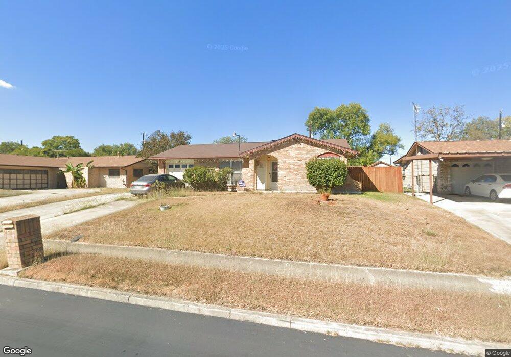
4711 Kay Ann Dr San Antonio, TX 78220
Southeast Side NeighborhoodEstimated Value: $192,000 - $218,000
3
Beds
2
Baths
1,504
Sq Ft
$137/Sq Ft
Est. Value
About This Home
This home is located at 4711 Kay Ann Dr, San Antonio, TX 78220 and is currently estimated at $205,644, approximately $136 per square foot. 4711 Kay Ann Dr is a home located in Bexar County with nearby schools including Hirsch Elementary School, Sam Houston High School, and Southwest Preparatory School.
Ownership History
Date
Name
Owned For
Owner Type
Purchase Details
Closed on
Oct 7, 2019
Sold by
Pledger Rodney Craig and Estate Of Isaac Pledger
Bought by
Pledger Rodney Craig
Current Estimated Value
Purchase Details
Closed on
Dec 15, 1999
Sold by
Patrick Daniel E and Estate Of Nelva H Patrick
Bought by
Pledger Isaac and Pledger Billie Kathryn
Create a Home Valuation Report for This Property
The Home Valuation Report is an in-depth analysis detailing your home's value as well as a comparison with similar homes in the area
Home Values in the Area
Average Home Value in this Area
Purchase History
| Date | Buyer | Sale Price | Title Company |
|---|---|---|---|
| Pledger Rodney Craig | -- | None Available | |
| Pledger Isaac | -- | -- |
Source: Public Records
Tax History Compared to Growth
Tax History
| Year | Tax Paid | Tax Assessment Tax Assessment Total Assessment is a certain percentage of the fair market value that is determined by local assessors to be the total taxable value of land and additions on the property. | Land | Improvement |
|---|---|---|---|---|
| 2025 | $2,981 | $181,780 | $47,350 | $134,430 |
| 2024 | $2,981 | $189,630 | $47,350 | $142,280 |
| 2023 | $2,806 | $178,234 | $47,350 | $150,120 |
| 2022 | $4,390 | $162,031 | $37,620 | $133,230 |
| 2021 | $4,115 | $147,301 | $22,480 | $127,810 |
| 2020 | $3,795 | $133,910 | $16,360 | $117,550 |
| 2019 | $2,754 | $96,098 | $15,250 | $101,870 |
| 2018 | $2,479 | $87,362 | $13,910 | $83,520 |
| 2017 | $2,242 | $79,420 | $12,600 | $66,820 |
| 2016 | $2,060 | $72,975 | $12,600 | $66,400 |
| 2015 | $340 | $66,341 | $12,600 | $53,950 |
| 2014 | $340 | $60,310 | $0 | $0 |
Source: Public Records
Map
Nearby Homes
- 4631 Kay Ann Dr
- 510 Carol Crest St
- 4614 Belinda Lee St
- 4610 Belinda Lee St
- 4607 Belinda Lee St
- 4603 Lavender Ln
- 4534 Kay Ann Dr
- 4851 Alfred Dr
- 4810 John Victor Dr
- 4823 John Victor Dr
- 203 Lynhaven Dr
- 4906 Frostwood Dr
- 302 Glenbrook
- 4842 Lord Rd
- 8532 Frostwood Dr
- 257 Glenoak Dr
- 4442 Lord Rd
- 111 Zerrcliff Ln
- 318 Charcliff Dr
- 4419 N Hein Rd
- 4707 Kay Ann Dr
- 4715 Kay Ann Dr
- 4714 Belinda Lee St
- 4718 Belinda Lee St
- 4703 Kay Ann Dr
- 4719 Kay Ann Dr
- 4710 Belinda Lee St
- 4722 Belinda Lee St
- 4710 Kay Ann Dr
- 4714 Kay Ann Dr
- 4706 Belinda Lee St
- 4726 Belinda Lee St
- 4706 Kay Ann Dr
- 4635 Kay Ann Dr
- 4718 Kay Ann Dr
- 4723 Kay Ann Dr
- 4702 Belinda Lee St
- 4730 Belinda Lee St
- 4722 Kay Ann Dr
- 4634 Belinda Lee St