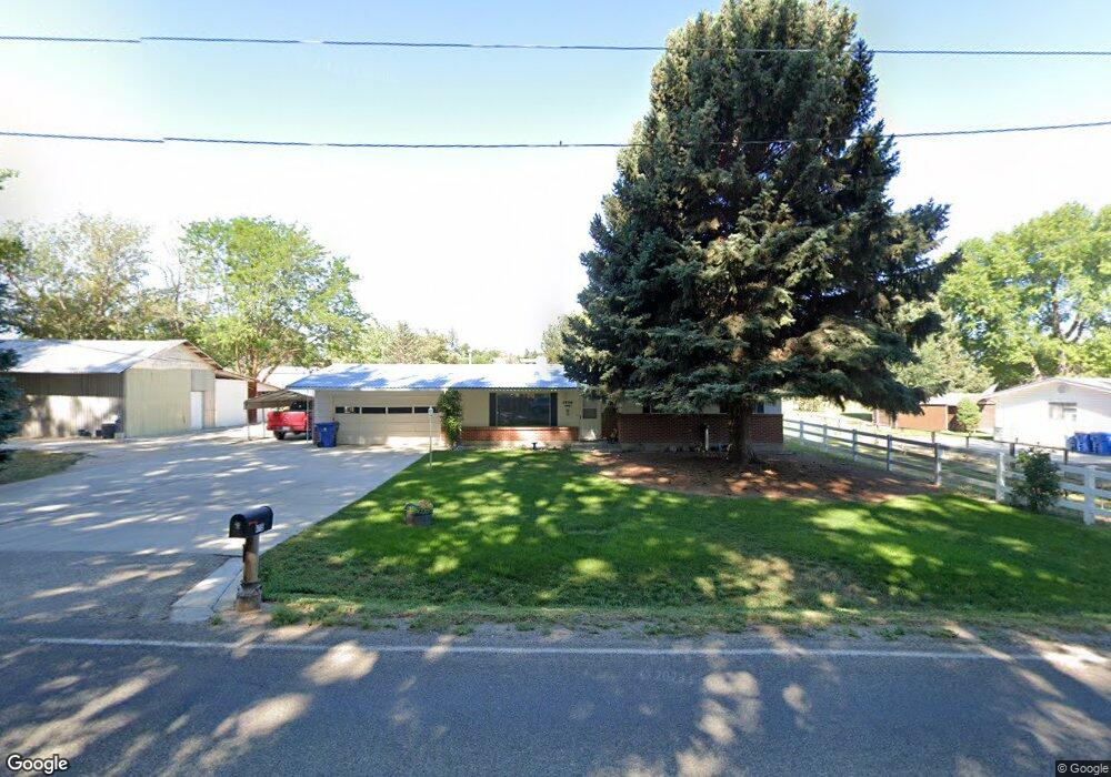
4715 S Locust Grove Rd Meridian, ID 83642
Southeast Meridian NeighborhoodEstimated Value: $519,000 - $589,000
3
Beds
2
Baths
1,676
Sq Ft
$335/Sq Ft
Est. Value
About This Home
This home is located at 4715 S Locust Grove Rd, Meridian, ID 83642 and is currently estimated at $562,112, approximately $335 per square foot. 4715 S Locust Grove Rd is a home located in Ada County with nearby schools including Mary McPherson Elementary School, Victory Middle School, and Mountain View High School.
Ownership History
Date
Name
Owned For
Owner Type
Purchase Details
Closed on
Jan 16, 2024
Sold by
Nodene G Mondt Living Trust
Bought by
White Steen B
Current Estimated Value
Purchase Details
Closed on
Jan 4, 2024
Sold by
Mondt Nadene G
Bought by
Mondt Nadene G
Purchase Details
Closed on
Mar 15, 2021
Sold by
Mondt Nadene G
Bought by
Mondt Nadene G and The Nadene G Mondt Living Trus
Create a Home Valuation Report for This Property
The Home Valuation Report is an in-depth analysis detailing your home's value as well as a comparison with similar homes in the area
Home Values in the Area
Average Home Value in this Area
Purchase History
| Date | Buyer | Sale Price | Title Company |
|---|---|---|---|
| White Steen B | -- | None Listed On Document | |
| Nadene G Mondt Living Trust | -- | None Listed On Document | |
| Mondt Nadene G | -- | None Listed On Document | |
| White Steen B | -- | None Listed On Document | |
| Mondt Nadene G | -- | None Available |
Source: Public Records
Tax History Compared to Growth
Tax History
| Year | Tax Paid | Tax Assessment Tax Assessment Total Assessment is a certain percentage of the fair market value that is determined by local assessors to be the total taxable value of land and additions on the property. | Land | Improvement |
|---|---|---|---|---|
| 2025 | $1,533 | $536,100 | -- | -- |
| 2024 | $1,533 | $496,200 | -- | -- |
| 2023 | $1,533 | $480,400 | $0 | $0 |
| 2022 | $1,633 | $498,100 | $0 | $0 |
| 2021 | $1,496 | $381,100 | $0 | $0 |
| 2020 | $1,612 | $323,300 | $0 | $0 |
| 2019 | $1,720 | $292,600 | $0 | $0 |
| 2018 | $1,401 | $238,900 | $0 | $0 |
| 2017 | $1,230 | $214,100 | $0 | $0 |
| 2016 | $1,183 | $202,500 | $0 | $0 |
| 2015 | $553 | $192,200 | $0 | $0 |
| 2012 | -- | $149,600 | $0 | $0 |
Source: Public Records
Map
Nearby Homes
- 1753 E Grayson St
- 1769 E Grayson St
- 1785 E Grayson St
- 1801 E Grayson St
- 2023 E Wrightwood Dr
- 4082 S Murlo Ave
- 1031 E Reflect Ridge Dr
- 2251 E Grayson St
- 1426 E Argence St
- 4637 S Zopiro Dr
- 4657 S Zopiro Ave
- 2031 S Locust Grove Rd
- 801 E Crest Ridge Dr
- 1107 E Pisa St
- 2215 E Shady Glade Dr
- 4671 S Abbot Way
- 4925 S Colusa Ave
- 3867 S Lamone Way
- 2362 E Shady Glade Dr
- 808 E Reflect Ridge Dr
- 4675 S Locust Grove Rd
- 4669 S Denison Ave
- 1 E Daulby St
- 4643 S Denison Ave
- 4615 S Locust Grove Rd
- 1670 E Amity Rd
- 1653 E Daulby St
- 4617 S Denison Ave
- 1505 E Amity Rd
- 1691 E Daulby St
- 1505 E Pitkin Ave
- 1420 E Amity Rd
- 1710 E Amity Rd
- 1725 E Daulby St
- 4636 S Denison Ave
- 1737 E Grayson St
- 4565 S Locust Grove Rd
- 1449 E Pitkin Ave
- 1743 E Daulby St
- 4614 S Denison Ave