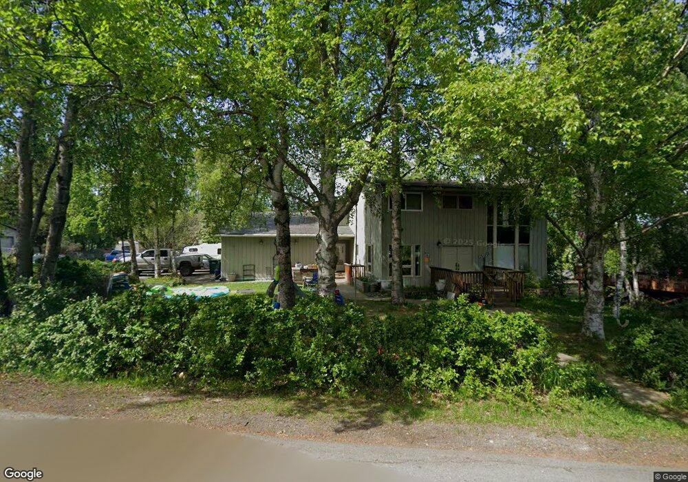
4718 Malibu Rd Anchorage, AK 99517
Spenard NeighborhoodEstimated Value: $380,000 - $700,271
5
Beds
2
Baths
3,552
Sq Ft
$146/Sq Ft
Est. Value
About This Home
This home is located at 4718 Malibu Rd, Anchorage, AK 99517 and is currently estimated at $517,818, approximately $145 per square foot. 4718 Malibu Rd is a home located in Anchorage Municipality with nearby schools including Northwood Elementary School, Romig Middle School, and West High School.
Ownership History
Date
Name
Owned For
Owner Type
Purchase Details
Closed on
Jul 10, 2003
Sold by
Sullivan William A
Bought by
Sieghart Marc A and Sieghart Paula M
Current Estimated Value
Home Financials for this Owner
Home Financials are based on the most recent Mortgage that was taken out on this home.
Original Mortgage
$273,980
Outstanding Balance
$116,131
Interest Rate
5.22%
Mortgage Type
VA
Estimated Equity
$401,687
Purchase Details
Closed on
Nov 18, 1988
Sold by
Alaska Housing Finance Corp
Bought by
Sullivan William A and Sullivan Deborah D
Home Financials for this Owner
Home Financials are based on the most recent Mortgage that was taken out on this home.
Original Mortgage
$125,234
Interest Rate
10.45%
Mortgage Type
New Conventional
Create a Home Valuation Report for This Property
The Home Valuation Report is an in-depth analysis detailing your home's value as well as a comparison with similar homes in the area
Home Values in the Area
Average Home Value in this Area
Purchase History
| Date | Buyer | Sale Price | Title Company |
|---|---|---|---|
| Sieghart Marc A | -- | -- | |
| Sullivan William A | -- | -- |
Source: Public Records
Mortgage History
| Date | Status | Borrower | Loan Amount |
|---|---|---|---|
| Open | Sieghart Marc A | $273,980 | |
| Previous Owner | Sullivan William A | $125,234 |
Source: Public Records
Tax History Compared to Growth
Tax History
| Year | Tax Paid | Tax Assessment Tax Assessment Total Assessment is a certain percentage of the fair market value that is determined by local assessors to be the total taxable value of land and additions on the property. | Land | Improvement |
|---|---|---|---|---|
| 2025 | $8,933 | $660,600 | $116,400 | $544,200 |
| 2024 | $8,933 | $628,300 | $116,400 | $511,900 |
| 2023 | $9,704 | $569,800 | $116,400 | $453,400 |
| 2022 | $8,476 | $553,300 | $116,500 | $436,800 |
| 2021 | $8,821 | $489,500 | $116,500 | $373,000 |
| 2020 | $7,400 | $485,600 | $116,500 | $369,100 |
| 2019 | $7,241 | $492,600 | $116,500 | $376,100 |
| 2018 | $6,963 | $474,600 | $116,500 | $358,100 |
| 2017 | $7,772 | $516,300 | $116,500 | $399,800 |
| 2016 | $6,647 | $545,400 | $122,600 | $422,800 |
| 2015 | $6,647 | $515,100 | $122,600 | $392,500 |
| 2014 | $6,647 | $470,900 | $122,600 | $348,300 |
Source: Public Records
Map
Nearby Homes
- 2891 W Intl Airport Rd Unit C108
- 2815 W International Airport Rd Unit B104
- 2808 Iris Dr
- 4302 Forrest Rd
- 3333 Lakeshore Dr Unit 5
- 3333 Lakeshore Dr Unit 2
- 2101 W 47th Ave
- NHN Northwood Dr
- 5000 Northwood Dr
- 3913 Barbara Dr
- 4000 Iowa Dr
- 2040 Wenmatt Cir
- 1808 W 47th Ave
- 2202 Lincoln Ave
- 3900 Crosson Dr
- 6017 Collins Way
- 6305 Blackberry St
- 2105 Mckinley Ave
- 2820 Wiley Post Ave
- 3223 W 62nd Ave
- 4827 Klamath Dr Unit 9B
- 4833 Klamath Dr Unit 10B
- 4712 Malibu Rd
- 2792 Valleywood Dr
- 4802 Malibu Rd
- 2705 Klamath Dr
- 2798 Valleywood Dr
- 2798 Valleywood Dr Unit B
- 4719 Malibu Rd
- 4708 Malibu Rd
- 2707 Klamath Dr
- 2802 Klamath Dr
- 4715 Malibu Rd
- 2800 Valleywood Dr
- 2800 Valleywood Dr Unit B
- 4806 Malibu Rd
- 2821 Malibu Meadows Way Unit 1A
- 2801 Valleywood Dr
- 2709 Klamath Dr
- 2803 Valleywood Dr
