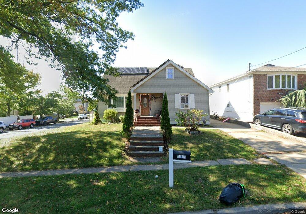
472 Foster Rd Staten Island, NY 10309
Woodrow NeighborhoodEstimated Value: $635,377 - $791,000
--
Bed
4
Baths
830
Sq Ft
$880/Sq Ft
Est. Value
About This Home
This home is located at 472 Foster Rd, Staten Island, NY 10309 and is currently estimated at $730,344, approximately $879 per square foot. 472 Foster Rd is a home located in Richmond County with nearby schools including Kathleen Grimm School For Leadership, P.S. 3 - The Margaret Gioiosa School, and Is 34 Tottenville.
Ownership History
Date
Name
Owned For
Owner Type
Purchase Details
Closed on
Feb 24, 2012
Sold by
Anzalone Albert J and Anzalone Mary
Bought by
Passantino Camille
Current Estimated Value
Purchase Details
Closed on
Mar 20, 1995
Sold by
Ballschmieder Charles J and Ballschmieder Joanne
Bought by
Anzalone Albert J and Anzalone Mary
Home Financials for this Owner
Home Financials are based on the most recent Mortgage that was taken out on this home.
Original Mortgage
$148,000
Interest Rate
8.8%
Create a Home Valuation Report for This Property
The Home Valuation Report is an in-depth analysis detailing your home's value as well as a comparison with similar homes in the area
Home Values in the Area
Average Home Value in this Area
Purchase History
| Date | Buyer | Sale Price | Title Company |
|---|---|---|---|
| Passantino Camille | -- | Chicago Title Insurance Co | |
| Anzalone Albert J | $185,000 | Chicago Title Insurance Co |
Source: Public Records
Mortgage History
| Date | Status | Borrower | Loan Amount |
|---|---|---|---|
| Previous Owner | Anzalone Albert J | $148,000 |
Source: Public Records
Tax History Compared to Growth
Tax History
| Year | Tax Paid | Tax Assessment Tax Assessment Total Assessment is a certain percentage of the fair market value that is determined by local assessors to be the total taxable value of land and additions on the property. | Land | Improvement |
|---|---|---|---|---|
| 2025 | $6,151 | $36,480 | $15,296 | $21,184 |
| 2024 | $6,163 | $32,940 | $16,099 | $16,841 |
| 2023 | $5,851 | $30,210 | $16,317 | $13,893 |
| 2022 | $5,402 | $28,500 | $16,560 | $11,940 |
| 2021 | $5,728 | $30,000 | $16,560 | $13,440 |
| 2020 | $20,405 | $28,080 | $16,560 | $11,520 |
| 2019 | $16,858 | $29,220 | $16,560 | $12,660 |
| 2018 | $5,172 | $26,830 | $14,780 | $12,050 |
| 2017 | $4,860 | $25,312 | $15,525 | $9,787 |
| 2016 | $4,464 | $23,880 | $16,560 | $7,320 |
| 2015 | $4,215 | $24,966 | $13,543 | $11,423 |
| 2014 | $4,215 | $23,554 | $10,856 | $12,698 |
Source: Public Records
Map
Nearby Homes
- 960 Rensselaer Ave
- 980 Rensselaer Ave
- 973 Sheldon Ave
- 859 Rathbun Ave
- 880 Sinclair Ave
- 1030 Rensselaer Ave
- 839 Sinclair Ave
- 1046 Rensselaer Ave
- 859 Lamont Ave
- 1054 Rensselaer Ave
- 104 Wieland Ave
- 106 Wieland Ave
- 108 Wieland Ave
- 1015 Rathbun Ave
- 816 Sinclair Ave
- 142 Wieland Ave
- 1272 Woodrow Rd
- 1047 Edgegrove Ave
- 1051 Edgegrove Ave
- 265 Ramapo Ave
- 480 Foster Rd
- 943 Rensselaer Ave
- 484 Foster Rd
- 458 Foster Rd
- 947 Rensselaer Ave
- 930 Sheldon Ave
- 471 Foster Rd
- 940 Rensselaer Ave
- 477 Foster Rd
- 450 Foster Rd
- 934 Sheldon Ave
- 944 Rensselaer Ave
- 457 Foster Rd
- 910 Sheldon Ave
- 955 Rensselaer Ave
- 948 Rensselaer Ave
- 942 Sheldon Ave
- 446 Foster Rd
- 952 Rensselaer Ave
- 451 Foster Rd