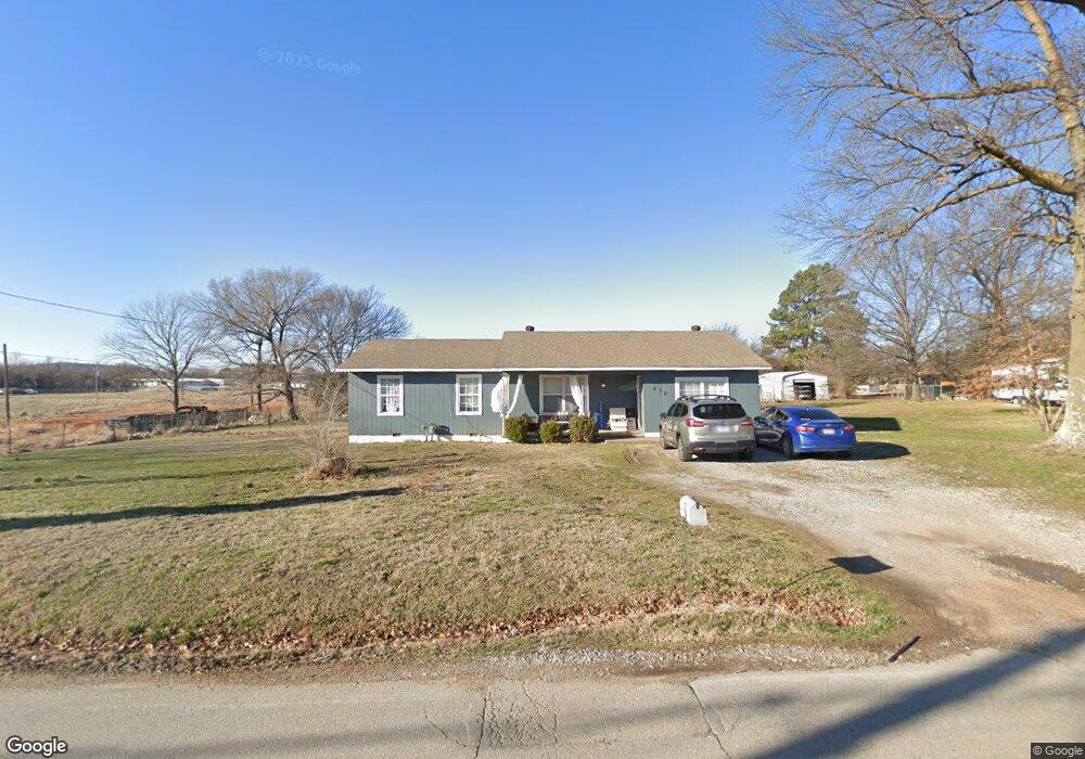
472 W County Line Rd Springdale, AR 72764
Estimated Value: $227,000 - $319,000
4
Beds
1
Bath
1,505
Sq Ft
$181/Sq Ft
Est. Value
About This Home
This home is located at 472 W County Line Rd, Springdale, AR 72764 and is currently estimated at $272,049, approximately $180 per square foot. 472 W County Line Rd is a home located in Benton County with nearby schools including Monitor Elementary School, Lakeside Junior High School, and Sonora Middle School.
Ownership History
Date
Name
Owned For
Owner Type
Purchase Details
Closed on
Jul 2, 2009
Sold by
Federal Home Loan Mortgage Corporation
Bought by
Cook Bruce and Cook Doris
Current Estimated Value
Purchase Details
Closed on
Apr 14, 2009
Sold by
Vargas Veronica
Bought by
Federal Home Loan Mortgage Corporation
Purchase Details
Closed on
Apr 26, 2007
Sold by
Becerra Gustavo
Bought by
Vargas Veronica
Home Financials for this Owner
Home Financials are based on the most recent Mortgage that was taken out on this home.
Original Mortgage
$127,000
Interest Rate
6.13%
Mortgage Type
Purchase Money Mortgage
Purchase Details
Closed on
Oct 11, 2001
Bought by
Becerra
Purchase Details
Closed on
Oct 5, 2001
Bought by
Becerra
Purchase Details
Closed on
May 27, 1987
Bought by
Lewis and Lewis Brown
Purchase Details
Closed on
Dec 30, 1977
Bought by
Mcginnis Olan W
Create a Home Valuation Report for This Property
The Home Valuation Report is an in-depth analysis detailing your home's value as well as a comparison with similar homes in the area
Home Values in the Area
Average Home Value in this Area
Purchase History
| Date | Buyer | Sale Price | Title Company |
|---|---|---|---|
| Cook Bruce | $36,000 | Stewart Title Of Ar Inc | |
| Federal Home Loan Mortgage Corporation | $96,509 | None Available | |
| Vargas Veronica | $127,000 | Fayetteville Title | |
| Becerra | $38,000 | -- | |
| Becerra | -- | -- | |
| Lewis | $33,000 | -- | |
| Mcginnis Olan W | -- | -- |
Source: Public Records
Mortgage History
| Date | Status | Borrower | Loan Amount |
|---|---|---|---|
| Previous Owner | Vargas Veronica | $127,000 |
Source: Public Records
Tax History Compared to Growth
Tax History
| Year | Tax Paid | Tax Assessment Tax Assessment Total Assessment is a certain percentage of the fair market value that is determined by local assessors to be the total taxable value of land and additions on the property. | Land | Improvement |
|---|---|---|---|---|
| 2025 | $1,269 | $36,784 | $13,800 | $22,984 |
| 2024 | $1,190 | $36,784 | $13,800 | $22,984 |
| 2023 | $1,082 | $22,550 | $7,400 | $15,150 |
| 2022 | $1,001 | $22,550 | $7,400 | $15,150 |
| 2021 | $914 | $22,550 | $7,400 | $15,150 |
| 2020 | $833 | $15,620 | $5,000 | $10,620 |
| 2019 | $833 | $15,620 | $5,000 | $10,620 |
| 2018 | $833 | $15,620 | $5,000 | $10,620 |
| 2017 | $707 | $15,620 | $5,000 | $10,620 |
| 2016 | $707 | $15,620 | $5,000 | $10,620 |
| 2015 | $642 | $12,040 | $3,000 | $9,040 |
| 2014 | $642 | $12,040 | $3,000 | $9,040 |
Source: Public Records
Map
Nearby Homes
- 2996 Twin County St
- 3435 Alliance Dr
- 7.25 AC Thompson
- 337 Joy Carol Loop
- 3751 Alliance Dr
- 3621 Alliance Dr
- 2977 Kings Dr
- 2169 Harry St
- 1483 Leesburg Ave
- 985 Remington Dr
- 3450 Pasofino Loop
- 114 E Bailey Ave
- 413 W Highway 264
- 1308 W Stultz Rd
- 1015 Mill St
- 2012 Larkspur St
- 1258 Apache Trail
- 1719 Wensworth Ave
- 1967 Cheyenne Trail
- 303 Sanders Ave
- 424 W County Line Rd
- 3027 Memory Ln Unit A,B,C,D
- 3027 Memory Ln
- 2850 N Lowell Rd
- 2930 Twin County St
- 2952 Twin County St
- 2974 Twin County St
- 3039 Memory Ln
- 3039 Memory Ln Unit A & B
- 16 Twin County
- 3066 Memory Ln
- 3066 Memory Ln Unit D
- 3066 Memory Ln Unit C
- 3066 Memory Ln Unit A
- 3066 Memory Ln Unit B
- 3016 Twin County St
- 570 W County Line Rd
- 3055 Memory Ln
- 518 County Line Rd