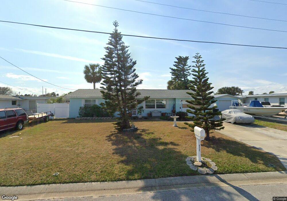
472 Wild Olive Ave Ormond Beach, FL 32176
Estimated Value: $268,792 - $277,000
2
Beds
2
Baths
1,270
Sq Ft
$215/Sq Ft
Est. Value
About This Home
This home is located at 472 Wild Olive Ave, Ormond Beach, FL 32176 and is currently estimated at $272,948, approximately $214 per square foot. 472 Wild Olive Ave is a home located in Volusia County with nearby schools including Ormond Beach Middle School, Seabreeze High School, and St Brendan Catholic School.
Ownership History
Date
Name
Owned For
Owner Type
Purchase Details
Closed on
Jan 16, 2003
Sold by
White Aimee C
Bought by
Hogan John W
Current Estimated Value
Purchase Details
Closed on
May 10, 2001
Sold by
Bessette Wayne R
Bought by
White Aimee C
Home Financials for this Owner
Home Financials are based on the most recent Mortgage that was taken out on this home.
Original Mortgage
$87,310
Interest Rate
6.95%
Mortgage Type
FHA
Purchase Details
Closed on
Oct 14, 1996
Sold by
Fuscaldo Joseph M and Fuscaldo Eleanor
Bought by
Bessette Wayne R
Home Financials for this Owner
Home Financials are based on the most recent Mortgage that was taken out on this home.
Original Mortgage
$55,000
Interest Rate
8.32%
Purchase Details
Closed on
Aug 15, 1969
Bought by
Hogan John W
Create a Home Valuation Report for This Property
The Home Valuation Report is an in-depth analysis detailing your home's value as well as a comparison with similar homes in the area
Home Values in the Area
Average Home Value in this Area
Purchase History
| Date | Buyer | Sale Price | Title Company |
|---|---|---|---|
| Hogan John W | $105,000 | -- | |
| White Aimee C | $88,000 | -- | |
| Bessette Wayne R | $60,000 | -- | |
| Hogan John W | $4,200 | -- |
Source: Public Records
Mortgage History
| Date | Status | Borrower | Loan Amount |
|---|---|---|---|
| Previous Owner | White Aimee C | $87,310 | |
| Previous Owner | Bessette Wayne R | $55,000 |
Source: Public Records
Tax History
| Year | Tax Paid | Tax Assessment Tax Assessment Total Assessment is a certain percentage of the fair market value that is determined by local assessors to be the total taxable value of land and additions on the property. | Land | Improvement |
|---|---|---|---|---|
| 2026 | $1,252 | $118,908 | -- | -- |
| 2025 | $1,252 | $118,908 | -- | -- |
| 2024 | $1,151 | $115,557 | -- | -- |
| 2023 | $1,151 | $112,192 | $0 | $0 |
| 2022 | $1,103 | $108,924 | $0 | $0 |
| 2021 | $1,126 | $105,751 | $0 | $0 |
| 2020 | $1,103 | $104,291 | $0 | $0 |
| 2019 | $1,074 | $101,946 | $0 | $0 |
| 2018 | $1,070 | $100,045 | $0 | $0 |
| 2017 | $1,078 | $97,987 | $0 | $0 |
| 2016 | $1,081 | $95,972 | $0 | $0 |
| 2015 | $1,113 | $95,305 | $0 | $0 |
| 2014 | $1,103 | $94,549 | $0 | $0 |
Source: Public Records
Map
Nearby Homes
- 468 Grandview Ave
- 188 River Beach Dr
- 453 S Atlantic Ave Unit 3090
- 453 S Atlantic Ave Unit 3060
- 2 Cypress Cir
- 46 Chippingwood Ln
- 395 S Atlantic Ave Unit 305
- 395 S Atlantic Ave Unit 301
- 395 S Atlantic Ave Unit 102
- 395 S Atlantic Ave Unit 501
- 395 S Atlantic Ave Unit 402
- 59 Chippingwood Ln
- 47 Chippingwood Ln
- 3 Oriole Cir Unit B
- 504 S Halifax Dr
- 67 Ormond Shores Dr
- 601 Robin Rd Unit A
- 11 Oriole Cir Unit A
- 123 Arlington Way
- ELLE Plan at Tide's Edge - Tides Edge
- 466 Wild Olive Ave
- 484 Wild Olive Ave
- 475 Cedar St
- 465 Cedar St
- 487 Cedar St
- 475 Wild Olive Ave
- 178 Rockefeller Dr
- 186 Rockefeller Dr
- 496 Wild Olive Ave
- 481 Wild Olive Ave
- 465 Wild Olive Ave
- 455 Cedar St
- 491 Wild Olive Ave
- 196 Rockefeller Dr
- 493 Cedar St
- 495 Wild Olive Ave
- 204 Rockefeller Dr
- 504 Wild Olive Ave
- 480 Cedar St
- 466 Cedar St
Your Personal Tour Guide
Ask me questions while you tour the home.