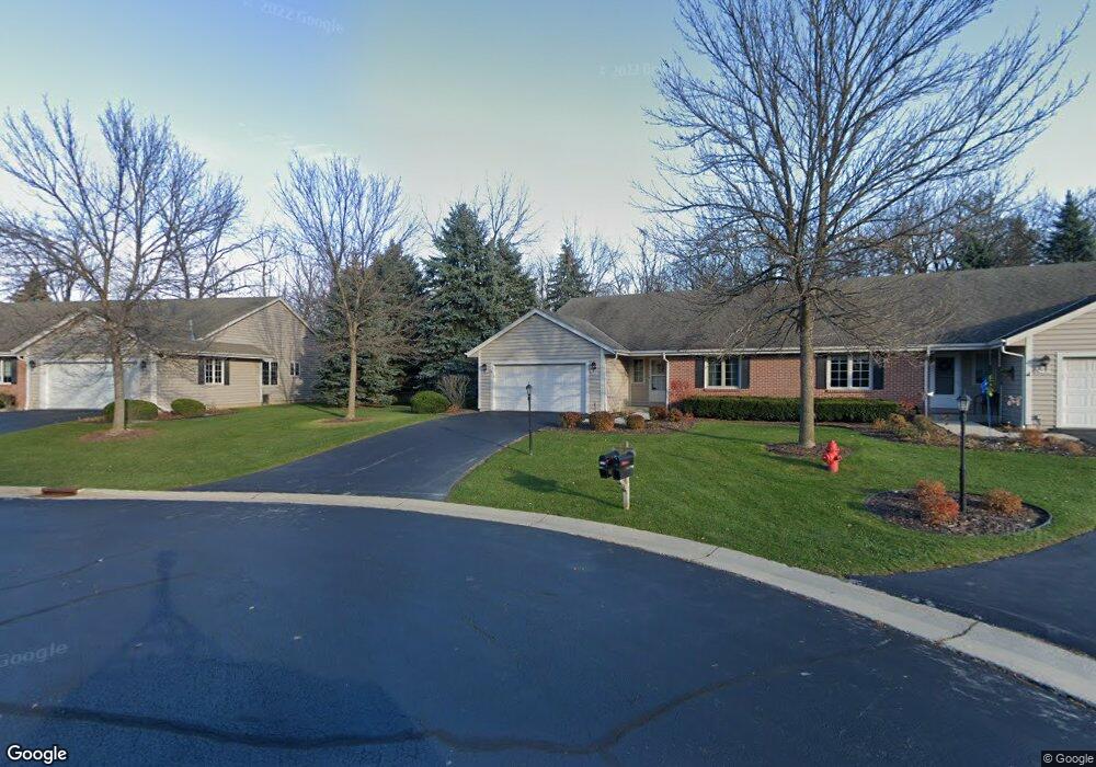
4720 Cara Marie Ct Unit B Brookfield, WI 53005
Estimated Value: $452,000 - $660,000
2
Beds
3
Baths
1,829
Sq Ft
$307/Sq Ft
Est. Value
About This Home
This home is located at 4720 Cara Marie Ct Unit B, Brookfield, WI 53005 and is currently estimated at $561,524, approximately $307 per square foot. 4720 Cara Marie Ct Unit B is a home located in Waukesha County with nearby schools including Burleigh Elementary School, Pilgrim Park Middle School, and Brookfield East High School.
Ownership History
Date
Name
Owned For
Owner Type
Purchase Details
Closed on
Jul 31, 2015
Sold by
Hintzman Jon D and Hintzman Judith L
Bought by
Ronald J And Susan E Sinclair Revocable
Current Estimated Value
Home Financials for this Owner
Home Financials are based on the most recent Mortgage that was taken out on this home.
Original Mortgage
$261,200
Outstanding Balance
$200,707
Interest Rate
3.37%
Mortgage Type
Adjustable Rate Mortgage/ARM
Estimated Equity
$360,817
Purchase Details
Closed on
May 15, 2009
Sold by
Cverko Gregory J and Cverko Karen L
Bought by
Livi Jon D and Livi Judith L Hintzman Revocable
Purchase Details
Closed on
Jul 22, 1999
Sold by
Turtle Creek Enterprises Of Brookfield I
Bought by
Cuerko Gregory J and Cuerko Karen L
Create a Home Valuation Report for This Property
The Home Valuation Report is an in-depth analysis detailing your home's value as well as a comparison with similar homes in the area
Home Values in the Area
Average Home Value in this Area
Purchase History
| Date | Buyer | Sale Price | Title Company |
|---|---|---|---|
| Ronald J And Susan E Sinclair Revocable | $326,500 | None Available | |
| Livi Jon D | $295,000 | None Available | |
| Cuerko Gregory J | $227,000 | -- |
Source: Public Records
Mortgage History
| Date | Status | Borrower | Loan Amount |
|---|---|---|---|
| Open | Ronald J And Susan E Sinclair Revocable | $261,200 |
Source: Public Records
Tax History Compared to Growth
Tax History
| Year | Tax Paid | Tax Assessment Tax Assessment Total Assessment is a certain percentage of the fair market value that is determined by local assessors to be the total taxable value of land and additions on the property. | Land | Improvement |
|---|---|---|---|---|
| 2024 | $4,582 | $413,900 | $100,000 | $313,900 |
| 2023 | $4,580 | $413,900 | $100,000 | $313,900 |
| 2022 | $4,681 | $330,700 | $90,000 | $240,700 |
| 2021 | $4,955 | $330,700 | $90,000 | $240,700 |
| 2020 | $5,180 | $330,700 | $90,000 | $240,700 |
| 2019 | $4,972 | $330,700 | $90,000 | $240,700 |
| 2018 | $5,046 | $325,600 | $90,000 | $235,600 |
| 2017 | $5,826 | $325,600 | $90,000 | $235,600 |
| 2016 | $5,125 | $325,600 | $90,000 | $235,600 |
| 2015 | $4,771 | $305,400 | $90,000 | $215,400 |
| 2014 | $4,778 | $305,400 | $90,000 | $215,400 |
| 2013 | $4,949 | $305,400 | $90,000 | $215,400 |
Source: Public Records
Map
Nearby Homes
- 4720 Cara Marie Ct
- W144N4822 Stone Dr Unit C
- 4440 Lilly Rd
- W144N4821 Stone Dr
- 4335 Nighthawk Trail
- 4425 N 143rd St
- Lt7-8 Lucille Ln
- 12729 W Derby Place
- 14220 Ranch Rd
- N54W14225 Van Buren Dr
- 15290 Shamrock Ln
- 4685 Pilgrim Rd
- 4602 N 118th St
- 4460 N 158th St
- 14165 Lindsay Dr
- 5253 N Lovers Lane Rd Unit 324
- 5253 N Lovers Lane Rd Unit 204
- 5253 N Lovers Lane Rd Unit 232
- Lt2 Capitol Dr
- 3500 Westwood Dr
- 4785 Cara Marie Ct Unit B
- 4730 Cara Marie Ct Unit A
- 4765 Cara Marie Ct Unit B
- 4760 Cara Marie Ct Unit B
- 4780 Cara Marie Ct Unit A
- 4785 Cara Marie Ct Unit A
- 4730 Cara Marie Ct Unit B
- 4765 Cara Marie Ct Unit A
- 4760 Cara Marie Ct Unit A
- 4780 Cara Marie Ct Unit B
- 13665 Hampton Rd
- 13730 Courtland Ave
- 13635 Hampton Rd
- 13680 Courtland Ave
- 13640 Courtland Ave
- 13625 Hampton Rd
- 4765 N 135th St
- 4745 N 135th St
- 13620 Courtland Ave
- 4725 N 135th St