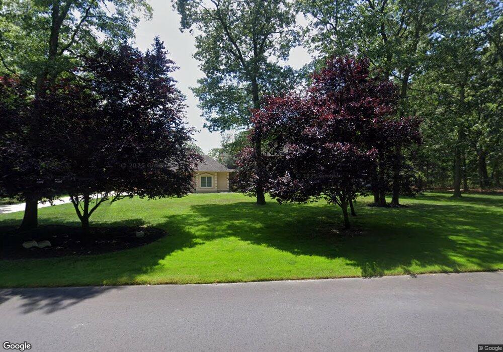
4720 Covered Bridge Rd Millville, NJ 08332
Estimated Value: $638,697 - $949,000
--
Bed
--
Bath
4,224
Sq Ft
$194/Sq Ft
Est. Value
About This Home
This home is located at 4720 Covered Bridge Rd, Millville, NJ 08332 and is currently estimated at $818,899, approximately $193 per square foot. 4720 Covered Bridge Rd is a home located in Cumberland County with nearby schools including Dr. William Mennies School, Landis Middle School, and Vineland Senior High School.
Ownership History
Date
Name
Owned For
Owner Type
Purchase Details
Closed on
Aug 6, 2022
Sold by
Brian Stringari Jr
Bought by
Stringari Brian and Bonjean-Stringari Nichole
Current Estimated Value
Purchase Details
Closed on
May 1, 2013
Sold by
Harris Douglas and Stringari Brian
Bought by
Stringari Brian
Home Financials for this Owner
Home Financials are based on the most recent Mortgage that was taken out on this home.
Original Mortgage
$415,000
Interest Rate
2.65%
Mortgage Type
Purchase Money Mortgage
Purchase Details
Closed on
Nov 9, 2004
Sold by
Aliano Michael
Bought by
Harris Paul M and Calchi Catherine Anne
Create a Home Valuation Report for This Property
The Home Valuation Report is an in-depth analysis detailing your home's value as well as a comparison with similar homes in the area
Home Values in the Area
Average Home Value in this Area
Purchase History
| Date | Buyer | Sale Price | Title Company |
|---|---|---|---|
| Stringari Brian | -- | Stringari Brian | |
| Stringari Brian | -- | Stringari Brian | |
| Stringari Brian | $600,000 | Landis Title Corp | |
| Harris Paul M | $104,500 | -- |
Source: Public Records
Mortgage History
| Date | Status | Borrower | Loan Amount |
|---|---|---|---|
| Previous Owner | Stringari Brian | $415,000 |
Source: Public Records
Tax History Compared to Growth
Tax History
| Year | Tax Paid | Tax Assessment Tax Assessment Total Assessment is a certain percentage of the fair market value that is determined by local assessors to be the total taxable value of land and additions on the property. | Land | Improvement |
|---|---|---|---|---|
| 2025 | $14,382 | $451,700 | $59,200 | $392,500 |
| 2024 | $14,382 | $451,700 | $59,200 | $392,500 |
| 2023 | $14,287 | $451,700 | $59,200 | $392,500 |
| 2022 | $13,863 | $451,700 | $59,200 | $392,500 |
| 2021 | $13,610 | $451,700 | $59,200 | $392,500 |
| 2020 | $13,221 | $451,700 | $59,200 | $392,500 |
| 2019 | $13,041 | $451,700 | $59,200 | $392,500 |
| 2018 | $12,697 | $451,700 | $59,200 | $392,500 |
| 2017 | $12,060 | $451,700 | $59,200 | $392,500 |
| 2016 | $11,636 | $451,700 | $59,200 | $392,500 |
| 2015 | $11,207 | $451,700 | $59,200 | $392,500 |
| 2014 | $10,597 | $451,700 | $59,200 | $392,500 |
Source: Public Records
Map
Nearby Homes
- 4770 Stoney Bridge Rd
- 4225 Mays Landing Rd
- 2110 Mays Landing Rd Unit 199
- 2110 Mays Landing Rd Unit 14
- 2110 Mays Landing Rd Unit 73
- 2110 Mays Landing Rd Unit 77
- 2110 Mays Landing Rd Unit 169
- 2110 Mays Landing Rd
- 2110 Mays Landing Rd Unit 317
- 2110 Mays Landing Rd Unit 267
- 2110 Mays Landing Rd Unit 308
- 1916 Bessie Way
- 1921 Mountain Dr
- 447 Manor Ave
- 3717 Nathan Ln
- 429 Manor Ave
- 9 Greenlawn Ct
- 22 Whitaker Ct
- 2655 Mays Landing Rd
- 16 Whitaker Ct
- 4700 Covered Bridge Rd
- 4742 Covered Bridge Rd
- 4746 Covered Bridge Rd
- 4762 Covered Bridge Rd
- 4686 Covered Bridge Rd
- 4683 Covered Bridge Rd
- 1455 Hance Bridge Rd
- 1630 Country Bridge Rd
- 1635 Country Bridge Rd
- 1541 Hance Bridge Rd
- 4770 Covered Bridge Rd
- 4765 Covered Bridge Rd
- 1700 Natural Bridge Rd
- 1677 Country Bridge Rd
- 1565 Hance Bridge Rd
- 1656 Country Bridge Rd
- 4800 Covered Bridge Rd
- 1730 Natural Bridge Rd
- 4815 Covered Bridge Rd
- 1715 Country Bridge Rd