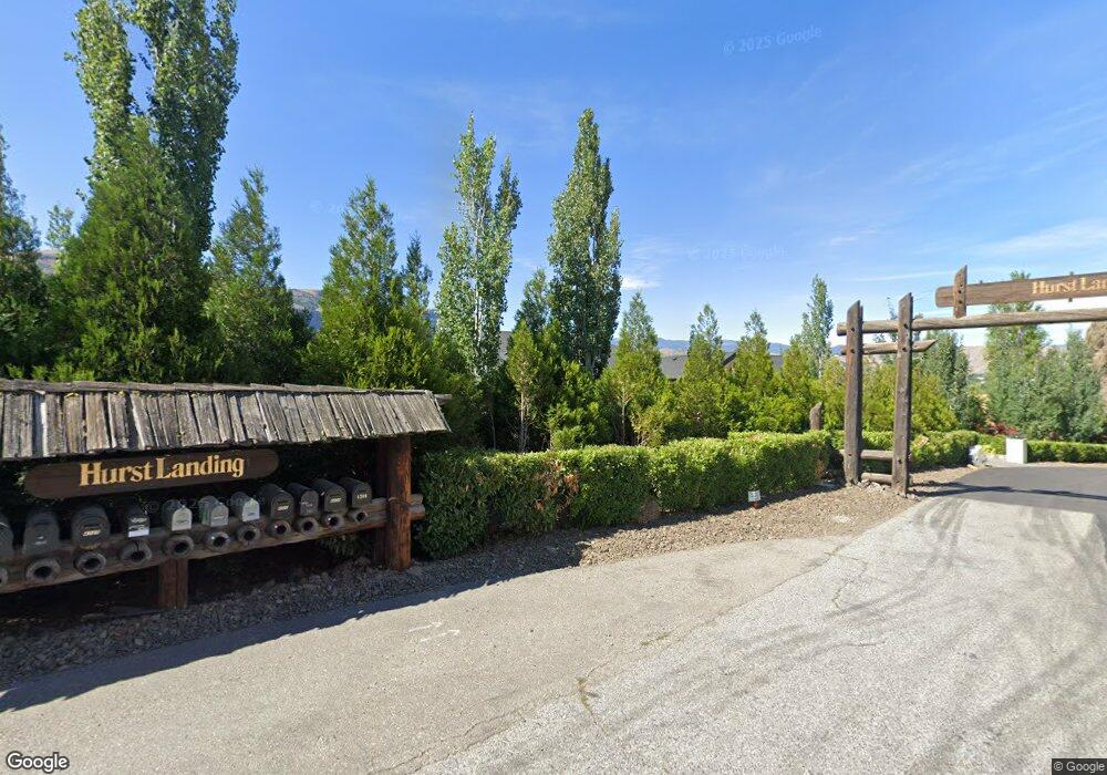
4720 Hurst Landing Rd Rock Island, WA 98850
Estimated Value: $1,510,000 - $2,862,613
4
Beds
6
Baths
6,750
Sq Ft
$308/Sq Ft
Est. Value
About This Home
This home is located at 4720 Hurst Landing Rd, Rock Island, WA 98850 and is currently estimated at $2,078,204, approximately $307 per square foot. 4720 Hurst Landing Rd is a home located in Douglas County with nearby schools including Rock Island Elementary School, Clovis Point Intermediate School, and Eastmont Junior High School.
Ownership History
Date
Name
Owned For
Owner Type
Purchase Details
Closed on
Nov 26, 2014
Sold by
Tab Land Llc
Bought by
Gst Barros Maria Christina and Gst Maria Christina Barros Tab
Current Estimated Value
Purchase Details
Closed on
Nov 15, 2012
Sold by
Barros Thomas
Bought by
Tab Land Llc
Purchase Details
Closed on
Jan 5, 2010
Sold by
Nolen Peter S and Nolen April
Bought by
Barros Thomas A
Create a Home Valuation Report for This Property
The Home Valuation Report is an in-depth analysis detailing your home's value as well as a comparison with similar homes in the area
Home Values in the Area
Average Home Value in this Area
Purchase History
| Date | Buyer | Sale Price | Title Company |
|---|---|---|---|
| Gst Barros Maria Christina | -- | None Available | |
| Tab Land Llc | -- | None Available | |
| Barros Thomas A | $395,000 | Central Washington Title Co |
Source: Public Records
Tax History Compared to Growth
Tax History
| Year | Tax Paid | Tax Assessment Tax Assessment Total Assessment is a certain percentage of the fair market value that is determined by local assessors to be the total taxable value of land and additions on the property. | Land | Improvement |
|---|---|---|---|---|
| 2025 | $90 | $2,306,700 | $484,000 | $1,822,700 |
| 2024 | $18,400 | $2,182,000 | $439,000 | $1,743,000 |
| 2023 | $16,892 | $1,718,000 | $395,800 | $1,322,200 |
| 2022 | $15,183 | $1,430,300 | $304,000 | $1,126,300 |
| 2021 | $15,388 | $1,430,300 | $304,000 | $1,126,300 |
| 2020 | $14,352 | $1,332,400 | $304,000 | $1,028,400 |
| 2018 | $14,364 | $1,232,100 | $304,000 | $928,100 |
| 2017 | $13,319 | $1,232,100 | $304,000 | $928,100 |
| 2016 | $3,457 | $1,232,100 | $304,000 | $928,100 |
| 2015 | $3,604 | $304,000 | $304,000 | $0 |
| 2014 | -- | $304,000 | $304,000 | $0 |
| 2013 | -- | $388,500 | $304,000 | $84,500 |
Source: Public Records
Map
Nearby Homes
- 1550 Pear Ln
- 5060 Washington 28
- 0 Pear Ln
- 0 S Valiant Dr Unit 18 NWM2392419
- 0 S Valiant Dr Unit 19 NWM2392423
- 0 S Valiant Dr Unit 20 NWM2392428
- 0 S Valiant Dr Unit 21 NWM2392435
- 0 S Valiant Dr Unit 22 NWM2392444
- 0 S Valiant Dr Unit 1A4 NWM2385161
- 0 S Valiant Dr Unit 1A5 NWM2385208
- 0 S Valiant Dr Unit 1A6 NWM2385244
- 0 S Valiant Dr Unit 1A9
- 0 S Valiant Dr Unit 1A8
- 0 S Valiant Dr Unit 1A7
- 3004 Rock St
- 1114 Wells St
- 5097 Malaga Alcoa Hwy
- 3796 Searles Rd
- 0 Leray Ranch Rd
- 3809 Searles Rd
- 4687 Hurst Landing Rd
- 4680 Hurst Landing Rd
- 4750 Hurst Landing Rd
- 4620 Hurst Landing Rd
- 4500 Hurst Landing Rd
- 4600 Rock Island Rd
- 4470 Hurst Landing Rd
- 4790 Rock Island Rd
- 4886 Hurst Landing Rd
- 4657 SE Colockum View Dr
- 4898 Hurst Landing Rd
- 0 Hurst Landing Rd Unit 762695
- 4906 Hurst Landing Rd
- 4886 Hurst Landing Rd
- 4906 Hurst Landing Rd
- 4400 Hurst Landing Rd
- 4850 Rock Island Rd
- 4920 Hurst Landing Rd
- 4593 Rock Island Rd
- 4645 SE Colockum View Dr
