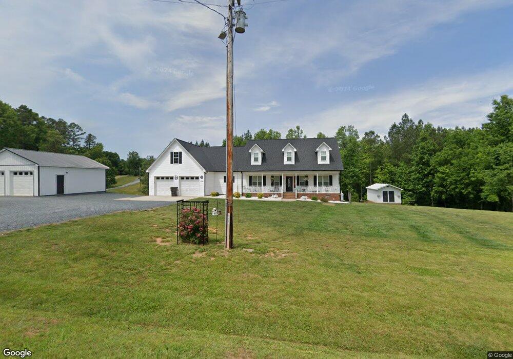
4722 Lassiter Mill Rd Asheboro, NC 27205
Estimated Value: $331,000 - $477,000
--
Bed
1
Bath
1,939
Sq Ft
$217/Sq Ft
Est. Value
About This Home
This home is located at 4722 Lassiter Mill Rd, Asheboro, NC 27205 and is currently estimated at $420,994, approximately $217 per square foot. 4722 Lassiter Mill Rd is a home with nearby schools including Sycamore Elementary School, Farmer Elementary School, and Uwharrie Ridge Six-Twelve.
Ownership History
Date
Name
Owned For
Owner Type
Purchase Details
Closed on
Jun 1, 2017
Sold by
Phil Burgess Construction Inc
Bought by
Davis Robert E and Davis Vickie L
Current Estimated Value
Home Financials for this Owner
Home Financials are based on the most recent Mortgage that was taken out on this home.
Original Mortgage
$227,950
Outstanding Balance
$188,429
Interest Rate
3.97%
Mortgage Type
New Conventional
Estimated Equity
$232,565
Create a Home Valuation Report for This Property
The Home Valuation Report is an in-depth analysis detailing your home's value as well as a comparison with similar homes in the area
Home Values in the Area
Average Home Value in this Area
Purchase History
| Date | Buyer | Sale Price | Title Company |
|---|---|---|---|
| Davis Robert E | $235,000 | None Available |
Source: Public Records
Mortgage History
| Date | Status | Borrower | Loan Amount |
|---|---|---|---|
| Open | Davis Robert E | $227,950 |
Source: Public Records
Tax History Compared to Growth
Tax History
| Year | Tax Paid | Tax Assessment Tax Assessment Total Assessment is a certain percentage of the fair market value that is determined by local assessors to be the total taxable value of land and additions on the property. | Land | Improvement |
|---|---|---|---|---|
| 2025 | $2,074 | $379,480 | $56,000 | $323,480 |
| 2024 | $2,353 | $379,480 | $56,000 | $323,480 |
| 2023 | $2,353 | $379,480 | $56,000 | $323,480 |
| 2022 | $1,882 | $249,970 | $27,000 | $222,970 |
| 2021 | $1,631 | $225,020 | $27,000 | $198,020 |
| 2020 | $1,631 | $225,020 | $27,000 | $198,020 |
| 2019 | $511 | $225,020 | $27,000 | $198,020 |
| 2018 | $1,757 | $236,693 | $23,000 | $213,693 |
| 2016 | $171 | $23,000 | $23,000 | $0 |
| 2015 | $168 | $23,000 | $23,000 | $0 |
| 2014 | -- | $23,000 | $23,000 | $0 |
Source: Public Records
Map
Nearby Homes
- 4422 Nc Highway 49 S
- 0000 Hwy 49
- 00 Nc Highway 49 S
- 0000 Nc Highway 49 S
- Lot 24 Maple Hill Ct
- 3526 Tot Hill Farm Rd
- Lot 13 Johns Ridge Dr
- Lot 12 Johns Ridge Dr
- 0 Tot Hill Farm Rd
- 001 High Meadow Dr
- 2613 High Meadow Dr
- 2565 High Meadow Dr
- 0 Deer Ridge Rd Unit 1190677
- 0 Deer Ridge Rd Unit 1191444
- 2579 Grey Rabbit Run
- 00 High Pine Church Rd
- 0 Fox Ridge Rd Unit 1197775
- Lot 37 Fox Ridge Rd
- 2626 Fox Ridge Rd
- 5747 Lou Cranford Rd
- 4756 Lassiter Mill Rd
- 4784 Lassiter Mill Rd
- 4747 Lassiter Mill Rd
- Tract 3 Moonlight Meadow Rd
- 4717 Lassiter Mill Rd
- 4692 Lassiter Mill Rd
- 4128 Thornburg Farm Trail
- 4059 Moonlight Meadow Rd
- 4206 Thornburg Farm Trail
- 4660 Lassiter Mill Rd
- 4051 Old Uwharrie Rd
- 4244 Thornburg Farm Trail
- 4955 Lassiter Mill Rd
- 4026 Old Uwharrie Rd
- 4952 Lassiter Mill Rd
- 4990 Lassiter Mill Rd
- 3990 Old Uwharrie Rd
- 5003 Lassiter Mill Rd
- 5013 Lassiter Mill Rd
- 4317 Thornburg Farm Trail