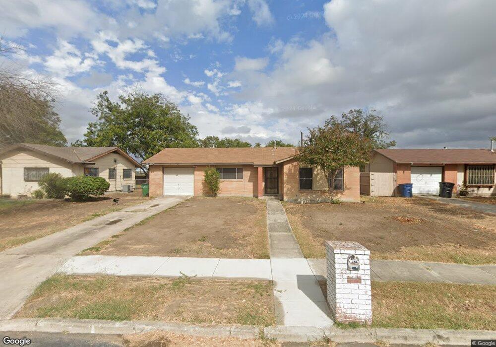
4723 Argonne Dr San Antonio, TX 78220
Southeast Side NeighborhoodEstimated Value: $165,909 - $192,000
3
Beds
2
Baths
1,064
Sq Ft
$165/Sq Ft
Est. Value
About This Home
This home is located at 4723 Argonne Dr, San Antonio, TX 78220 and is currently estimated at $175,977, approximately $165 per square foot. 4723 Argonne Dr is a home located in Bexar County with nearby schools including Hirsch Elementary School, Sam Houston High School, and Southwest Preparatory School.
Ownership History
Date
Name
Owned For
Owner Type
Purchase Details
Closed on
Jul 25, 2023
Sold by
Mendoza Diane
Bought by
Eaton Diane
Current Estimated Value
Purchase Details
Closed on
Nov 23, 2005
Sold by
Sorola Gilbert
Bought by
Mendoza Diane
Home Financials for this Owner
Home Financials are based on the most recent Mortgage that was taken out on this home.
Original Mortgage
$58,400
Interest Rate
6.06%
Mortgage Type
Fannie Mae Freddie Mac
Create a Home Valuation Report for This Property
The Home Valuation Report is an in-depth analysis detailing your home's value as well as a comparison with similar homes in the area
Home Values in the Area
Average Home Value in this Area
Purchase History
| Date | Buyer | Sale Price | Title Company |
|---|---|---|---|
| Eaton Diane | -- | None Listed On Document | |
| Mendoza Diane | -- | Lalt |
Source: Public Records
Mortgage History
| Date | Status | Borrower | Loan Amount |
|---|---|---|---|
| Previous Owner | Mendoza Diane | $58,400 |
Source: Public Records
Tax History Compared to Growth
Tax History
| Year | Tax Paid | Tax Assessment Tax Assessment Total Assessment is a certain percentage of the fair market value that is determined by local assessors to be the total taxable value of land and additions on the property. | Land | Improvement |
|---|---|---|---|---|
| 2025 | $3,637 | $143,170 | $42,550 | $100,620 |
| 2024 | $3,637 | $149,040 | $42,550 | $106,490 |
| 2023 | $3,637 | $110,262 | $42,550 | $112,360 |
| 2022 | $2,716 | $100,238 | $33,770 | $99,800 |
| 2021 | $2,546 | $91,125 | $20,190 | $95,940 |
| 2020 | $2,348 | $82,841 | $14,720 | $88,290 |
| 2019 | $2,158 | $75,310 | $13,660 | $76,520 |
| 2018 | $1,943 | $68,464 | $13,250 | $62,760 |
| 2017 | $1,757 | $62,240 | $12,030 | $50,210 |
| 2016 | $1,631 | $57,805 | $12,030 | $49,860 |
| 2015 | $1,288 | $52,550 | $12,030 | $40,520 |
| 2014 | $1,288 | $55,330 | $0 | $0 |
Source: Public Records
Map
Nearby Homes
- 510 Carol Crest St
- 4631 Kay Ann Dr
- 4823 John Victor Dr
- 4614 Belinda Lee St
- 4810 John Victor Dr
- 4607 Belinda Lee St
- 4610 Belinda Lee St
- 4851 Alfred Dr
- 4534 Kay Ann Dr
- 4603 Lavender Ln
- 203 Lynhaven Dr
- 4906 Frostwood Dr
- 302 Glenbrook
- 8532 Frostwood Dr
- 111 Zerrcliff Ln
- 126 Highway Dr
- 215 Midland Dr
- 4842 Lord Rd
- 318 Charcliff Dr
- 4338 Kilrea Dr
- 4727 Argonne Dr
- 4719 Argonne Dr
- 4731 Argonne Dr
- 4711 Argonne Dr
- 4722 Argonne Dr
- 4718 Argonne Dr
- 4707 Argonne Dr
- 4735 Argonne Dr
- 4726 Argonne Dr
- 4710 Argonne Dr
- 4730 Argonne Dr
- 4706 Argonne Dr
- 4703 Argonne Dr
- 4702 Argonne Dr
- 4739 Argonne Dr
- 4723 Belinda Lee St
- 4719 Belinda Lee St
- 500 Carol Crest St
- 4715 Belinda Lee St
- 4727 Belinda Lee St