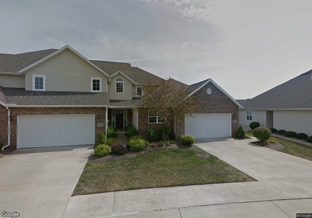
4724 Cypress Point Dr Brunswick, OH 44212
Estimated Value: $314,000 - $321,000
2
Beds
3
Baths
1,651
Sq Ft
$192/Sq Ft
Est. Value
About This Home
This home is located at 4724 Cypress Point Dr, Brunswick, OH 44212 and is currently estimated at $317,667, approximately $192 per square foot. 4724 Cypress Point Dr is a home located in Medina County with nearby schools including C.R. Towslee Elementary School, Willets Middle School, and Brunswick High School.
Ownership History
Date
Name
Owned For
Owner Type
Purchase Details
Closed on
Apr 22, 2016
Sold by
Love Carol J
Bought by
Love Carol J
Current Estimated Value
Purchase Details
Closed on
Mar 1, 2004
Sold by
Sweetbriar The Links Llc
Bought by
Love Carol J
Home Financials for this Owner
Home Financials are based on the most recent Mortgage that was taken out on this home.
Original Mortgage
$31,800
Interest Rate
5.03%
Mortgage Type
Purchase Money Mortgage
Create a Home Valuation Report for This Property
The Home Valuation Report is an in-depth analysis detailing your home's value as well as a comparison with similar homes in the area
Home Values in the Area
Average Home Value in this Area
Purchase History
| Date | Buyer | Sale Price | Title Company |
|---|---|---|---|
| Love Carol J | -- | None Available | |
| Love Carol J | $192,100 | -- |
Source: Public Records
Mortgage History
| Date | Status | Borrower | Loan Amount |
|---|---|---|---|
| Closed | Love Carol J | $31,800 |
Source: Public Records
Tax History Compared to Growth
Tax History
| Year | Tax Paid | Tax Assessment Tax Assessment Total Assessment is a certain percentage of the fair market value that is determined by local assessors to be the total taxable value of land and additions on the property. | Land | Improvement |
|---|---|---|---|---|
| 2024 | $1,713 | $75,780 | $9,260 | $66,520 |
| 2023 | $1,713 | $75,780 | $9,260 | $66,520 |
| 2022 | $3,062 | $75,780 | $9,260 | $66,520 |
| 2021 | $2,655 | $60,150 | $7,350 | $52,800 |
| 2020 | $2,341 | $60,150 | $7,350 | $52,800 |
| 2019 | $2,342 | $60,150 | $7,350 | $52,800 |
| 2018 | $2,310 | $56,410 | $9,370 | $47,040 |
| 2017 | $2,314 | $56,410 | $9,370 | $47,040 |
| 2016 | $2,311 | $56,410 | $9,370 | $47,040 |
| 2015 | $2,191 | $52,230 | $8,680 | $43,550 |
| 2014 | $2,183 | $52,230 | $8,680 | $43,550 |
| 2013 | $2,123 | $52,230 | $8,680 | $43,550 |
Source: Public Records
Map
Nearby Homes
- 1389 Mussel Shoals Dr
- 1464 Troon Ave
- 1431 Roosevelt Ave
- 1307 Stearns St
- 1407 Lincoln Ave
- 1202 Substation Rd
- 1536 Jefferson Ave
- 1151 Mulberry Ln
- 4492 Cleveland St
- 5035 Center Rd
- 4684 Wolff Dr
- 0 Terrington Dr Unit 4467162
- VL Laurel & Substation Rd
- 5101 Center Rd
- 4383 Inner Circle Dr Unit C24
- 4383 Inner Circle Dr Unit A24
- 4385 Inner Circle Dr Unit B-18
- 4383 Inner Circle Dr Unit B22
- 0 Pearl Rd Unit 4173749
- V/L Pearl Rd
- 4722 Cypress Point Dr
- 4718 Cypress Point Dr
- 4730 Cypress Point Dr
- VL Cypress Point Dr
- VL Cypress Point Dr
- VL Cypress Point Dr
- VL Cypress Point Dr
- 4716 Cypress Point Dr
- VL Crooked River Dr
- SL# 143 Cypress Point Dr
- SL# 142 Cypress Point Dr
- SL# 141 Cypress Point Dr
- SL# 134 Cypress Point Dr
- SL# 133 Cypress Point Dr
- SL# 132 Cypress Point Dr
- SL# 131 Cypress Point Dr
- SL# 130 Cypress Point Dr
- SL# 129 Cypress Point Dr
- 4734 Cypress Point Dr
- 4736 Cypress Point Dr