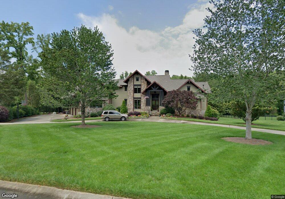
4724 Kay Bird Ln Concord, NC 28027
Estimated Value: $1,608,000 - $1,888,000
5
Beds
6
Baths
5,061
Sq Ft
$350/Sq Ft
Est. Value
About This Home
This home is located at 4724 Kay Bird Ln, Concord, NC 28027 and is currently estimated at $1,770,706, approximately $349 per square foot. 4724 Kay Bird Ln is a home located in Cabarrus County with nearby schools including Charles E. Boger Elementary School, Northwest Cabarrus Middle School, and Northwest Cabarrus High.
Ownership History
Date
Name
Owned For
Owner Type
Purchase Details
Closed on
Nov 28, 2005
Sold by
Yates Bost Developers Llc
Bought by
Fromke Mark K and Fromke Heidi M
Current Estimated Value
Home Financials for this Owner
Home Financials are based on the most recent Mortgage that was taken out on this home.
Original Mortgage
$1,000,000
Outstanding Balance
$560,988
Interest Rate
5.5%
Mortgage Type
Construction
Estimated Equity
$1,209,718
Create a Home Valuation Report for This Property
The Home Valuation Report is an in-depth analysis detailing your home's value as well as a comparison with similar homes in the area
Home Values in the Area
Average Home Value in this Area
Purchase History
| Date | Buyer | Sale Price | Title Company |
|---|---|---|---|
| Fromke Mark K | $205,000 | -- |
Source: Public Records
Mortgage History
| Date | Status | Borrower | Loan Amount |
|---|---|---|---|
| Open | Fromke Mark K | $1,000,000 |
Source: Public Records
Tax History Compared to Growth
Tax History
| Year | Tax Paid | Tax Assessment Tax Assessment Total Assessment is a certain percentage of the fair market value that is determined by local assessors to be the total taxable value of land and additions on the property. | Land | Improvement |
|---|---|---|---|---|
| 2025 | $17,468 | $1,538,390 | $128,920 | $1,409,470 |
| 2024 | $17,468 | $1,538,390 | $128,920 | $1,409,470 |
| 2023 | $12,942 | $944,640 | $79,930 | $864,710 |
| 2022 | $12,942 | $944,640 | $79,930 | $864,710 |
| 2021 | $12,942 | $944,640 | $79,930 | $864,710 |
| 2020 | $12,942 | $944,640 | $79,930 | $864,710 |
| 2019 | $11,668 | $851,670 | $56,310 | $795,360 |
| 2018 | $11,498 | $851,670 | $56,310 | $795,360 |
| 2017 | $11,327 | $851,670 | $56,310 | $795,360 |
| 2016 | $11,327 | $877,280 | $174,650 | $702,630 |
| 2015 | $11,054 | $877,280 | $174,650 | $702,630 |
| 2014 | $11,054 | $877,280 | $174,650 | $702,630 |
Source: Public Records
Map
Nearby Homes
- 0000 Farmstead Ln
- 0 Honey Tree Ln
- 4012 Honey Tree Ln
- 6872 Buttercup Ln
- 6321 Trinity Crossing Cir
- 3277 Trinity Church Dr
- 3351 Trinity Church Dr
- 5950 Willowood Rd
- 6327 Fox Tail Ln
- 5850 Alexander Rd
- 6017 Pagemont Rd
- 5445 Mooresville Rd
- 3099 Trinity Church Rd
- 6231 Kentwood Dr
- 6761 Fox Ridge Cir
- 4170 County Down Ave
- 3820 Shider Ln
- 9650 Barnett Rd
- 5461 S Oakmont St
- 260 Westen Acres Dr
- 4738 Kay Bird Ln
- 7299 Three Sisters Ln
- 4700 Kay Bird Ln
- 4700 Kay Bird Ln
- 4700 Kay Bird Ln Unit 27
- 4776 Kay Bird Ln
- 7298 Three Sisters Ln
- 4792 Kay Bird Ln
- 7117 Stirewalt Rd
- 7292 3 Sisters Ln
- 7253 Three Sisters Ln
- 7266 Three Sisters Ln
- 7248 Three Sisters Ln
- 7162 Drakestone Rd
- 4647 Owl Creek Ln
- 4671 Owl Creek Ln
- 7224 Three Sisters Ln
- 4607 Owl Creek Ln
- 4607 Owl Creek Ln Unit 3
- 4629 Owl Creek Ln