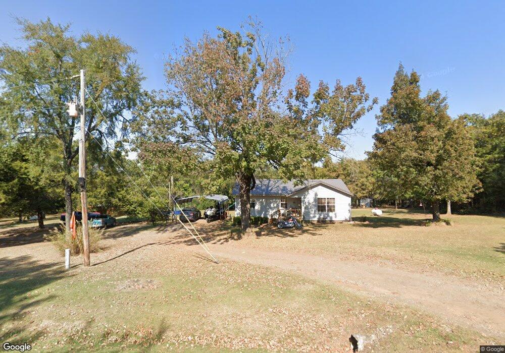
472479 E 1040 Rd Muldrow, OK 74948
Estimated Value: $102,000 - $228,000
3
Beds
1
Bath
624
Sq Ft
$263/Sq Ft
Est. Value
About This Home
This home is located at 472479 E 1040 Rd, Muldrow, OK 74948 and is currently estimated at $163,926, approximately $262 per square foot. 472479 E 1040 Rd is a home with nearby schools including Central Elementary School and Central High School.
Ownership History
Date
Name
Owned For
Owner Type
Purchase Details
Closed on
Mar 5, 2020
Sold by
Jiles Raymond and Jiles Denise
Bought by
Folsom Bruce and Folsom Valencia
Current Estimated Value
Purchase Details
Closed on
Jan 8, 2007
Sold by
Jiles Raymond and Jiles Denise
Bought by
Folsom Bruce Ray and Reed Joshua Todd
Purchase Details
Closed on
Mar 11, 2002
Sold by
Berry
Bought by
Jiles
Purchase Details
Closed on
Jun 12, 1999
Sold by
Adams Jim and Adams Wanda
Bought by
Berry Shelly
Create a Home Valuation Report for This Property
The Home Valuation Report is an in-depth analysis detailing your home's value as well as a comparison with similar homes in the area
Purchase History
| Date | Buyer | Sale Price | Title Company |
|---|---|---|---|
| Folsom Bruce | $39,000 | None Available | |
| Folsom Bruce Ray | $45,000 | None Available | |
| Jiles | $4,000 | -- | |
| Berry Shelly | -- | -- |
Source: Public Records
Mortgage History
| Date | Status | Borrower | Loan Amount |
|---|---|---|---|
| Closed | Folsom Bruce Ray | $0 |
Source: Public Records
Tax History
| Year | Tax Paid | Tax Assessment Tax Assessment Total Assessment is a certain percentage of the fair market value that is determined by local assessors to be the total taxable value of land and additions on the property. | Land | Improvement |
|---|---|---|---|---|
| 2025 | $798 | $11,130 | $1,374 | $9,756 |
| 2024 | $798 | $10,633 | $1,334 | $9,299 |
| 2023 | $767 | $10,323 | $1,267 | $9,056 |
| 2022 | $646 | $10,023 | $1,182 | $8,841 |
| 2021 | $625 | $10,022 | $1,175 | $8,847 |
| 2020 | $605 | $9,447 | $954 | $8,493 |
| 2019 | $585 | $9,172 | $926 | $8,246 |
| 2018 | $566 | $8,905 | $892 | $8,013 |
| 2017 | $547 | $8,646 | $855 | $7,791 |
| 2016 | $529 | $8,394 | $820 | $7,574 |
| 2015 | $512 | $8,150 | $786 | $7,364 |
| 2014 | $495 | $7,912 | $754 | $7,158 |
Source: Public Records
Map
Nearby Homes
- 103891 Oklahoma 64b
- 473365 E 1050 Rd
- TBD E 1023 Rd
- TBD Oklahoma 101
- 101950 S 4705 Rd
- 102816 Oklahoma 64b
- 106078 S 4715 Rd
- 470025 Highway 101
- 101383 S 4705 Rd
- Lot 43 E 1028 Rd
- 474132 Oklahoma 101
- 105750 S 4700 Rd
- 475531 E 1050 Rd
- 471804 E 1070 Rd
- TBD Oklahoma 101
- 471674 E 1020 Rd
- TBD Tract 4 E 1070 Rd
- 600 N Paw Rd
- TBD Tbd
- 600 Paw Rd
- 0 1040 Rd Unit 1409256
- 0 1040 Rd Unit 1409262
- 0 1040 Rd Unit 1409267
- 0 E 1040 Rd
- 0 1040 Rd Unit 1537435
- 0 1040 Rd Unit 1537430
- 0 1040 Rd Unit 1537433
- 0 1040 Rd Unit 1813484
- 0 1040 Rd Unit 1838157
- 0 1040 Rd Unit 1915155
- 0 1040 Rd Unit 2026639
- 472498 E 1040 Rd
- 472124 E 1040 Rd
- 472328 E 1044 Rd
- 472022 E 1040 Rd
- 103924 S 4730 Rd
- 104203 S 4720 Rd
- 472097 E 1044 Rd
- 472956 E 1040 Rd
- 103862 S 4720 Rd
Your Personal Tour Guide
Ask me questions while you tour the home.