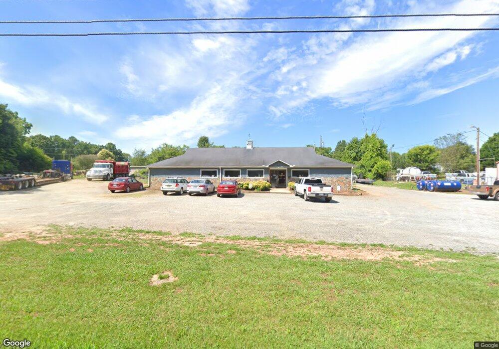
4725 Long Ferry Rd Unit 1&2 Salisbury, NC 28146
Estimated Value: $181,060
--
Bed
--
Bath
2,720
Sq Ft
$67/Sq Ft
Est. Value
About This Home
This home is located at 4725 Long Ferry Rd Unit 1&2, Salisbury, NC 28146 and is currently estimated at $181,060, approximately $66 per square foot. 4725 Long Ferry Rd Unit 1&2 is a home located in Rowan County with nearby schools including E Hanford Dole Elementary School, North Rowan Middle School, and North Rowan High School.
Ownership History
Date
Name
Owned For
Owner Type
Purchase Details
Closed on
Jan 25, 2022
Sold by
Ann Everhardt Pamela and Ann William M
Bought by
Tucker David B
Current Estimated Value
Purchase Details
Closed on
May 26, 2017
Sold by
Jordan Patricia B
Bought by
Tucker David B
Purchase Details
Closed on
Jul 29, 1996
Bought by
Jordan Melvin E and Jordan F
Create a Home Valuation Report for This Property
The Home Valuation Report is an in-depth analysis detailing your home's value as well as a comparison with similar homes in the area
Home Values in the Area
Average Home Value in this Area
Purchase History
| Date | Buyer | Sale Price | Title Company |
|---|---|---|---|
| Tucker David B | $132,000 | None Listed On Document | |
| Tucker David B | $85,000 | None Available | |
| Jordan Melvin E | -- | -- |
Source: Public Records
Tax History Compared to Growth
Tax History
| Year | Tax Paid | Tax Assessment Tax Assessment Total Assessment is a certain percentage of the fair market value that is determined by local assessors to be the total taxable value of land and additions on the property. | Land | Improvement |
|---|---|---|---|---|
| 2025 | $1,116 | $167,208 | $54,000 | $113,208 |
| 2024 | $1,116 | $167,208 | $54,000 | $113,208 |
| 2023 | $1,116 | $167,208 | $54,000 | $113,208 |
| 2022 | $1,150 | $154,424 | $48,000 | $106,424 |
| 2021 | $1,139 | $154,424 | $48,000 | $106,424 |
| 2020 | $1,139 | $154,424 | $48,000 | $106,424 |
| 2019 | $1,139 | $154,424 | $48,000 | $106,424 |
| 2018 | $923 | $126,216 | $48,000 | $78,216 |
| 2017 | $923 | $126,216 | $48,000 | $78,216 |
| 2016 | $923 | $126,216 | $48,000 | $78,216 |
| 2015 | $937 | $126,216 | $48,000 | $78,216 |
| 2014 | $967 | $134,310 | $48,000 | $86,310 |
Source: Public Records
Map
Nearby Homes
- 465 White Crane Rd
- 260 River Country Rd
- 238 Bluff Ln
- 350 River Country Rd
- 5555 Long Ferry Rd
- 453 Sunset Pointe Dr
- 1547 Sunset Pointe Dr
- 700 Sunset Pointe Dr
- 1135 Rudder Cir
- 621 Sunset Pointe Dr
- 1105 Rudder Cir
- 1261 Sunset Pointe Dr Unit 60
- 1283 Sunset Pointe Dr
- 0 Tidewater Rd
- 3445 Long Ferry Rd
- 1053 Inlet Point Rd
- 3420 Long Ferry Rd
- 3425 Long Ferry Rd
- 1140 Inlet Point Rd
- 3105 Riverside Dr
- 4725 Long Ferry Rd
- 1205 Chez Charolais Rd
- 1215 Chez Charolais Rd
- 1145 Chez Charolais Rd
- 1225 Chez Charolais Rd
- 4685 Long Ferry Rd
- 4773 Long Ferry Rd
- 1135 Chez Charolais Rd
- 1220 Chez Charolais Rd
- 1140 Chez Charolais Rd
- 1235 Chez Charolais Rd
- 1130 Chez Charolais Rd
- 4675 Long Ferry Rd
- 1230 Chez Charolais Rd
- 1120 Chez Charolais Rd
- 4730 Long Ferry Rd
- 4655 Long Ferry Rd
- 1245 Chez Charolais Rd
- 1240 Chez Charolais Rd
- 1110 Chez Charolais Rd