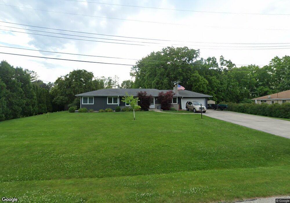
4725 N 135th St Brookfield, WI 53005
Estimated Value: $453,000 - $497,000
3
Beds
3
Baths
1,706
Sq Ft
$276/Sq Ft
Est. Value
About This Home
This home is located at 4725 N 135th St, Brookfield, WI 53005 and is currently estimated at $470,835, approximately $275 per square foot. 4725 N 135th St is a home located in Waukesha County with nearby schools including Burleigh Elementary School, Pilgrim Park Middle School, and Brookfield East High School.
Ownership History
Date
Name
Owned For
Owner Type
Purchase Details
Closed on
Jun 2, 2020
Sold by
Derler Paul E
Bought by
Derler Trust
Current Estimated Value
Purchase Details
Closed on
Nov 1, 2013
Sold by
Derler Paul E
Bought by
Derler Paul E
Home Financials for this Owner
Home Financials are based on the most recent Mortgage that was taken out on this home.
Original Mortgage
$193,900
Interest Rate
4.24%
Mortgage Type
New Conventional
Purchase Details
Closed on
Apr 30, 1997
Sold by
Krueger Victor and Krueger Shirley
Bought by
Derler Paul E and Derler Debra M
Home Financials for this Owner
Home Financials are based on the most recent Mortgage that was taken out on this home.
Original Mortgage
$131,800
Interest Rate
8%
Mortgage Type
Purchase Money Mortgage
Create a Home Valuation Report for This Property
The Home Valuation Report is an in-depth analysis detailing your home's value as well as a comparison with similar homes in the area
Home Values in the Area
Average Home Value in this Area
Purchase History
| Date | Buyer | Sale Price | Title Company |
|---|---|---|---|
| Derler Trust | -- | None Available | |
| Derler Paul E | $273,000 | -- | |
| Derler Paul E | $167,000 | -- |
Source: Public Records
Mortgage History
| Date | Status | Borrower | Loan Amount |
|---|---|---|---|
| Previous Owner | Derler Paul E | $193,900 | |
| Previous Owner | Derler Paul E | $131,800 |
Source: Public Records
Tax History Compared to Growth
Tax History
| Year | Tax Paid | Tax Assessment Tax Assessment Total Assessment is a certain percentage of the fair market value that is determined by local assessors to be the total taxable value of land and additions on the property. | Land | Improvement |
|---|---|---|---|---|
| 2024 | $4,161 | $377,800 | $128,400 | $249,400 |
| 2023 | $4,156 | $377,800 | $128,400 | $249,400 |
| 2022 | $4,069 | $289,800 | $123,400 | $166,400 |
| 2021 | $4,304 | $289,800 | $123,400 | $166,400 |
| 2020 | $4,510 | $289,800 | $123,400 | $166,400 |
| 2019 | $4,325 | $289,800 | $123,400 | $166,400 |
| 2018 | $4,239 | $275,800 | $120,000 | $155,800 |
| 2017 | $4,251 | $275,800 | $120,000 | $155,800 |
| 2016 | $4,312 | $275,800 | $120,000 | $155,800 |
| 2015 | $4,292 | $275,800 | $120,000 | $155,800 |
| 2014 | $4,452 | $275,800 | $120,000 | $155,800 |
| 2013 | $4,452 | $275,800 | $120,000 | $155,800 |
Source: Public Records
Map
Nearby Homes
- 4720 Cara Marie Ct Unit A
- 4440 Lilly Rd
- 4335 Nighthawk Trail
- W144N4822 Stone Dr Unit C
- 12729 W Derby Place
- W144N4821 Stone Dr
- Lt7-8 Lucille Ln
- 4425 N 143rd St
- 14220 Ranch Rd
- N54W14225 Van Buren Dr
- 4602 N 118th St
- 15290 Shamrock Ln
- 4685 Pilgrim Rd
- 4460 N 158th St
- 5253 N Lovers Lane Rd Unit 324
- 5253 N Lovers Lane Rd Unit 204
- 5253 N Lovers Lane Rd Unit 232
- 14165 Lindsay Dr
- 3500 Westwood Dr
- Lt2 Capitol Dr
- 4745 N 135th St
- 13560 Courtland Ave
- 13620 Courtland Ave
- 13530 Courtland Ave
- 13640 Courtland Ave
- 4765 N 135th St
- 13680 Courtland Ave
- 13565 Courtland Ave
- 13635 Courtland Ave
- 13445 Hampton Rd
- 13535 Courtland Ave
- 13565 Hampton Rd
- 13665 Courtland Ave
- 13625 Hampton Rd
- 13635 Hampton Rd
- 13730 Courtland Ave
- 4665 N 135th St
- 13640 Squirrel Dr
- 4720 Cara Marie Ct Unit B
- 4720 Cara Marie Ct
