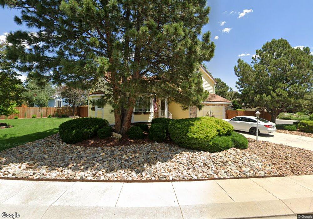
4725 Oz Ct Colorado Springs, CO 80922
Stetson Hills NeighborhoodEstimated Value: $441,000 - $503,000
3
Beds
3
Baths
1,984
Sq Ft
$240/Sq Ft
Est. Value
About This Home
This home is located at 4725 Oz Ct, Colorado Springs, CO 80922 and is currently estimated at $475,899, approximately $239 per square foot. 4725 Oz Ct is a home located in El Paso County with nearby schools including Stetson Elementary School, Skyview Middle School, and Sand Creek High School.
Ownership History
Date
Name
Owned For
Owner Type
Purchase Details
Closed on
Apr 25, 1996
Sold by
Larson Stephan G and Larson Diane M
Bought by
Kouba Paul J and Kouba Glenda S
Current Estimated Value
Home Financials for this Owner
Home Financials are based on the most recent Mortgage that was taken out on this home.
Original Mortgage
$130,500
Outstanding Balance
$7,287
Interest Rate
7.78%
Estimated Equity
$468,612
Purchase Details
Closed on
Jan 26, 1993
Bought by
Kouba Paul J and Kouba Glenda S
Purchase Details
Closed on
Apr 29, 1987
Bought by
Kouba Paul J and Kouba Glenda S
Purchase Details
Closed on
Dec 1, 1986
Bought by
Kouba Paul J and Kouba Glenda S
Create a Home Valuation Report for This Property
The Home Valuation Report is an in-depth analysis detailing your home's value as well as a comparison with similar homes in the area
Home Values in the Area
Average Home Value in this Area
Purchase History
| Date | Buyer | Sale Price | Title Company |
|---|---|---|---|
| Kouba Paul J | $145,000 | -- | |
| Kouba Paul J | $123,000 | -- | |
| Kouba Paul J | -- | -- | |
| Kouba Paul J | -- | -- |
Source: Public Records
Mortgage History
| Date | Status | Borrower | Loan Amount |
|---|---|---|---|
| Open | Kouba Paul J | $130,500 |
Source: Public Records
Tax History Compared to Growth
Tax History
| Year | Tax Paid | Tax Assessment Tax Assessment Total Assessment is a certain percentage of the fair market value that is determined by local assessors to be the total taxable value of land and additions on the property. | Land | Improvement |
|---|---|---|---|---|
| 2025 | $1,804 | $32,400 | -- | -- |
| 2024 | $1,275 | $32,330 | $4,620 | $27,710 |
| 2023 | $1,275 | $32,330 | $4,620 | $27,710 |
| 2022 | $982 | $22,750 | $4,170 | $18,580 |
| 2021 | $1,023 | $23,410 | $4,290 | $19,120 |
| 2020 | $846 | $20,450 | $3,580 | $16,870 |
| 2019 | $1,288 | $20,450 | $3,580 | $16,870 |
| 2018 | $1,050 | $16,350 | $3,020 | $13,330 |
| 2017 | $1,055 | $16,350 | $3,020 | $13,330 |
| 2016 | $1,079 | $16,500 | $2,950 | $13,550 |
| 2015 | $1,080 | $16,500 | $2,950 | $13,550 |
| 2014 | $1,011 | $15,160 | $2,790 | $12,370 |
Source: Public Records
Map
Nearby Homes
- 4611 Hotspur Dr
- 6835 Ashley Dr
- 5914 Instone Cir
- 6180 Kettle Ct
- 4690 Badlands Ct
- 6980 Ashley Dr
- 6615 Annanhill Place
- 5934 Instone Cir
- 6330 Emma Ln
- 6125 Lowlander Ct
- 6170 Katy Ct
- 7004 Ash Creek Heights Unit 201
- 6984 Ash Creek Heights Unit 204
- 6385 Boscomb Place
- 7084 Ash Creek Heights Unit 201
- 5053 Blackcloud Loop
- 7020 Hillbeck Dr
- 7010 Highcroft Dr
- 6350 Naturita Trail
- 7104 Ash Creek Heights Unit 203
- 4760 Signal Rock Rd
- 4770 Signal Rock Rd
- 4720 Oz Ct
- 4755 Oz Ct
- 4730 Oz Ct
- 4755 Signal Rock Rd
- 4765 Signal Rock Rd
- 4745 Signal Rock Rd
- 4730 Signal Rock Rd
- 4750 Oz Ct
- 4740 Oz Ct
- 4775 Signal Rock Rd
- 4735 Signal Rock Rd
- 4780 Signal Rock Rd
- 4665 Purcell Dr
- 4655 Purcell Dr
- 4725 Signal Rock Rd
- 4645 Purcell Dr
- 4675 Purcell Dr
- 4785 Signal Rock Rd
