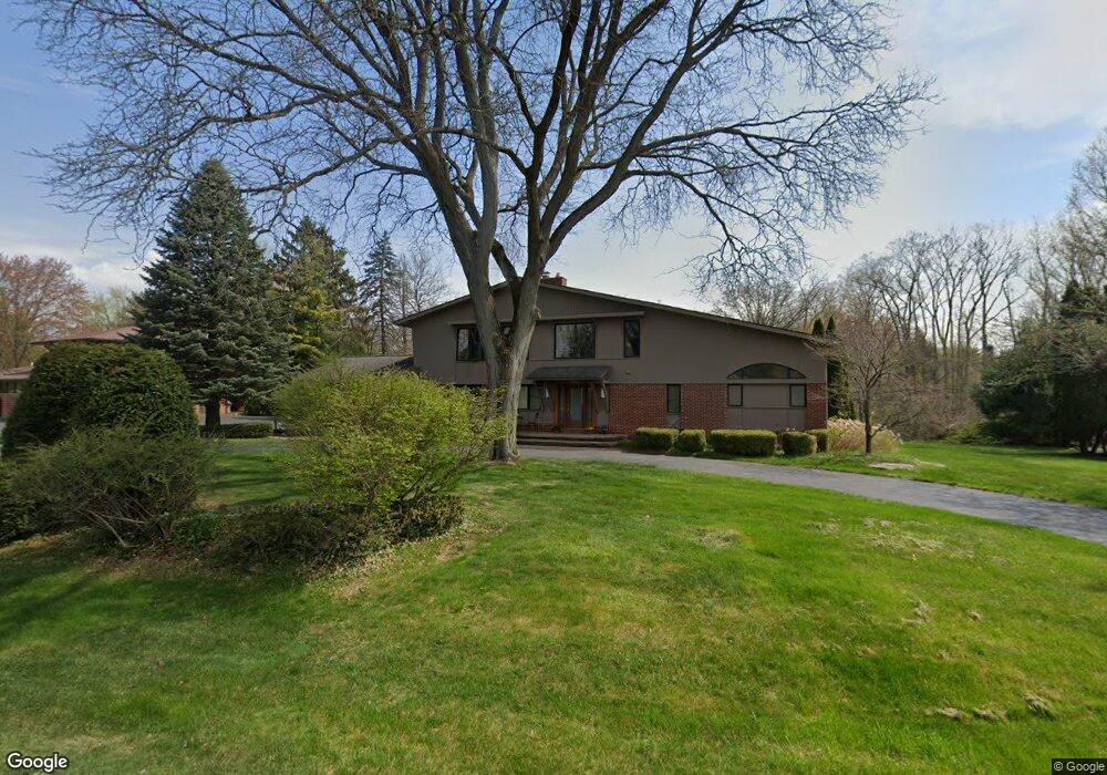
4727 Burnley Dr Bloomfield Hills, MI 48304
Estimated Value: $890,109 - $1,070,000
5
Beds
6
Baths
3,542
Sq Ft
$282/Sq Ft
Est. Value
About This Home
This home is located at 4727 Burnley Dr, Bloomfield Hills, MI 48304 and is currently estimated at $999,527, approximately $282 per square foot. 4727 Burnley Dr is a home located in Oakland County with nearby schools including Harlan Elementary School, Ernest W. Seaholm High School, and Academy of Sacred Heart.
Ownership History
Date
Name
Owned For
Owner Type
Purchase Details
Closed on
Apr 16, 2021
Sold by
Foley Jennifer L
Bought by
Foley Jennifer Lee and Foley Jennifer Lee
Current Estimated Value
Purchase Details
Closed on
Dec 3, 2019
Sold by
Lee Patrick D
Bought by
Foley Jennifer L
Purchase Details
Closed on
Aug 15, 2006
Sold by
Sahney Judith Gail and Judith Gail Sahney Revocable T
Bought by
Lee Patrick D and Foley Jennifer L
Purchase Details
Closed on
Sep 26, 2003
Sold by
Sahney Vinod K and Sahney Judith Gail
Bought by
Sahney Judith Gail and Judith Gail Sahney Revocable Trust
Create a Home Valuation Report for This Property
The Home Valuation Report is an in-depth analysis detailing your home's value as well as a comparison with similar homes in the area
Home Values in the Area
Average Home Value in this Area
Purchase History
| Date | Buyer | Sale Price | Title Company |
|---|---|---|---|
| Foley Jennifer Lee | -- | None Available | |
| Foley Jennifer L | -- | None Available | |
| Lee Patrick D | $565,000 | Metropolitan | |
| Sahney Judith Gail | -- | -- |
Source: Public Records
Tax History Compared to Growth
Tax History
| Year | Tax Paid | Tax Assessment Tax Assessment Total Assessment is a certain percentage of the fair market value that is determined by local assessors to be the total taxable value of land and additions on the property. | Land | Improvement |
|---|---|---|---|---|
| 2024 | $5,460 | $374,240 | $0 | $0 |
| 2023 | $5,240 | $345,700 | $0 | $0 |
| 2022 | $8,870 | $337,730 | $0 | $0 |
| 2021 | $8,944 | $336,070 | $0 | $0 |
| 2020 | $5,034 | $324,650 | $0 | $0 |
| 2019 | $8,930 | $319,980 | $0 | $0 |
| 2018 | $9,432 | $324,820 | $0 | $0 |
| 2017 | $9,362 | $315,160 | $0 | $0 |
| 2016 | $8,905 | $298,800 | $0 | $0 |
| 2015 | -- | $278,110 | $0 | $0 |
| 2014 | -- | $251,320 | $0 | $0 |
| 2011 | -- | $194,320 | $0 | $0 |
Source: Public Records
Map
Nearby Homes
- 4731 Haddington Dr
- 2991 Lanergan Dr
- 2840 Bolingbroke Dr
- 0000 Brookdale Rd
- 4890 Charing Cross Rd
- 2650 Binbrooke Dr
- 4389 Charing Way
- 4144 Rouge Circle Dr
- 433 Whippers In Ct
- 1330 Oxford Rd
- 796 Rock Spring Rd
- 5554 Pine Brooke Ct
- 1333 N Adams Rd
- 654 Shepardbush St
- 680 Shepardbush St
- 170 Kirkwood Ct
- 3826 Lakecrest Dr
- 2611 Tarragona Way
- 3014 Caswell Dr
- 1048 Satterlee Rd
- 4711 Burnley Dr
- 4700 Burnley Dr
- 4694 Burnley Dr
- 4691 Burnley Dr
- 4765 Tullamore Dr
- 4759 Burnley Dr
- 4791 Tullamore Dr
- 4754 Burnley Dr
- 4680 Burnley Dr
- 4811 Tullamore Dr
- 743 Robinhood Cir
- 702 Browning Ct
- 4775 Burnley Dr
- 735 Robinhood Cir
- 4770 Burnley Dr
- 4730 Tullamore Dr
- 4760 Tullamore Dr
- 4780 Tullamore Dr
- 4825 Tullamore Dr
- 4660 Burnley Dr