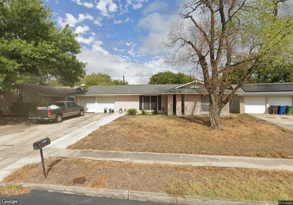
4727 Lock Lomond Ln San Antonio, TX 78220
Southeast Side NeighborhoodEstimated Value: $196,000 - $219,000
3
Beds
2
Baths
1,632
Sq Ft
$127/Sq Ft
Est. Value
About This Home
This home is located at 4727 Lock Lomond Ln, San Antonio, TX 78220 and is currently estimated at $206,590, approximately $126 per square foot. 4727 Lock Lomond Ln is a home located in Bexar County with nearby schools including Hirsch Elementary School, Sam Houston High School, and Southwest Preparatory School.
Ownership History
Date
Name
Owned For
Owner Type
Purchase Details
Closed on
Nov 16, 2015
Sold by
Lee Angela and Brown Cheryl
Bought by
Vinton Israel
Current Estimated Value
Home Financials for this Owner
Home Financials are based on the most recent Mortgage that was taken out on this home.
Original Mortgage
$90,333
Outstanding Balance
$71,075
Interest Rate
3.8%
Mortgage Type
FHA
Estimated Equity
$135,515
Purchase Details
Closed on
Aug 3, 2015
Sold by
Lee Angela
Bought by
Marshall Pearlie Marie
Purchase Details
Closed on
May 1, 2015
Sold by
Marshall Pearlie Marie
Bought by
Lee Angela
Purchase Details
Closed on
May 25, 2002
Sold by
Brown Bryant Cheryl Elise Marshall
Bought by
Marshall Pearlie Marie
Purchase Details
Closed on
Apr 27, 2002
Sold by
Brown Bryant Cheryl Elise Marshall
Bought by
Marshall Pearlie Marie
Create a Home Valuation Report for This Property
The Home Valuation Report is an in-depth analysis detailing your home's value as well as a comparison with similar homes in the area
Home Values in the Area
Average Home Value in this Area
Purchase History
| Date | Buyer | Sale Price | Title Company |
|---|---|---|---|
| Vinton Israel | -- | Capital Title | |
| Vinton Israel | -- | Capital Title | |
| Marshall Pearlie Marie | -- | None Available | |
| Lee Angela | -- | None Available | |
| Marshall Pearlie Marie | -- | -- | |
| Marshall Pearlie Marie | -- | -- | |
| Marshall Pearlie Marie | -- | -- | |
| Marshall Pearlie Marie | -- | -- |
Source: Public Records
Mortgage History
| Date | Status | Borrower | Loan Amount |
|---|---|---|---|
| Open | Vinton Israel | $90,333 | |
| Closed | Vinton Israel | $90,333 |
Source: Public Records
Tax History Compared to Growth
Tax History
| Year | Tax Paid | Tax Assessment Tax Assessment Total Assessment is a certain percentage of the fair market value that is determined by local assessors to be the total taxable value of land and additions on the property. | Land | Improvement |
|---|---|---|---|---|
| 2025 | $2,611 | $193,910 | $42,830 | $157,150 |
| 2024 | $2,611 | $176,282 | $42,830 | $166,320 |
| 2023 | $2,611 | $160,256 | $42,830 | $175,490 |
| 2022 | $3,947 | $145,687 | $33,980 | $155,820 |
| 2021 | $3,700 | $132,443 | $20,360 | $149,690 |
| 2020 | $3,413 | $120,403 | $14,840 | $137,740 |
| 2019 | $3,137 | $109,457 | $13,780 | $119,380 |
| 2018 | $2,824 | $99,506 | $13,280 | $97,910 |
| 2017 | $2,553 | $90,460 | $12,130 | $78,330 |
| 2016 | $2,539 | $89,960 | $12,130 | $77,830 |
| 2015 | $897 | $74,866 | $12,130 | $63,240 |
| 2014 | $897 | $68,060 | $0 | $0 |
Source: Public Records
Map
Nearby Homes
- 4631 Kay Ann Dr
- 510 Carol Crest St
- 4603 Lavender Ln
- 4851 Alfred Dr
- 4614 Belinda Lee St
- 4610 Belinda Lee St
- 4607 Belinda Lee St
- 4534 Kay Ann Dr
- 4810 John Victor Dr
- 4823 John Victor Dr
- 203 Lynhaven Dr
- 4906 Frostwood Dr
- 4842 Lord Rd
- 302 Glenbrook
- 257 Glenoak Dr
- 8532 Frostwood Dr
- 4442 Lord Rd
- 4419 N Hein Rd
- 318 Charcliff Dr
- 111 Zerrcliff Ln
- 4723 Lock Lomond Ln
- 4731 Lock Lomond Ln
- 4719 Lock Lomond Ln
- 4726 Lock Lomond Ln
- 4726 Kay Ann Dr
- 4730 Lock Lomond Ln
- 4734 Kay Ann Dr
- 4722 Lock Lomond Ln
- 602 Knotty Oak Trail
- 4715 Lock Lomond Ln
- 4722 Kay Ann Dr
- 4718 Lock Lomond Ln
- 4718 Kay Ann Dr
- 538 Carol Crest St
- 4711 Lock Lomond Ln
- 4714 Lock Lomond Ln
- 606 Knotty Oak Trail
- 4727 Lavender Ln
- 4731 Lavender Ln
- 4723 Lavender Ln