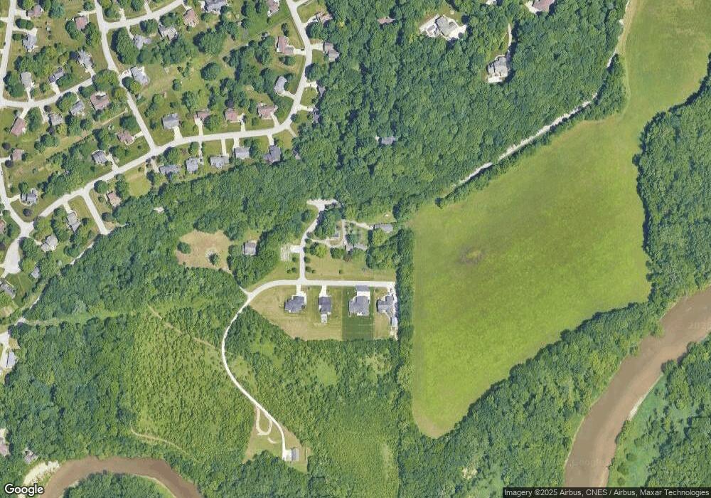
4729 Eisenhower Rd Lafayette, IN 47905
Estimated Value: $366,675 - $398,000
3
Beds
1
Bath
2,152
Sq Ft
$176/Sq Ft
Est. Value
About This Home
This home is located at 4729 Eisenhower Rd, Lafayette, IN 47905 and is currently estimated at $379,669, approximately $176 per square foot. 4729 Eisenhower Rd is a home located in Tippecanoe County with nearby schools including Hershey Elementary School, East Tipp Middle School, and William Henry Harrison High School.
Ownership History
Date
Name
Owned For
Owner Type
Purchase Details
Closed on
Nov 13, 2025
Sold by
Wilcox Laura S
Bought by
Wilcox Benjamin Adam and Wilcox Laura Suzanne
Current Estimated Value
Purchase Details
Closed on
Dec 5, 2018
Sold by
Lorton Mardelle N
Bought by
Smith Laura S
Home Financials for this Owner
Home Financials are based on the most recent Mortgage that was taken out on this home.
Original Mortgage
$120,000
Interest Rate
4.9%
Mortgage Type
New Conventional
Purchase Details
Closed on
Nov 25, 2015
Sold by
Valley Ridge Ltd
Bought by
Lorton Mardelle N
Home Financials for this Owner
Home Financials are based on the most recent Mortgage that was taken out on this home.
Original Mortgage
$166,580
Interest Rate
3.8%
Mortgage Type
New Conventional
Create a Home Valuation Report for This Property
The Home Valuation Report is an in-depth analysis detailing your home's value as well as a comparison with similar homes in the area
Home Values in the Area
Average Home Value in this Area
Purchase History
| Date | Buyer | Sale Price | Title Company |
|---|---|---|---|
| Wilcox Benjamin Adam | -- | None Listed On Document | |
| Smith Laura S | -- | None Available | |
| Lorton Mardelle N | -- | -- |
Source: Public Records
Mortgage History
| Date | Status | Borrower | Loan Amount |
|---|---|---|---|
| Previous Owner | Smith Laura S | $120,000 | |
| Previous Owner | Lorton Mardelle N | $166,580 |
Source: Public Records
Tax History Compared to Growth
Tax History
| Year | Tax Paid | Tax Assessment Tax Assessment Total Assessment is a certain percentage of the fair market value that is determined by local assessors to be the total taxable value of land and additions on the property. | Land | Improvement |
|---|---|---|---|---|
| 2024 | $2,190 | $314,600 | $36,000 | $278,600 |
| 2023 | $1,941 | $295,600 | $36,000 | $259,600 |
| 2022 | $1,872 | $260,200 | $36,000 | $224,200 |
| 2021 | $1,641 | $232,600 | $36,000 | $196,600 |
| 2020 | $1,420 | $211,300 | $36,000 | $175,300 |
| 2019 | $1,329 | $201,200 | $36,000 | $165,200 |
| 2018 | $1,227 | $192,500 | $36,000 | $156,500 |
| 2017 | $1,216 | $191,100 | $36,000 | $155,100 |
| 2016 | $1,146 | $186,100 | $36,000 | $150,100 |
| 2014 | $2,393 | $164,900 | $36,000 | $128,900 |
| 2013 | $2,538 | $163,400 | $36,000 | $127,400 |
Source: Public Records
Map
Nearby Homes
- 4735 Eisenhower Rd
- 4532 E Foxmoor Ln
- 1320 Castle Dr
- 94 Steeplechase Ct
- 703 Emerald Dr
- 818 Emerald Dr
- 829 Foxwood Dr
- 717 Foxwood Dr
- 100 Sugar Maple Ct
- 2092 Ironbridge Ct
- 1237 Meadowbrook Dr
- 105 Marble Arch Way
- 570 Golden Place
- 819 Preston St
- 26 Haymarket Way
- 3893 Union St
- 3807 E 200 N
- 40 Teton Ct
- 3858 Rome Dr
- 3768 Kimberly Dr
- 4729 Eisenhower Rd
- 4725 Eisenhower Rd
- Lot 6 Ark Ln
- 4721 Ark Ln
- 4723 Ark Ln
- 4719 Ark Ln
- 4714 Ark Ln
- 4712 Ark Ln
- 4619 Doe Path Ln
- 50 White Tail Ln
- 4615 Doe Path Ln
- 4611 Doe Path Ln
- 4710 Ark Ln
- 4607 Doe Path Ln
- 4616 Doe Path Ln
- 4627 Doe Path Ln
- 4603 Doe Path Ln
- 4620 Doe Path Ln
- 4612 Doe Path Ln
- 1472 Santanna Dr
