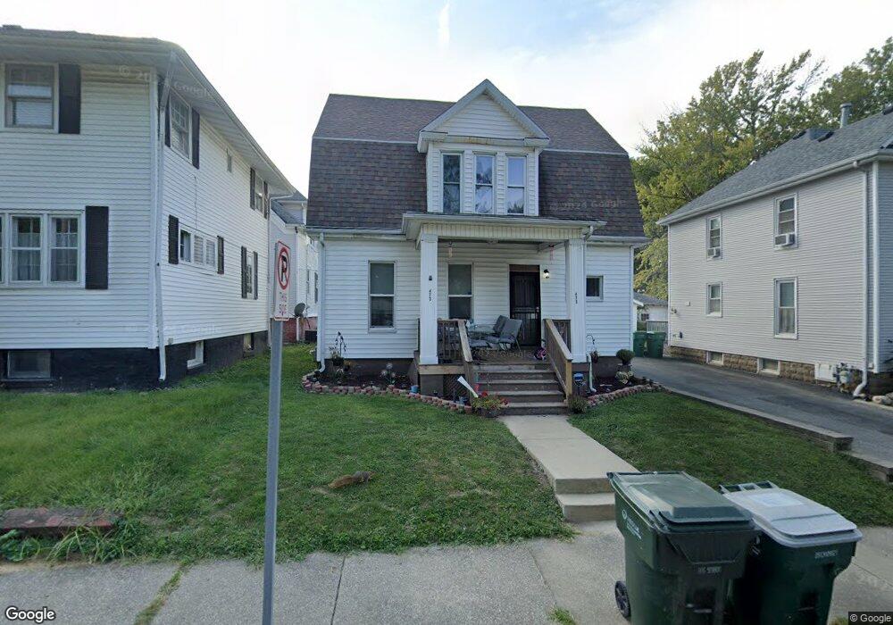
473 S Monroe St Decatur, IL 62522
Near West NeighborhoodEstimated Value: $50,224 - $87,000
4
Beds
2
Baths
2,184
Sq Ft
$31/Sq Ft
Est. Value
About This Home
This home is located at 473 S Monroe St, Decatur, IL 62522 and is currently estimated at $67,306, approximately $30 per square foot. 473 S Monroe St is a home located in Macon County with nearby schools including Dennis Lab School, St. Patrick School, and Teen Challenge-Home For Girls.
Ownership History
Date
Name
Owned For
Owner Type
Purchase Details
Closed on
Sep 10, 2013
Sold by
Legrande Dustin
Bought by
Trout Wilberta A
Current Estimated Value
Purchase Details
Closed on
Feb 8, 2012
Sold by
Us Bank Na
Bought by
Legrande Dustin
Purchase Details
Closed on
Jan 1, 2000
Create a Home Valuation Report for This Property
The Home Valuation Report is an in-depth analysis detailing your home's value as well as a comparison with similar homes in the area
Home Values in the Area
Average Home Value in this Area
Purchase History
| Date | Buyer | Sale Price | Title Company |
|---|---|---|---|
| Trout Wilberta A | $25,000 | None Available | |
| Legrande Dustin | $4,500 | None Available | |
| -- | $44,000 | -- |
Source: Public Records
Tax History Compared to Growth
Tax History
| Year | Tax Paid | Tax Assessment Tax Assessment Total Assessment is a certain percentage of the fair market value that is determined by local assessors to be the total taxable value of land and additions on the property. | Land | Improvement |
|---|---|---|---|---|
| 2024 | $1,978 | $20,434 | $1,222 | $19,212 |
| 2023 | $1,962 | $19,711 | $1,179 | $18,532 |
| 2022 | $1,623 | $15,874 | $1,091 | $14,783 |
| 2021 | $1,525 | $14,825 | $1,019 | $13,806 |
| 2020 | $1,503 | $14,136 | $971 | $13,165 |
| 2019 | $1,503 | $14,136 | $971 | $13,165 |
| 2018 | $1,490 | $14,183 | $974 | $13,209 |
| 2017 | $1,525 | $14,562 | $1,000 | $13,562 |
| 2016 | $1,554 | $14,710 | $1,010 | $13,700 |
| 2015 | $1,477 | $14,450 | $992 | $13,458 |
| 2014 | $1,372 | $14,307 | $982 | $13,325 |
| 2013 | $1,417 | $14,844 | $1,019 | $13,825 |
Source: Public Records
Map
Nearby Homes
- 628 W Forest Ave
- 617 W Decatur St
- 441 S Seigel St
- 437 Powers Ln
- 612 W Macon St
- 657 W Wood St
- 530 Powers Ln
- 450 W Macon St
- 440 W Macon St
- 650 S Crea St
- 580 Powers Ln
- 899 W Main St
- 717 W Prairie Ave Unit 2
- 320 W Main St
- 452 W Prairie Ave
- 442 W Prairie Ave
- 609 W William St
- 1005 W Main St
- 254 N Pine St
- 233 N Edward St
- 465 S Monroe St
- 495 S Monroe St
- 616 W Forest Ave
- 463 S Monroe St
- 634 W Forest Ave
- 480 S Monroe St
- 468 S Monroe St
- 459 S Monroe St
- 609 W Forest Ave
- 619 W Forest Ave
- 640 W Forest Ave
- 629 W Forest Ave
- 454 S Monroe St
- 437 S Monroe St
- 442 S Monroe St
- 462 S Seigel St
- 487 S Ewing Ave
- 456 S Seigel St
- 472 S Seigel St
- 482 S Seigel St