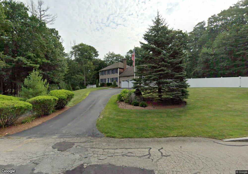
473 Whitman St Hanson, MA 02341
Estimated Value: $615,000 - $757,000
3
Beds
3
Baths
1,632
Sq Ft
$418/Sq Ft
Est. Value
About This Home
This home is located at 473 Whitman St, Hanson, MA 02341 and is currently estimated at $682,522, approximately $418 per square foot. 473 Whitman St is a home located in Plymouth County.
Ownership History
Date
Name
Owned For
Owner Type
Purchase Details
Closed on
Jun 7, 2016
Sold by
Brite Christopher and Brite Sonya
Bought by
Stappen Christopher J and Stappen Kelly
Current Estimated Value
Home Financials for this Owner
Home Financials are based on the most recent Mortgage that was taken out on this home.
Original Mortgage
$416,999
Outstanding Balance
$332,101
Interest Rate
3.59%
Mortgage Type
VA
Estimated Equity
$350,421
Purchase Details
Closed on
Mar 20, 1998
Sold by
Collamore Ests Rt and Konish William D
Bought by
Brite Christopher and Brite Sonya
Create a Home Valuation Report for This Property
The Home Valuation Report is an in-depth analysis detailing your home's value as well as a comparison with similar homes in the area
Home Values in the Area
Average Home Value in this Area
Purchase History
| Date | Buyer | Sale Price | Title Company |
|---|---|---|---|
| Stappen Christopher J | $425,000 | -- | |
| Brite Christopher | $235,090 | -- |
Source: Public Records
Mortgage History
| Date | Status | Borrower | Loan Amount |
|---|---|---|---|
| Open | Stappen Christopher J | $416,999 | |
| Previous Owner | Brite Christopher | $170,700 | |
| Previous Owner | Brite Christopher | $145,430 | |
| Previous Owner | Brite Christopher | $150,000 | |
| Previous Owner | Brite Christopher | $225,000 |
Source: Public Records
Tax History Compared to Growth
Tax History
| Year | Tax Paid | Tax Assessment Tax Assessment Total Assessment is a certain percentage of the fair market value that is determined by local assessors to be the total taxable value of land and additions on the property. | Land | Improvement |
|---|---|---|---|---|
| 2025 | $7,392 | $552,500 | $172,000 | $380,500 |
| 2024 | $7,180 | $536,600 | $167,000 | $369,600 |
| 2023 | $6,934 | $489,000 | $167,000 | $322,000 |
| 2022 | $6,714 | $444,900 | $151,800 | $293,100 |
| 2021 | $5,955 | $394,400 | $146,000 | $248,400 |
| 2020 | $5,865 | $384,100 | $141,000 | $243,100 |
| 2019 | $5,628 | $362,400 | $138,300 | $224,100 |
| 2018 | $5,561 | $351,300 | $133,000 | $218,300 |
| 2017 | $5,341 | $334,200 | $126,700 | $207,500 |
| 2016 | $5,423 | $327,700 | $126,700 | $201,000 |
| 2015 | $5,134 | $322,500 | $126,700 | $195,800 |
Source: Public Records
Map
Nearby Homes
- 248 E Washington St
- 168 Spring St
- 418 E Washington St
- Lot 5 Princeton Way
- 33 Tavern Way
- 57 Liberty St
- 22 Howland Trail Unit 34
- 13 Hayford Trail Unit 15
- 12 Hayford Trail Unit 17
- 5 Hayford Trail Unit 11
- 7 Hayford Trail Unit 12
- 842 Whitman St
- 37 Brook St
- 417 Birchbark Dr
- 1057 Whitman St
- 842 E Washington St
- 55 Plymouth St Unit A5
- Lot 2 Harvard Rd
- Lot 6 Way
- 131 Holly Ridge Dr
- 8 Capt Nathaniel Dr
- 3 Capt Nathaniel Dr
- 469 Whitman St
- 35 Captain Nathaniel Dr
- 18 Capt Nathaniel Dr
- 470 Whitman St
- 22 Captain Nathaniel Dr
- 464 Whitman St
- 40 Captain Nathaniel Dr
- 451 Whitman St
- 480 Whitman St
- 53 Captain Nathaniel Dr
- 450 Whitman St
- 524 Whitman St
- 118 Lexington St
- 64 Captain Nathaniel Dr
- 439 Whitman St
- 436 Whitman St
- 71 Captain Nathaniel Dr
- 100 Lexington St