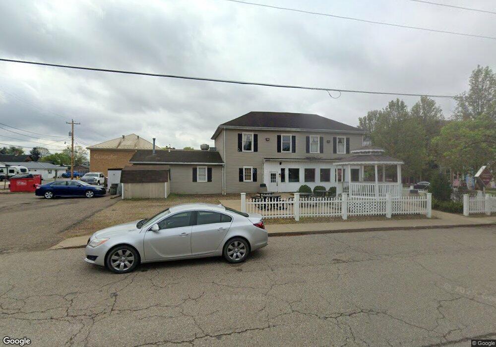
4730 Foster Rd Dresden, OH 43821
Estimated Value: $289,000 - $474,000
4
Beds
1
Bath
1,844
Sq Ft
$191/Sq Ft
Est. Value
About This Home
This home is located at 4730 Foster Rd, Dresden, OH 43821 and is currently estimated at $352,751, approximately $191 per square foot. 4730 Foster Rd is a home located in Muskingum County with nearby schools including Tri-Valley High School.
Ownership History
Date
Name
Owned For
Owner Type
Purchase Details
Closed on
Jul 16, 2014
Sold by
Johnston Grace M
Bought by
Green Floyd E and Green Debra A
Current Estimated Value
Home Financials for this Owner
Home Financials are based on the most recent Mortgage that was taken out on this home.
Original Mortgage
$120,000
Outstanding Balance
$38,146
Interest Rate
4.19%
Mortgage Type
Future Advance Clause Open End Mortgage
Estimated Equity
$314,605
Purchase Details
Closed on
Dec 2, 2011
Sold by
Ahmadi Mahmoud and Ahmadi Leslie P
Bought by
Vance R Martin Gst Exempt Fam Tr and Johnston Grace M
Create a Home Valuation Report for This Property
The Home Valuation Report is an in-depth analysis detailing your home's value as well as a comparison with similar homes in the area
Home Values in the Area
Average Home Value in this Area
Purchase History
| Date | Buyer | Sale Price | Title Company |
|---|---|---|---|
| Green Floyd E | $120,000 | None Available | |
| Vance R Martin Gst Exempt Fam Tr | $148,000 | Attorney |
Source: Public Records
Mortgage History
| Date | Status | Borrower | Loan Amount |
|---|---|---|---|
| Open | Green Floyd E | $120,000 |
Source: Public Records
Tax History Compared to Growth
Tax History
| Year | Tax Paid | Tax Assessment Tax Assessment Total Assessment is a certain percentage of the fair market value that is determined by local assessors to be the total taxable value of land and additions on the property. | Land | Improvement |
|---|---|---|---|---|
| 2024 | $1,635 | $90,405 | $51,485 | $38,920 |
| 2023 | $1,047 | $59,080 | $35,525 | $23,555 |
| 2022 | $1,020 | $59,080 | $35,525 | $23,555 |
| 2021 | $1,060 | $60,760 | $35,525 | $25,235 |
| 2020 | $1,087 | $60,760 | $35,525 | $25,235 |
| 2019 | $1,087 | $60,760 | $35,525 | $25,235 |
| 2018 | $552 | $60,760 | $35,525 | $25,235 |
| 2017 | $1,054 | $47,705 | $26,075 | $21,630 |
| 2016 | $1,068 | $47,710 | $26,080 | $21,630 |
| 2015 | $1,097 | $47,710 | $26,080 | $21,630 |
| 2013 | $1,166 | $47,710 | $26,080 | $21,630 |
Source: Public Records
Map
Nearby Homes
- 15713 State Route 16
- 12490 Ferncliff Rd
- 0 County Road 294
- 7855 East St
- 0 Copeland Woods Rd
- 14240 Cr 410 Lot# 58
- 49694 Township Road 146
- 10200 N River Rd
- 1111 Main St
- 815 Chestnut St
- 510 Chestnut St
- 7255 Mitchell Ln
- 50 W Dave Longaberger Ave
- 40873 Township Road 64b
- 19625 County Road 6
- 20101 Ohio 16
- 6995 Mutton Ridge Rd
- 20296 County Road 6
- 20413 Township Road 1184
- 2269 Otsego Ave
- 4730 Foster Rd Unit Lot 3
- 4730 Foster Rd Unit Lot 4
- 4730 Foster Rd Unit Lot 1
- 4730 Foster Rd Unit Lot 2
- 4700 Foster Rd
- 0 Pear Orchard Rd Unit 5041177
- 0 Pear Orchard Rd Unit 2428156
- 13659 Pear Orchard Rd
- 0 Pear Orchard Rd Unit 221012132
- 0 Pear Orchard Rd Unit 221008569
- 0 Pear Orchard Rd Unit 221006316
- 0 Pear Orchard Rd Unit 221001650
- 0 Pear Orchard Rd Unit 221001647
- 0 Pear Orchard Rd Unit 221001646
- 0 Pear Orchard Rd Unit 221001644
- 0 Pear Orchard Rd
- 0 Pear Orchard Rd Unit LotWP001
- 12775 Titus Rd
- 13130 Titus Rd
- 13290 Pear Orchard Rd