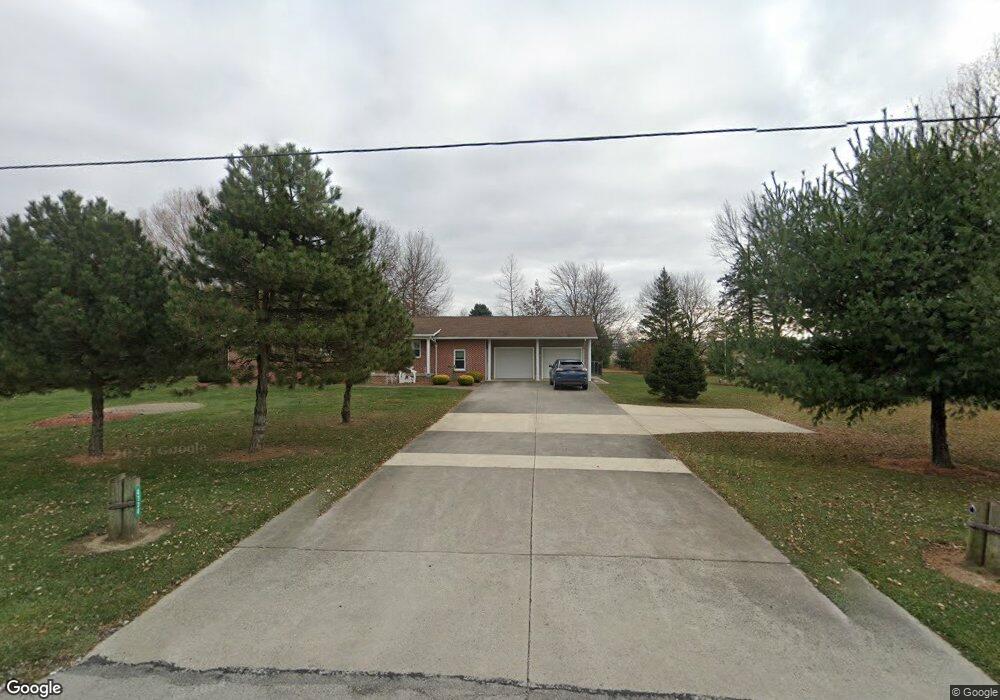
4730 State Route 4 Bellevue, OH 44811
Estimated Value: $217,824 - $319,000
3
Beds
3
Baths
1,644
Sq Ft
$157/Sq Ft
Est. Value
About This Home
This home is located at 4730 State Route 4, Bellevue, OH 44811 and is currently estimated at $257,706, approximately $156 per square foot. 4730 State Route 4 is a home located in Huron County with nearby schools including Bellevue Elementary School, Bellevue Middle School, and Bellevue High School.
Ownership History
Date
Name
Owned For
Owner Type
Purchase Details
Closed on
Feb 16, 2011
Bought by
Jeffrey A Slomsky
Current Estimated Value
Purchase Details
Closed on
Jun 8, 2000
Sold by
Kromer Laura
Bought by
Slomsky Jeffrey A and Slomsky Sharon R
Purchase Details
Closed on
Jun 8, 1998
Bought by
Beard Laura
Purchase Details
Closed on
Aug 31, 1995
Sold by
Konst Ronald R
Bought by
Konst Neil R and Konst Fay E
Purchase Details
Closed on
Jun 30, 1978
Bought by
Konst Ruth G
Create a Home Valuation Report for This Property
The Home Valuation Report is an in-depth analysis detailing your home's value as well as a comparison with similar homes in the area
Home Values in the Area
Average Home Value in this Area
Purchase History
| Date | Buyer | Sale Price | Title Company |
|---|---|---|---|
| Jeffrey A Slomsky | -- | -- | |
| Slomsky Jeffrey A | $148,000 | -- | |
| Beard Laura | $165,800 | -- | |
| Konst Neil R | $115,000 | -- | |
| Konst Ruth G | -- | -- |
Source: Public Records
Tax History Compared to Growth
Tax History
| Year | Tax Paid | Tax Assessment Tax Assessment Total Assessment is a certain percentage of the fair market value that is determined by local assessors to be the total taxable value of land and additions on the property. | Land | Improvement |
|---|---|---|---|---|
| 2024 | $1,972 | $56,960 | $9,680 | $47,280 |
| 2023 | $1,972 | $43,420 | $6,960 | $36,460 |
| 2022 | $1,604 | $44,600 | $6,960 | $37,640 |
| 2021 | $1,617 | $44,600 | $6,960 | $37,640 |
| 2020 | $1,477 | $39,930 | $6,960 | $32,970 |
| 2019 | $1,454 | $39,930 | $6,960 | $32,970 |
| 2018 | $1,838 | $39,930 | $6,960 | $32,970 |
| 2017 | $1,759 | $40,090 | $6,960 | $33,130 |
| 2016 | $1,706 | $40,090 | $6,960 | $33,130 |
| 2015 | $1,698 | $40,110 | $6,970 | $33,140 |
| 2014 | $1,803 | $39,840 | $7,740 | $32,100 |
| 2013 | $1,800 | $39,840 | $7,740 | $32,100 |
Source: Public Records
Map
Nearby Homes
- 3050 E Main St
- 817 E Main St
- 140 Hobson St
- 140 Harkness St
- 501 E Center St
- 808 Castalia St
- 819 Castalia St
- 206 Southwest St
- 124 Sunset Dr
- 130 Huffman St
- 111 Park Ave
- 219 Huffman St
- 129 Hamilton St
- 126 Greenwood Heights
- 408 W Main St
- 154 Ashford Ave
- 155 Ashford Ave
- 231 Lawrence St
- 720 Kilbourne St
- 230 Highland Ave Unit 106
- 4731 State Route 4
- 4766 State Route 4
- 4719 State Route 4
- 4699 State Route 4
- 4699 Ohio 4
- 4665 State Route 4
- 4770 Beckstein Rd
- 4724 Beckstein Rd
- 4818 Beckstein Rd
- 4852 Beckstein Rd
- 4657 Beckstein Rd
- 4890 Beckstein Rd
- 4541 State Route 4
- 5625 State Route 113
- 4954 State Route 4
- 4958 State Route 4
- 3010 E Main St
- 4986 State Route 4
- 4986 State Route 4
- 4422 Section Line Road 30