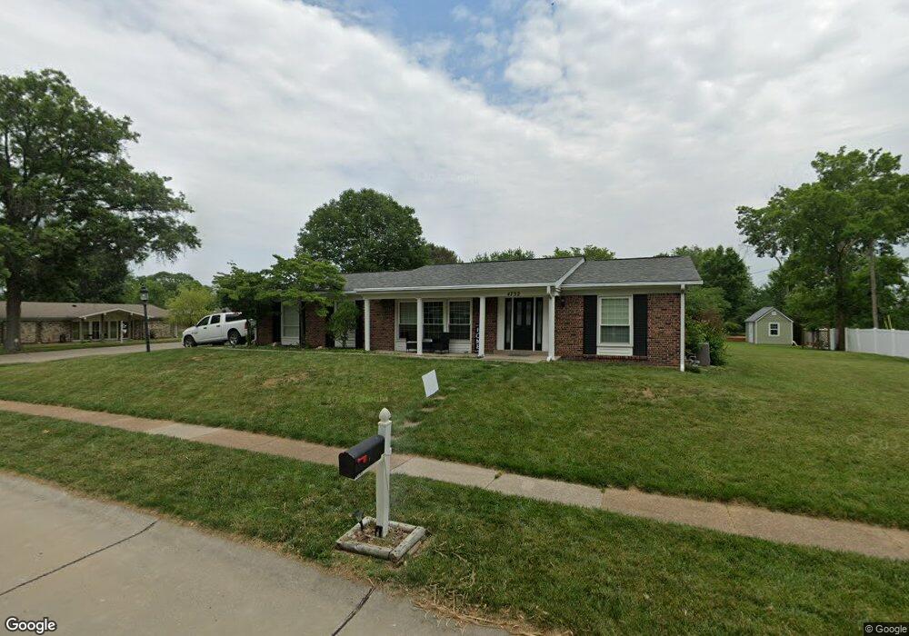
4732 Langtree Dr Saint Louis, MO 63128
Estimated Value: $382,511 - $413,000
3
Beds
3
Baths
1,778
Sq Ft
$226/Sq Ft
Est. Value
About This Home
This home is located at 4732 Langtree Dr, Saint Louis, MO 63128 and is currently estimated at $402,628, approximately $226 per square foot. 4732 Langtree Dr is a home located in St. Louis County with nearby schools including Kennerly Elementary School, Sperreng Middle School, and Lindbergh High School.
Ownership History
Date
Name
Owned For
Owner Type
Purchase Details
Closed on
Aug 31, 2010
Sold by
Yahl Irene M and Yahl Leo N
Bought by
Dobbs John and Dobbs Katherine
Current Estimated Value
Home Financials for this Owner
Home Financials are based on the most recent Mortgage that was taken out on this home.
Original Mortgage
$207,209
Outstanding Balance
$135,501
Interest Rate
4.25%
Mortgage Type
FHA
Estimated Equity
$267,127
Create a Home Valuation Report for This Property
The Home Valuation Report is an in-depth analysis detailing your home's value as well as a comparison with similar homes in the area
Home Values in the Area
Average Home Value in this Area
Purchase History
| Date | Buyer | Sale Price | Title Company |
|---|---|---|---|
| Dobbs John | $210,000 | U S Title |
Source: Public Records
Mortgage History
| Date | Status | Borrower | Loan Amount |
|---|---|---|---|
| Open | Dobbs John | $207,209 |
Source: Public Records
Tax History
| Year | Tax Paid | Tax Assessment Tax Assessment Total Assessment is a certain percentage of the fair market value that is determined by local assessors to be the total taxable value of land and additions on the property. | Land | Improvement |
|---|---|---|---|---|
| 2025 | $3,985 | $67,300 | $17,200 | $50,100 |
| 2024 | $3,985 | $61,260 | $17,200 | $44,060 |
| 2023 | $3,975 | $61,260 | $17,200 | $44,060 |
| 2022 | $3,465 | $51,190 | $17,200 | $33,990 |
| 2021 | $3,342 | $51,190 | $17,200 | $33,990 |
| 2020 | $3,415 | $50,490 | $17,160 | $33,330 |
| 2019 | $3,407 | $50,490 | $17,160 | $33,330 |
| 2018 | $3,143 | $42,350 | $10,490 | $31,860 |
| 2017 | $3,109 | $42,350 | $10,490 | $31,860 |
| 2016 | $3,044 | $39,370 | $9,540 | $29,830 |
Source: Public Records
Map
Nearby Homes
- 105 Worthington Cir Unit 34
- 5108 Kennerly Place Dr Unit 7A
- 12430 Somerset Place Dr
- 4767 Towne South Rd
- 12568 Chardin Place Unit 1
- 12586 Chardin Place Unit 4
- 4839 Hursley Dr
- 4930 Mount Royal Rd
- 4988 Sefton Dr
- 16 Bayswater Rd
- 12055 Charwick Dr
- 4931 Butler Hill Rd
- 4931 Theiss Rd
- 10239 Hartshill Ln
- 10008 Meadowfield Ln
- 10652 Roanna Ln
- 11951 Tesson Ferry Rd Unit D
- 10032 Sakura Dr
- 10041 Sakura Dr
- 10070 Sakura Dr Unit 100070
- 5040 Kirkey Ct
- 4740 Langtree Dr
- 4735 Langtree Dr
- 4729 Langtree Dr
- 5047 Kirkey Ct
- 4741 Langtree Dr
- 4723 Langtree Dr
- 4748 Langtree Dr
- 5034 Kirkey Ct
- 5039 Darfield Ct
- 5037 Kirkey Ct
- 5033 Darfield Ct
- 4747 Langtree Dr
- 4717 Langtree Dr
- 141 Worthington Cir Unit 12
- 5031 Kirkey Ct
- 4710 Langtree Dr
- 140 Worthington Cir Unit 11
- 145 Worthington Cir Unit 13
- 5027 Darfield Ct
Your Personal Tour Guide
Ask me questions while you tour the home.