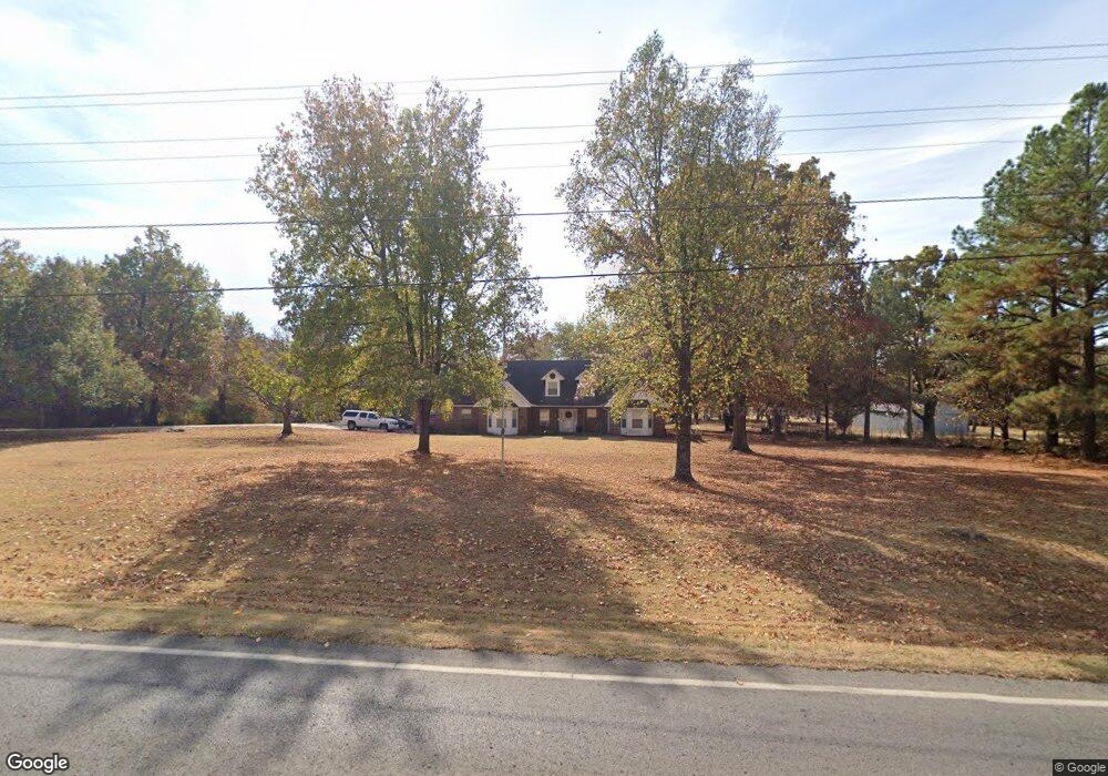
473306 Highway 62 Westville, OK 74965
Estimated Value: $272,000 - $384,000
4
Beds
2
Baths
2,093
Sq Ft
$151/Sq Ft
Est. Value
About This Home
This home is located at 473306 Highway 62, Westville, OK 74965 and is currently estimated at $315,705, approximately $150 per square foot. 473306 Highway 62 is a home with nearby schools including Westville Elementary School, Westville Junior High School, and Westville High School.
Ownership History
Date
Name
Owned For
Owner Type
Purchase Details
Closed on
Aug 17, 2018
Sold by
Smith Barbara Leinn and Smith Jackie Duane
Bought by
Ayo Jacob and Ayo Melissa
Current Estimated Value
Home Financials for this Owner
Home Financials are based on the most recent Mortgage that was taken out on this home.
Original Mortgage
$173,627
Outstanding Balance
$150,474
Interest Rate
4.5%
Mortgage Type
FHA
Estimated Equity
$165,231
Purchase Details
Closed on
Dec 9, 2005
Sold by
Smith Billy Jack and Smith Smith
Bought by
Smith Barbara and Smith Smith
Create a Home Valuation Report for This Property
The Home Valuation Report is an in-depth analysis detailing your home's value as well as a comparison with similar homes in the area
Home Values in the Area
Average Home Value in this Area
Purchase History
| Date | Buyer | Sale Price | Title Company |
|---|---|---|---|
| Ayo Jacob | $175,000 | None Available | |
| Smith Barbara | -- | -- |
Source: Public Records
Mortgage History
| Date | Status | Borrower | Loan Amount |
|---|---|---|---|
| Open | Ayo Jacob | $173,627 |
Source: Public Records
Tax History Compared to Growth
Tax History
| Year | Tax Paid | Tax Assessment Tax Assessment Total Assessment is a certain percentage of the fair market value that is determined by local assessors to be the total taxable value of land and additions on the property. | Land | Improvement |
|---|---|---|---|---|
| 2025 | $1,855 | $24,911 | $2,461 | $22,450 |
| 2024 | $1,855 | $23,725 | $2,344 | $21,381 |
| 2023 | $1,855 | $22,595 | $2,200 | $20,395 |
| 2022 | $1,678 | $22,595 | $2,160 | $20,435 |
| 2021 | $1,609 | $20,494 | $1,871 | $18,623 |
| 2020 | $1,630 | $20,714 | $1,871 | $18,843 |
| 2019 | $1,654 | $20,947 | $1,871 | $19,076 |
| 2018 | $1,466 | $19,381 | $1,871 | $17,510 |
| 2017 | $1,348 | $18,596 | $1,755 | $16,841 |
| 2016 | $1,317 | $18,055 | $1,371 | $16,684 |
| 2015 | $1,129 | $17,528 | $1,444 | $16,084 |
| 2014 | $1,129 | $17,018 | $995 | $16,023 |
Source: Public Records
Map
Nearby Homes
- 372 Rr 3
- 473522 Highway 62
- 347 Rr 2
- 474265 Highway 62
- TBD N4720 Rd
- 465084 Highway 62
- 463962 Highway 62
- 465425 Highway 62
- 468790 E 705 Rd
- 69012 S 4710 Rd
- 470992 E 714 Rd
- 464143 Highway 62
- 464143 Hwy 62
- 75246 S 4730 Rd
- 66766 E 668 Rd
- 71154 S 4710 Rd
- 69012 S 4710 Rd
- 3381 Rr 3
- 247 Rr 3 Ln
- 473757 Highway 62