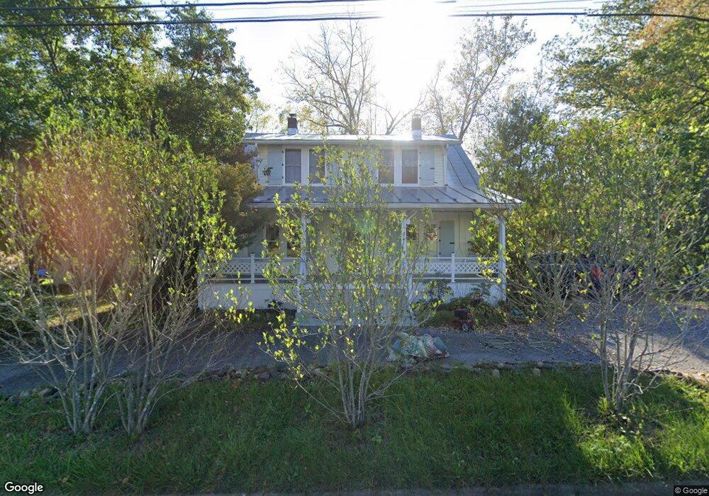
4735 Maury River Rd Unit RD Rockbridge Baths, VA 24473
Estimated Value: $149,000 - $472,000
3
Beds
2
Baths
2,300
Sq Ft
$147/Sq Ft
Est. Value
About This Home
This home is located at 4735 Maury River Rd Unit RD, Rockbridge Baths, VA 24473 and is currently estimated at $339,008, approximately $147 per square foot. 4735 Maury River Rd Unit RD is a home located in Rockbridge County with nearby schools including Rockbridge County High School.
Ownership History
Date
Name
Owned For
Owner Type
Purchase Details
Closed on
Nov 17, 2025
Sold by
Mary Lewis Thompson Revocable Trust and Thompson Mary Lewis
Bought by
4735 Maury River Road Llc
Current Estimated Value
Purchase Details
Closed on
May 5, 2017
Sold by
Hunter Paula Elizabeth
Bought by
Thompson Thomas H and Thompson Mary L
Home Financials for this Owner
Home Financials are based on the most recent Mortgage that was taken out on this home.
Original Mortgage
$225,000
Interest Rate
4.05%
Mortgage Type
New Conventional
Create a Home Valuation Report for This Property
The Home Valuation Report is an in-depth analysis detailing your home's value as well as a comparison with similar homes in the area
Home Values in the Area
Average Home Value in this Area
Purchase History
| Date | Buyer | Sale Price | Title Company |
|---|---|---|---|
| 4735 Maury River Road Llc | $450,000 | None Listed On Document | |
| Thompson Thomas H | $250,000 | None Available |
Source: Public Records
Mortgage History
| Date | Status | Borrower | Loan Amount |
|---|---|---|---|
| Previous Owner | Thompson Thomas H | $225,000 |
Source: Public Records
Tax History Compared to Growth
Tax History
| Year | Tax Paid | Tax Assessment Tax Assessment Total Assessment is a certain percentage of the fair market value that is determined by local assessors to be the total taxable value of land and additions on the property. | Land | Improvement |
|---|---|---|---|---|
| 2025 | $1,530 | $239,100 | $65,000 | $174,100 |
| 2024 | $1,459 | $239,100 | $65,000 | $174,100 |
| 2023 | $1,459 | $239,100 | $65,000 | $174,100 |
| 2022 | $1,700 | $229,700 | $65,000 | $164,700 |
| 2021 | $1,700 | $229,700 | $65,000 | $164,700 |
| 2020 | $0 | $216,200 | $65,000 | $151,200 |
| 2019 | $1,578 | $216,200 | $65,000 | $151,200 |
| 2018 | $1,509 | $216,200 | $65,000 | $151,200 |
| 2017 | $1,509 | $215,500 | $65,000 | $150,500 |
| 2016 | $1,213 | $165,000 | $40,000 | $125,000 |
| 2015 | -- | $0 | $0 | $0 |
| 2014 | -- | $0 | $0 | $0 |
| 2013 | -- | $0 | $0 | $0 |
Source: Public Records
Map
Nearby Homes
- 69 Farmhouse Rd
- TBD Anderson Farm Rd
- 100 Brownsburg Turnpike
- 599 Lindsay Ln
- 2.02 Acres Smokey Row Rd
- 842 Adair Hill Dr
- TBD Mount Atlas Rd
- 1111 Bethany Rd
- Lot 7 - Ridgeline Way
- 621 Adair Hill Dr
- 0 Saddle Ridge Rd Unit 11 Reid Rd
- 4acs Reid Rd
- 370 Old Chapel Rd
- 4.12 Ac. Boundary Line Ln
- 0 Boundary Line Ln
- .45 acres Boundary Line Ln
- 71 Triple Crown Dr
- 3111 N Lee Hwy
- Lot 9 Skyhigh Ln
- 307 Swope Ln
- 4735 Maury River Rd
- 4735 Maury River Rd
- 4735 Maury River Rd Unit 39
- 4725 Maury River Rd
- 4746 Maury River Rd
- 4720 Maury River Rd
- 4730 Maury River Rd
- 4730 Maury River Rd Unit 39
- 4717 Maury River Rd
- 4755 Maury River Rd
- 4750 Maury River Rd
- 4701 Maury River Rd
- 148 Terrell Dr
- 172 Terrell Dr
- 4779 Maury River Rd
- 4795 Maury River Rd
- 4681 Maury River Rd
- 4682 Maury River Rd
- 260 Terrell Dr
- 206 Terrell Dr